

The British Flanders Campaign of the French Revolutionary War
KITCHIN, Thomas.
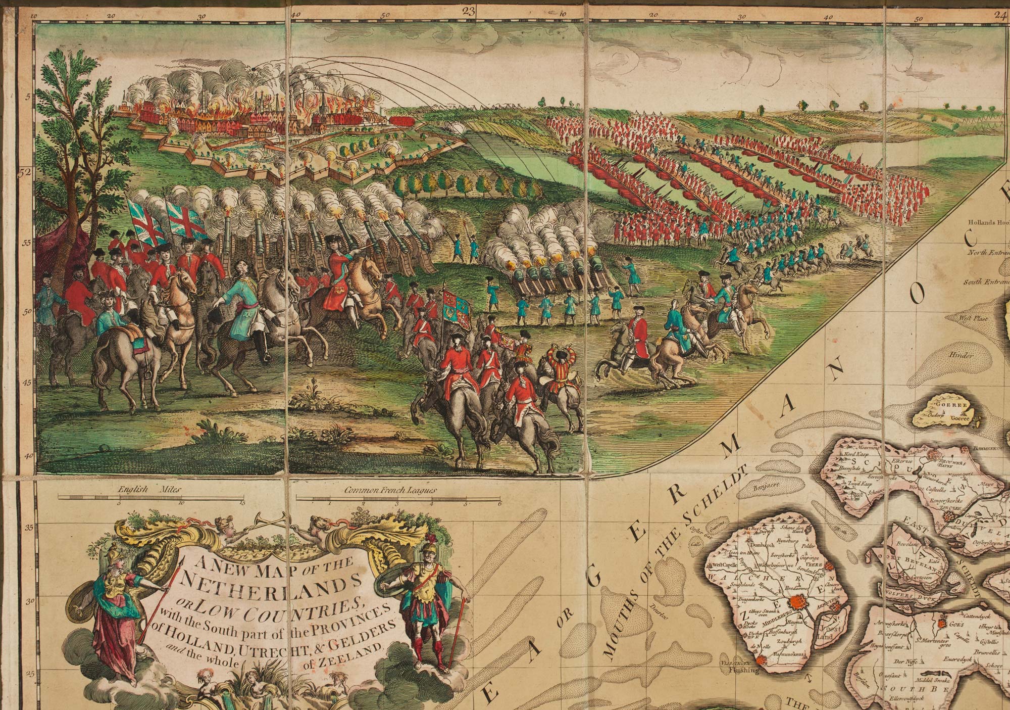
A New Map of the Netherlands or Low Countries, with the South Part of the Provinces of Holland, Utrecht, & Gelders, and the whole of Zeeland.
London: Laurie & Whittle, 1794. Original full body colour. Four sheets, dissected and laid on linen as issued. Total 980 x 1210mm.
A few signs of use.
A folding map of the Austrian Netherlands, published during the Flanders Campaign of the French Revolutionary War. The large vignette above the title shows the Siege of Valenciennes in 1793, in which the British and Austrians under Prince Frederick, Duke of York and Albany, took the city from the Republicans. Frederick, shown here on horseback, waving his hat, was welcomed by the French population, who tore down the Republican Tricolour and proclaimed him King of France. Unfortunately this was one of the few successes of the campaign: the following year the Coalition was forced to retreat, reaching Bremen in Hanover in the Spring of 1795, leaving the Dutch Republic in the hands of France.
This is an unusual presentation of this map: normally it is found in Laurie & Whittle atlases with basic outline colour, so this example seems to have been published in the short period of Allied success, possibly for a serving officer.
Stock ID : 15434
£1,250
£1,250

The British Flanders Campaign of the French Revolutionary War
KITCHIN, Thomas.
A New Map of the Netherlands or Low Countries, with the South Part of the Provinces of Holland, Utrecht, & Gelders, and the whole of Zeeland.
London: Laurie & Whittle, 1794. Original full body colour. Four sheets, dissected and laid on linen as issued. Total 980 x 1210mm.
A few signs of use.
A folding map of the Austrian Netherlands, published during the Flanders Campaign of the French Revolutionary War. The large vignette above the title shows the Siege of Valenciennes in 1793, in which the British and Austrians under Prince Frederick, Duke of York and Albany, took the city from the Republicans. Frederick, shown here on horseback, waving his hat, was welcomed by the French population, who tore down the Republican Tricolour and proclaimed him King of France. Unfortunately this was one of the few successes of the campaign: the following year the Coalition was forced to retreat, reaching Bremen in Hanover in the Spring of 1795, leaving the Dutch Republic in the hands of France.
This is an unusual presentation of this map: normally it is found in Laurie & Whittle atlases with basic outline colour, so this example seems to have been published in the short period of Allied success, possibly for a serving officer.
Stock ID : 15434
£1,250
£1,250


Altea Antique Maps & Charts
Altea Gallery Ltd, 35 St George Street
London
W1S 2FN
United Kingdom
Tel: +44 20 7491 0010
info@alteagallery.com
Sitemap :

