
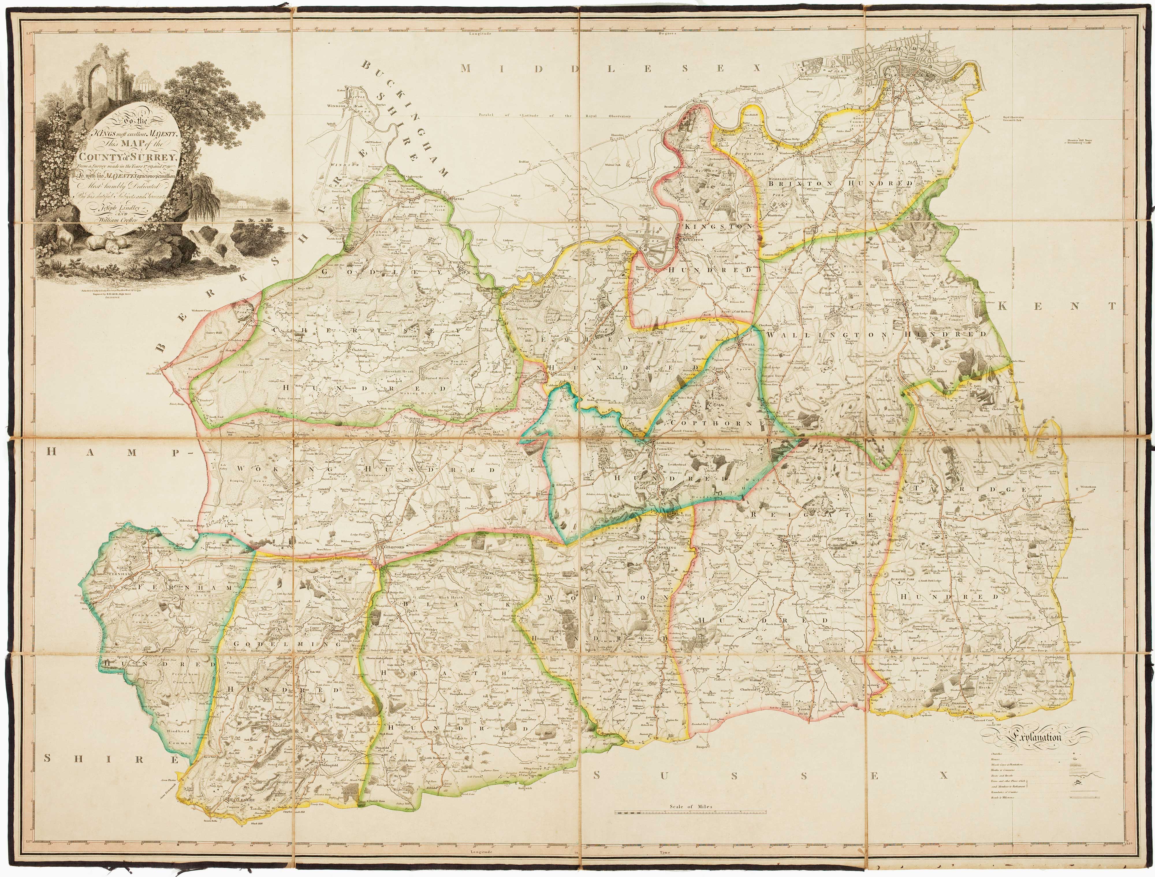
The first trigonometrical map of Surrey
LINDLEY, Joseph & CROSLEY, William.
To the Kings most excellent Majesty, This Map of the County of Surrey, From a Survey made in the Years 1789 and 1790 Is with his Majesty's gracious permission Most humbly Dedicated...
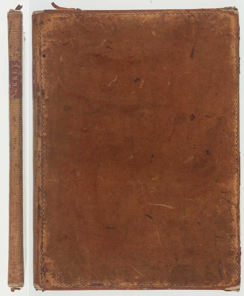
London: the Authors, 1793. Original colour. Two sheets, dissected and laid on linen edged with silk, as issued, total 850 x 1120mm, with contemporary full calf gilt slipcase with maroon morocco title label.
Slipcase rubbed.
A large and detailed map of Surrey in fine original colour, extending north of the Thames to show London's streets, the outlines of Hampton Court and Bushy Park, and also including Windsor Great Park in Berkshire. The title is within a fine cartouche of architectural ruins.
This, the sixth survey of the county, was the last completed before the government-funded Ordnance Survey. It was the work of two experienced surveyors, Joseph Lindley and William Crosley, who also wrote a detailed account of their work, 'Memoir of a Map of the County of Surrey', which gives an unusual insight into the creation of such a map.
Joseph Lindley (1756-1808) was born near Wakefield, the son of a local architect. He was sent to London to work in banking, but by 1781 he was employed at the Time Department at Greenwich where he rapidly rose to become Head of the Department and Assistant to Sir Nevil Maskelyne, the Astronomer Royal. In 1786 he helped General William Roy take chronometer readings for the triangulation of the line between Paris and London. Roy's Hounslow Heath baseline (1784), the basis of this measurement as well the modern Ordnance Survey, is marked here. Soon after Lindley's return from Paris he decided this survey of Surrey and asked Roy if he could use his triangulation of the South East as a basis. He then chose 85 'stations' (high points) to increase the accuracy of the triangulation.
For help drawing the map Lindley went into partnership with William Crosley (died 1794). Crosley has begun as an estate surveyor before working on the surveying of canals, working for both John Rennie and Robert Mylne. He worked on the Rochdale, Lancaster and Kennett & Avon canals, as well as the Arun Navigation in Sussex. For this survey he was assisted by a local land surveyor, Richard Crabtree of Farnham; the pair augmented the trigonometry with more traditional methods, measuring many roads with surveying wheels.
After the survey was completed in 1790 the orthography was proofed by or use of standard names by sending proofs to the local historians Rev Owen Manning, rector of Godalming, and William Bray (who later edited Manning's 'History of Surrey' for publication). On completion the map was passed to Benjamin Baker of Islington for engraving.
The project was not a financial success: Lindley gave up surveying and sold a share in the plates and stock of maps to Netlam Giles (c.1775-1816, a civil engineer who also worked for Rennie) for £64 in 1799. William Faden bought the plates and reissued the map as a second edition in 1814 and again with revisions in 1819; his son-in-law and successor James Wyld re-issued the map in 1874, after removing the names of Lindley and Crosley.
Lindley & Crosley's 'Memoir' is available for free on Google Books.
Stock ID : 16383
£2,200
£2,200

The first trigonometrical map of Surrey
LINDLEY, Joseph & CROSLEY, William.
To the Kings most excellent Majesty, This Map of the County of Surrey, From a Survey made in the Years 1789 and 1790 Is with his Majesty's gracious permission Most humbly Dedicated...
London: the Authors, 1793. Original colour. Two sheets, dissected and laid on linen edged with silk, as issued, total 850 x 1120mm, with contemporary full calf gilt slipcase with maroon morocco title label.
Slipcase rubbed.
A large and detailed map of Surrey in fine original colour, extending north of the Thames to show London's streets, the outlines of Hampton Court and Bushy Park, and also including Windsor Great Park in Berkshire. The title is within a fine cartouche of architectural ruins.
This, the sixth survey of the county, was the last completed before the government-funded Ordnance Survey. It was the work of two experienced surveyors, Joseph Lindley and William Crosley, who also wrote a detailed account of their work, 'Memoir of a Map of the County of Surrey', which gives an unusual insight into the creation of such a map.
Joseph Lindley (1756-1808) was born near Wakefield, the son of a local architect. He was sent to London to work in banking, but by 1781 he was employed at the Time Department at Greenwich where he rapidly rose to become Head of the Department and Assistant to Sir Nevil Maskelyne, the Astronomer Royal. In 1786 he helped General William Roy take chronometer readings for the triangulation of the line between Paris and London. Roy's Hounslow Heath baseline (1784), the basis of this measurement as well the modern Ordnance Survey, is marked here. Soon after Lindley's return from Paris he decided this survey of Surrey and asked Roy if he could use his triangulation of the South East as a basis. He then chose 85 'stations' (high points) to increase the accuracy of the triangulation.
For help drawing the map Lindley went into partnership with William Crosley (died 1794). Crosley has begun as an estate surveyor before working on the surveying of canals, working for both John Rennie and Robert Mylne. He worked on the Rochdale, Lancaster and Kennett & Avon canals, as well as the Arun Navigation in Sussex. For this survey he was assisted by a local land surveyor, Richard Crabtree of Farnham; the pair augmented the trigonometry with more traditional methods, measuring many roads with surveying wheels.
After the survey was completed in 1790 the orthography was proofed by or use of standard names by sending proofs to the local historians Rev Owen Manning, rector of Godalming, and William Bray (who later edited Manning's 'History of Surrey' for publication). On completion the map was passed to Benjamin Baker of Islington for engraving.
The project was not a financial success: Lindley gave up surveying and sold a share in the plates and stock of maps to Netlam Giles (c.1775-1816, a civil engineer who also worked for Rennie) for £64 in 1799. William Faden bought the plates and reissued the map as a second edition in 1814 and again with revisions in 1819; his son-in-law and successor James Wyld re-issued the map in 1874, after removing the names of Lindley and Crosley.
Lindley & Crosley's 'Memoir' is available for free on Google Books.
Stock ID : 16383
£2,200
£2,200


Altea Antique Maps & Charts
Altea Gallery Ltd, 35 St George Street
London
W1S 2FN
United Kingdom
Tel: +44 20 7491 0010
info@alteagallery.com
Sitemap :

