
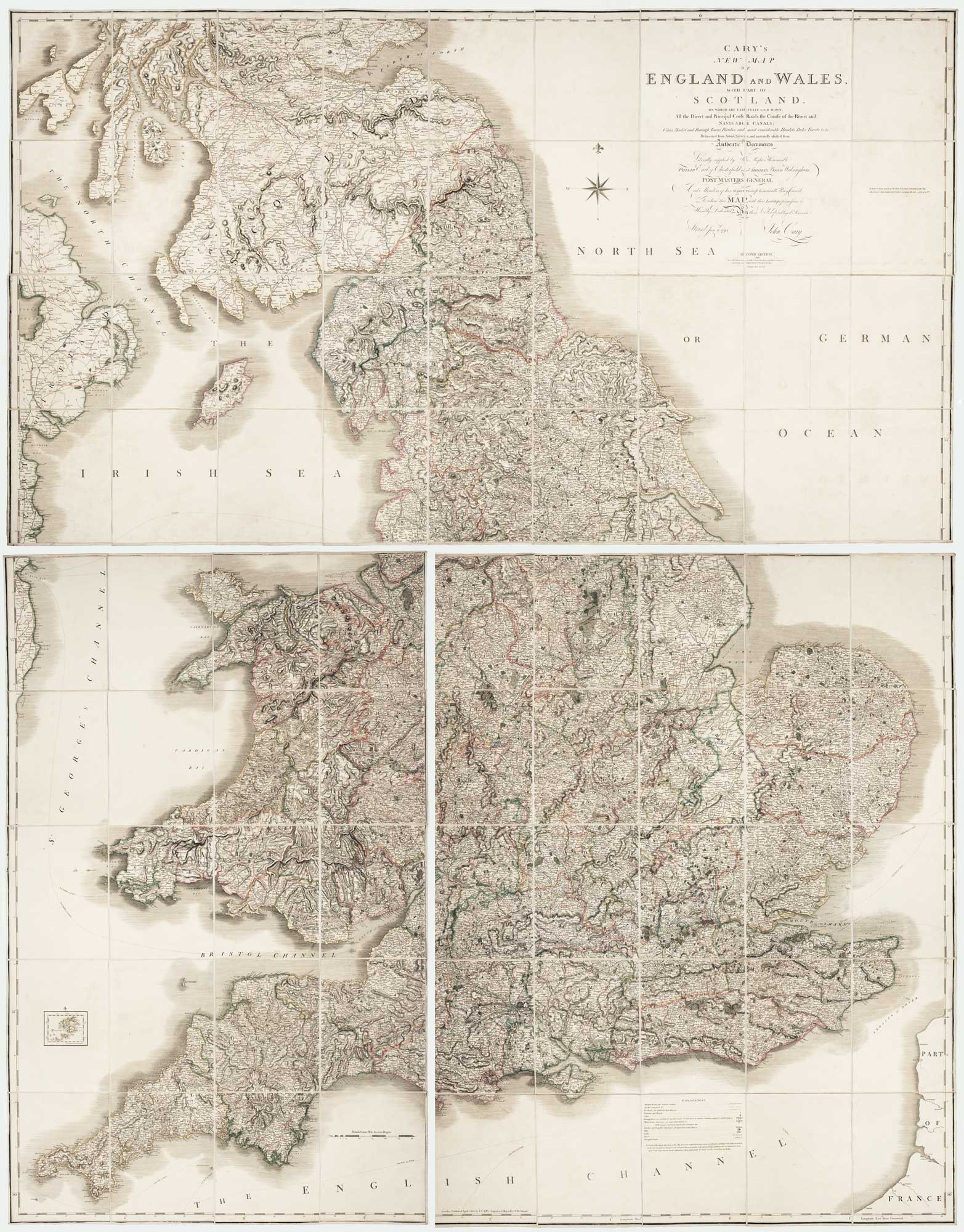
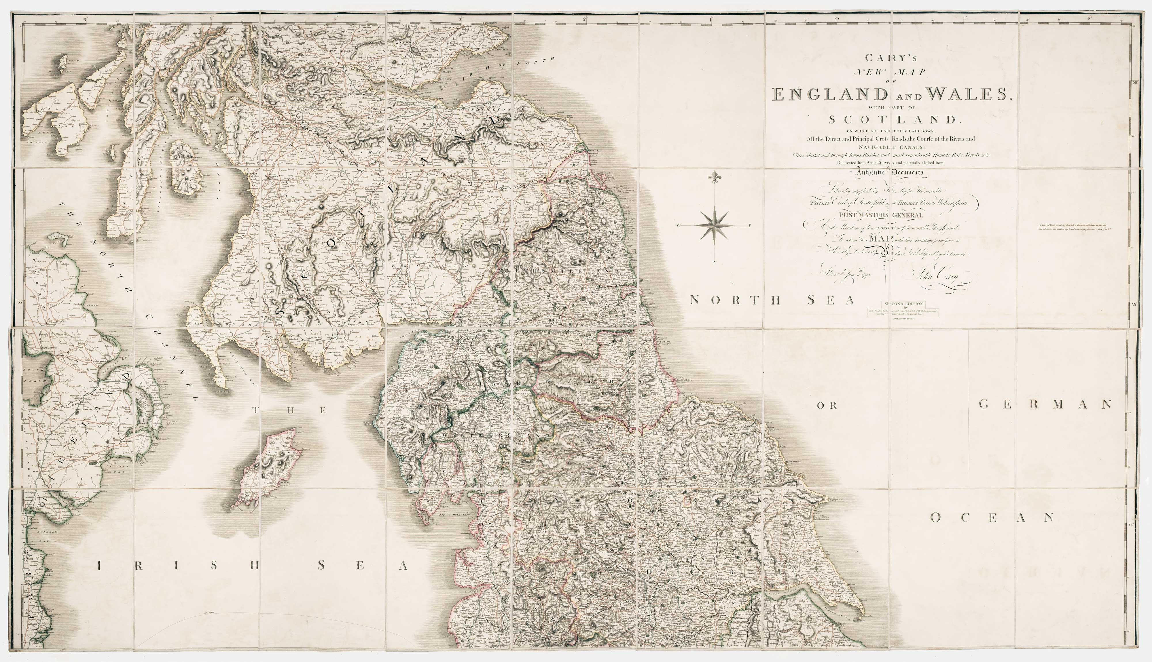
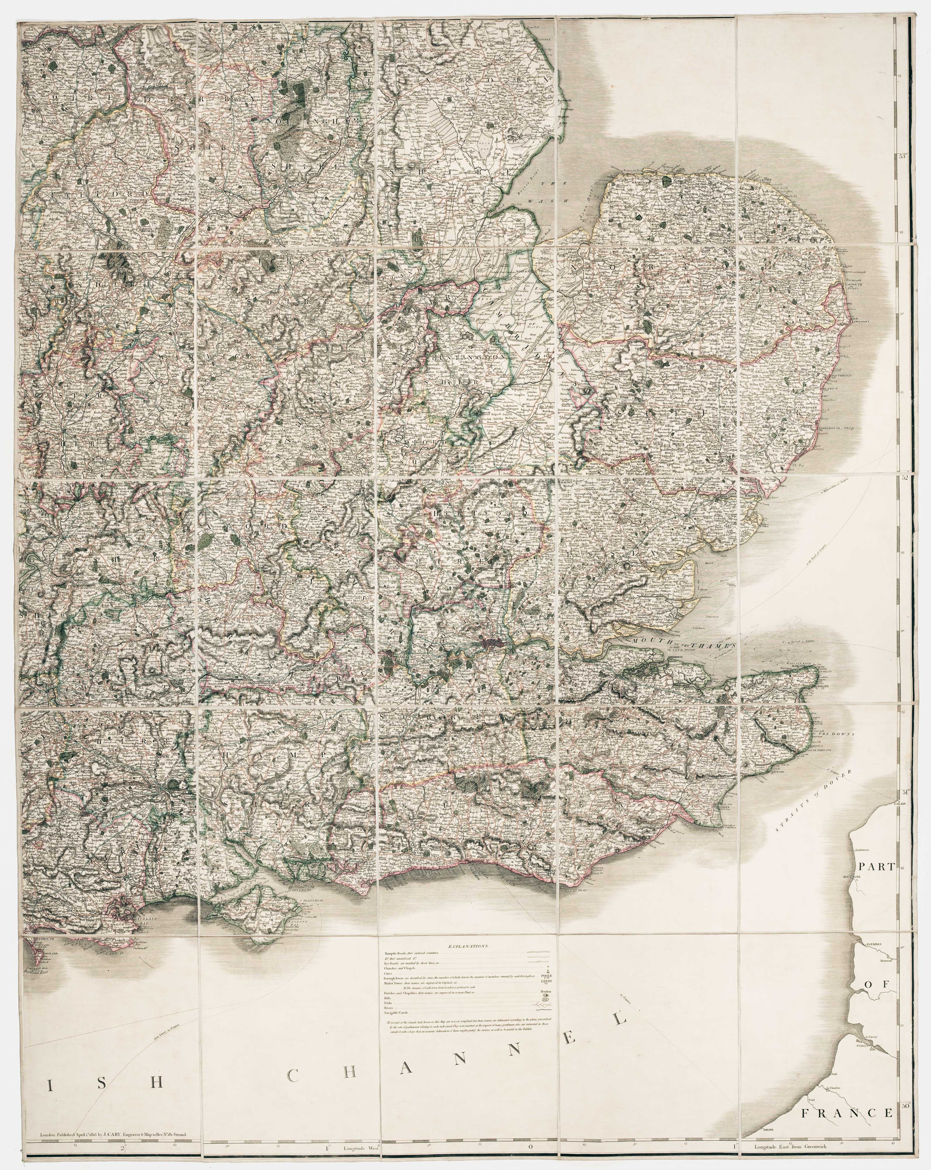
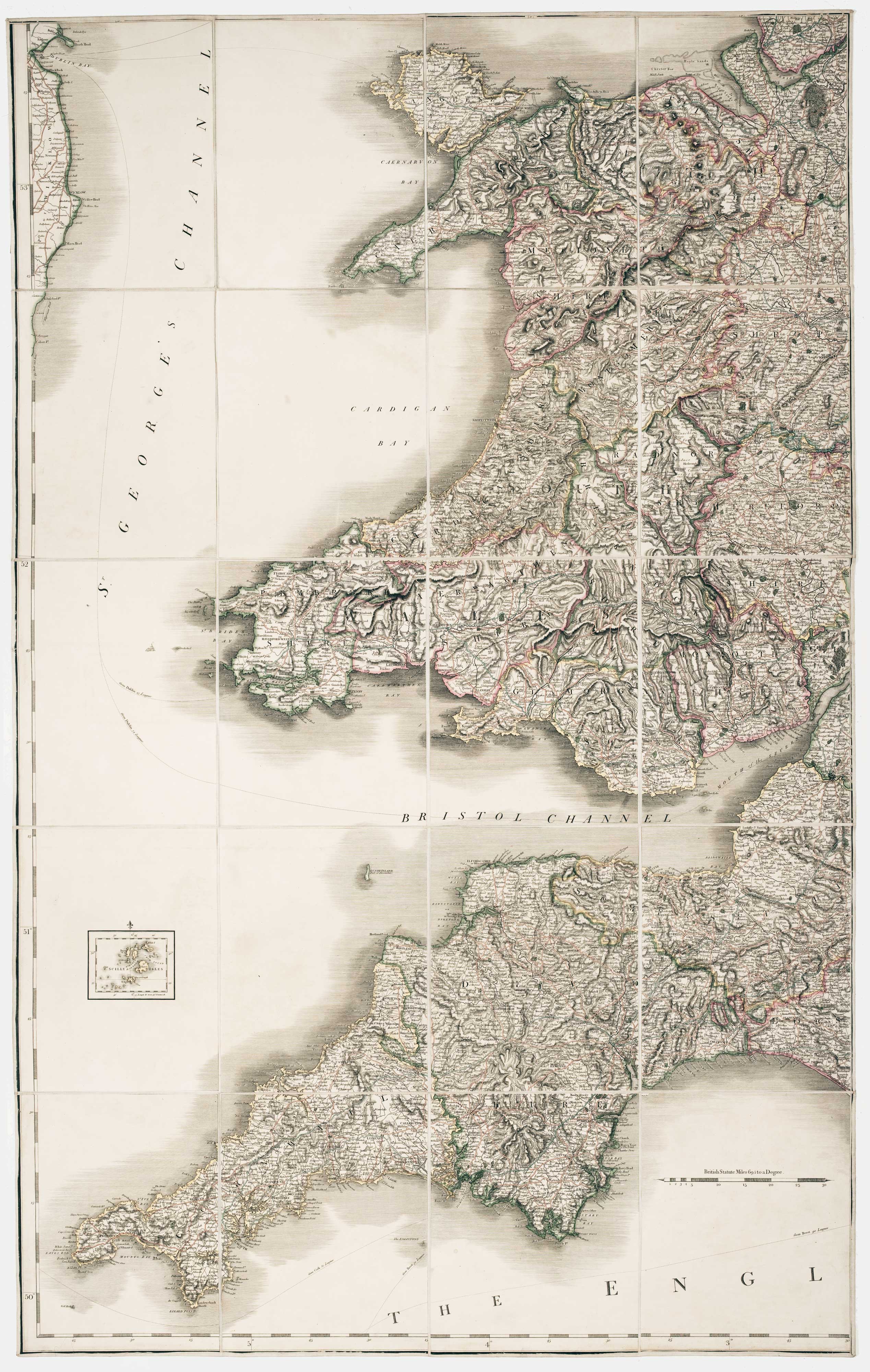
Georgian wall map of England & Wales
CARY, John.
Cary's New Map of England and Wales, With Part of Scotland. On which are carefully laid down All the Direct and Principal Cross Roads, the Course of the Rivers and Navigable Canals, Cities, Market and Borough Towns, Parishes and most considerable Hamlets, Prks, Forests &c &c... Second Edition, Corrected to 1820.
London: G. & J. Cary, 1820. Original outline colour. Dissected and laid on linen in three sections, total if joined 2310 x 1830mm, with diced calf slipcase with James Wyld's label inside lid.
Light offset, slipcase scuffed.
Cary's monumental map of England and Wales, first published in 1794, this example from the second edition of 1816 updated to 1820.
The map was published just prior to the age of railways: Britain's first public railway, the Stockton and Darlington Railway, opened only five years later, in 1825.
Stock ID : 22666
£1,250
£1,250


Altea Antique Maps & Charts
Altea Gallery Ltd, 35 St George Street
London
W1S 2FN
United Kingdom
Tel: +44 20 7491 0010
info@alteagallery.com
Sitemap :

