

A pictorial map of the Baltic theatre of the Crimean War
ILLUSTRATED LONDON NEWS.
Picture Map of the Baltic Sea.
London, 1856. Wood engraving, 500 x 760mm.
A large and lavishly illustrated map of the Baltic and countries bordering it, produced as a supplement to the Illustrated London News. With over fifty inset views and maps of the main cities of each country.
Produced soon after the end of the Crimean war, this map illustrates the areas where military action took place, especially Cronstadt, St Petersburg, and Finland (then part of the Russian Empire) where much of the miltary action took place, resulting in a stalemate.
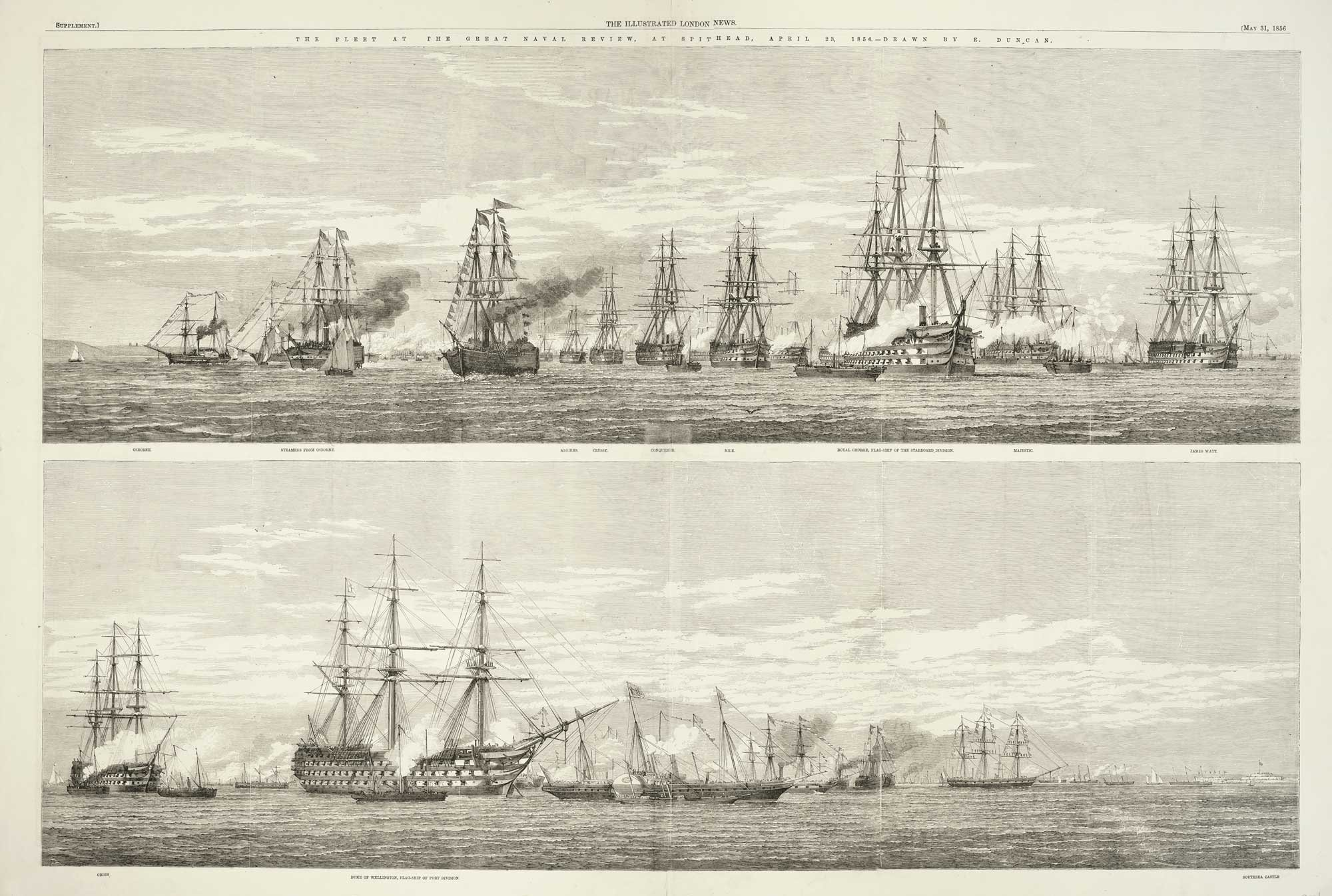
On the verso a representation of 'The Fleet At The Great Naval Review, At Spithead, April 23, 1856'.
Stock ID : 10369
£325
£325

A pictorial map of the Baltic theatre of the Crimean War
ILLUSTRATED LONDON NEWS.
Picture Map of the Baltic Sea.
London, 1856. Wood engraving, 500 x 760mm.
A large and lavishly illustrated map of the Baltic and countries bordering it, produced as a supplement to the Illustrated London News. With over fifty inset views and maps of the main cities of each country.
Produced soon after the end of the Crimean war, this map illustrates the areas where military action took place, especially Cronstadt, St Petersburg, and Finland (then part of the Russian Empire) where much of the miltary action took place, resulting in a stalemate.
On the verso a representation of 'The Fleet At The Great Naval Review, At Spithead, April 23, 1856'.
Stock ID : 10369
£325
£325


Altea Antique Maps & Charts
Altea Gallery Ltd, 35 St George Street
London
W1S 2FN
United Kingdom
Tel: +44 20 7491 0010
info@alteagallery.com
Sitemap :

