

Plan of London under William IV
MOGG, Edward.
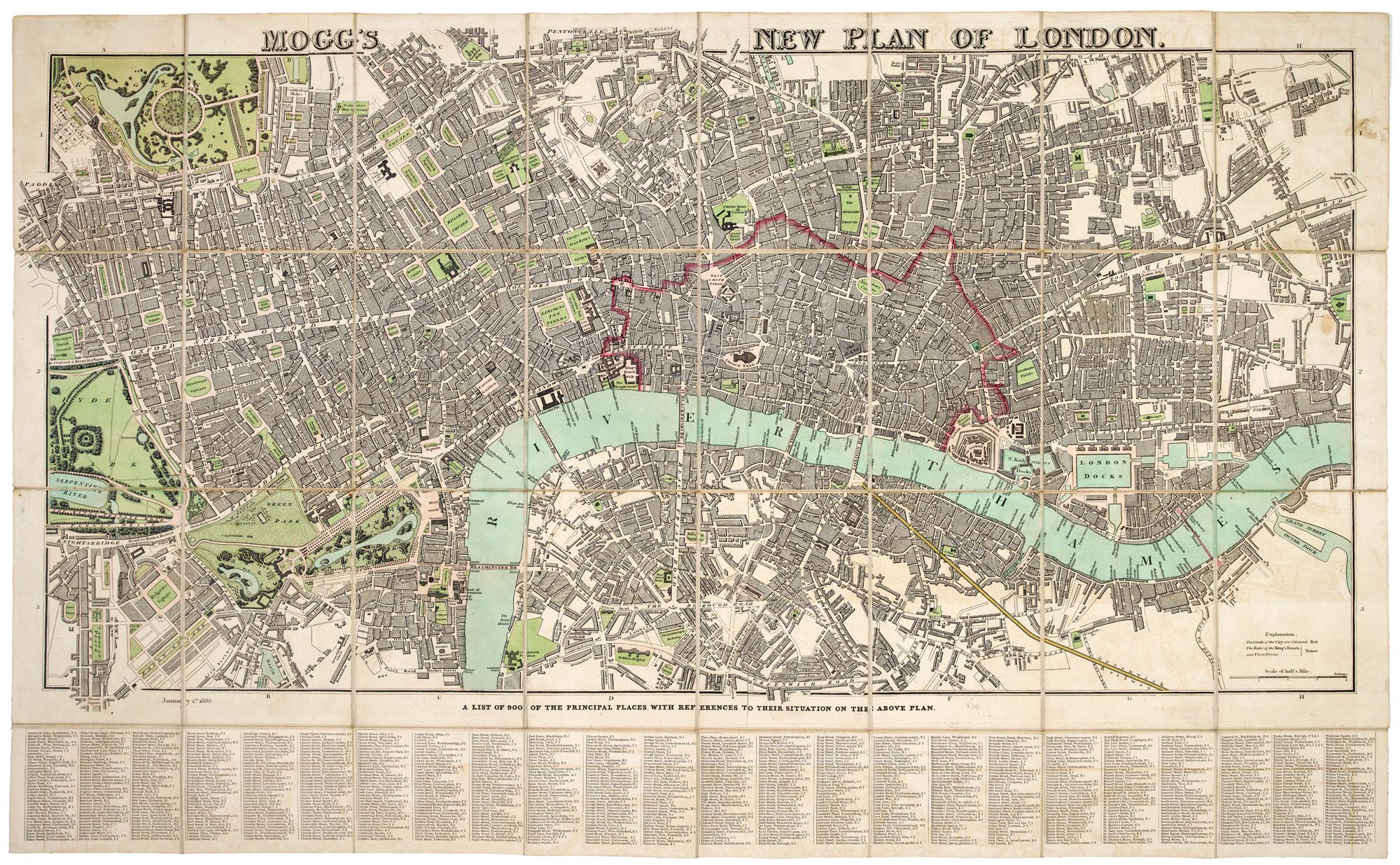
Mogg's New Plan of London.
London, 1835. Original colour. Dissected and laid on linen, as issued. 470 x 910mm, with separately-printed key under the map, total 550 x 910mm. With slipcase with illustrated publisher's label.
Slipcase rubbed and stained. Map in very fine condition
A detailed map of central London in fine colour. Extending from Hyde Park in the west, clockwise to Regent's Park, Pentonville, Bethnal Green, Stepney, Rotherhithe, Lambeth & Belgravia. Trafalgar Square is marked, five years before work started. Below the map is a key of '900 of the Principal Places' with a grid system of locations.
This example still has the date of the first issue but has the Greenwich Railway, the first railway into London, as per Howgego's second state.
HOWGEGO: 353a, unlisted state between 1 and 3 of 5.
Stock ID : 18424
SOLD
To see similar items click here

Plan of London under William IV
MOGG, Edward.
Mogg's New Plan of London.
London, 1835. Original colour. Dissected and laid on linen, as issued. 470 x 910mm, with separately-printed key under the map, total 550 x 910mm. With slipcase with illustrated publisher's label.
Slipcase rubbed and stained. Map in very fine condition
A detailed map of central London in fine colour. Extending from Hyde Park in the west, clockwise to Regent's Park, Pentonville, Bethnal Green, Stepney, Rotherhithe, Lambeth & Belgravia. Trafalgar Square is marked, five years before work started. Below the map is a key of '900 of the Principal Places' with a grid system of locations.
This example still has the date of the first issue but has the Greenwich Railway, the first railway into London, as per Howgego's second state.
HOWGEGO: 353a, unlisted state between 1 and 3 of 5.
Stock ID : 18424
SOLD
To see similar items click here


Altea Antique Maps & Charts
Altea Gallery Ltd, 35 St George Street
London
W1S 2FN
United Kingdom
Tel: +44 20 7491 0010
info@alteagallery.com
Sitemap :

