
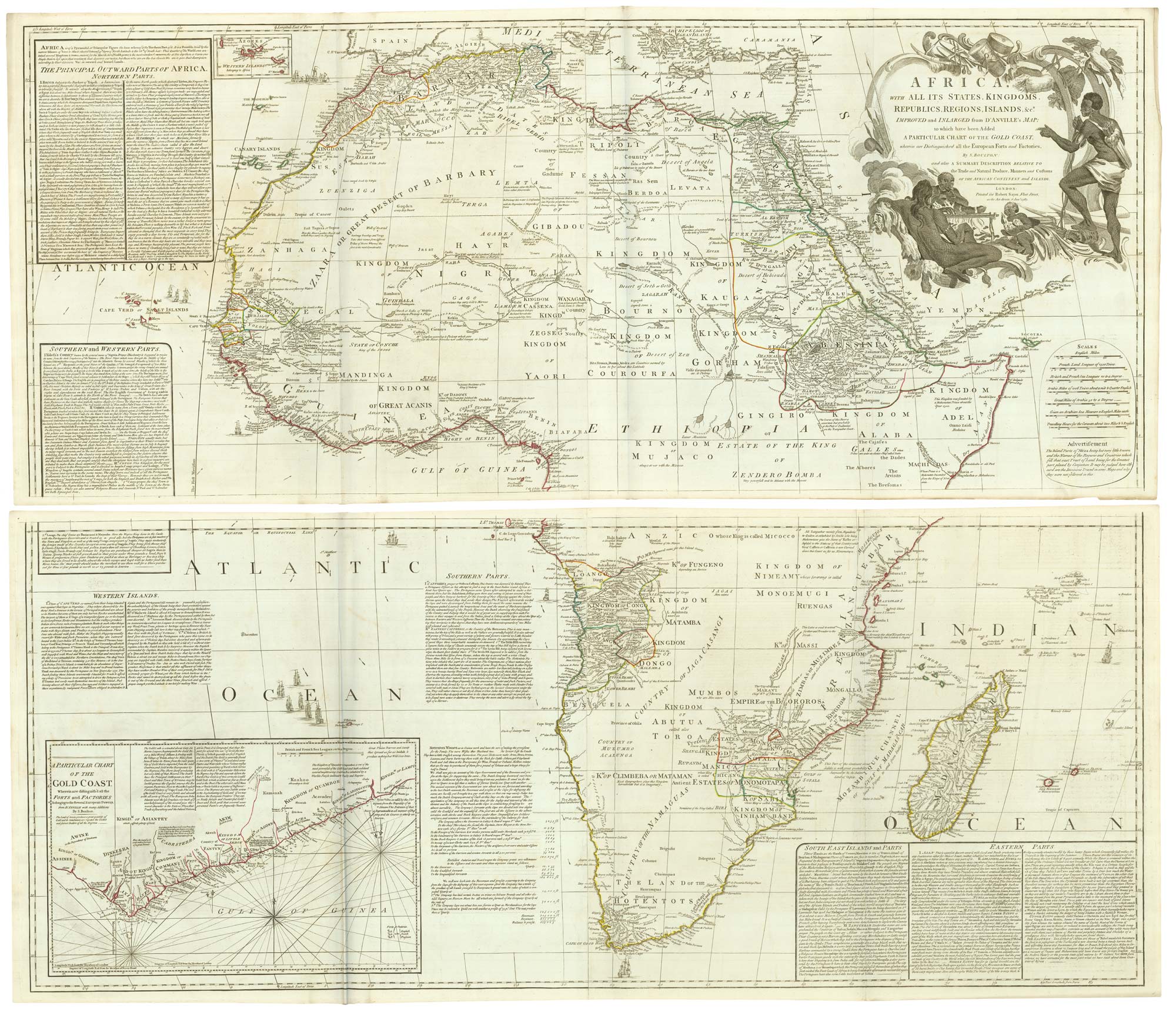

18th century wall map of Africa
BOULTON, Solomon.
Africa With All its States, Kingdoms, Republics, Regions, Islands, &c.a Improved and Inlarged from D'Anville's Map; to which have been Added A Particular Chart of the Gold COast, wherein are Distinguished all the European Forts and Factories.
London: Robert Sayer, 1787. Original outline colour. Four sheets joined in pairs, total 535 x 1030mm, total if joined 1040 x 1030mm.
A large and highly detailed map of Africa after D'Anville, with a decorative cartouche featuring four natives cooking food on a spit and an inset map of the Gold Coast. The sea areas are filled with descriptive text useful for traders.
See Norwich 105.
Stock ID : 21904
SOLD
To see similar items click here
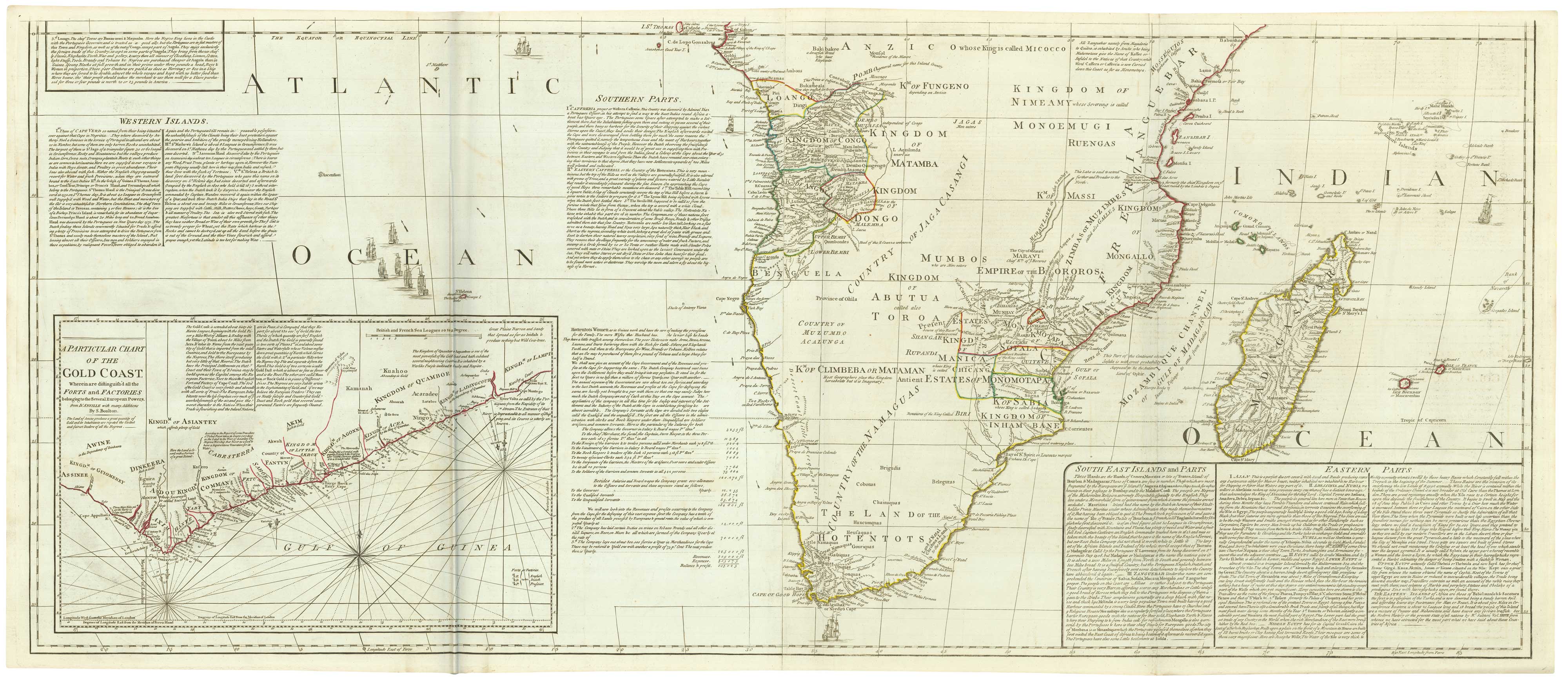


Altea Antique Maps & Charts
Altea Gallery Ltd, 35 St George Street
London
W1S 2FN
United Kingdom
Tel: +44 20 7491 0010
info@alteagallery.com
Sitemap :

