


Zatta's famous 'Atlante Novissimo' in 4 volumes
ZATTA, Antonio.
Atlante Novissimo, Illustrato ed Accresciuto sulle Osservazioni, e Scoperte fatte dai piu' celebri e piu' recenti Geograf.
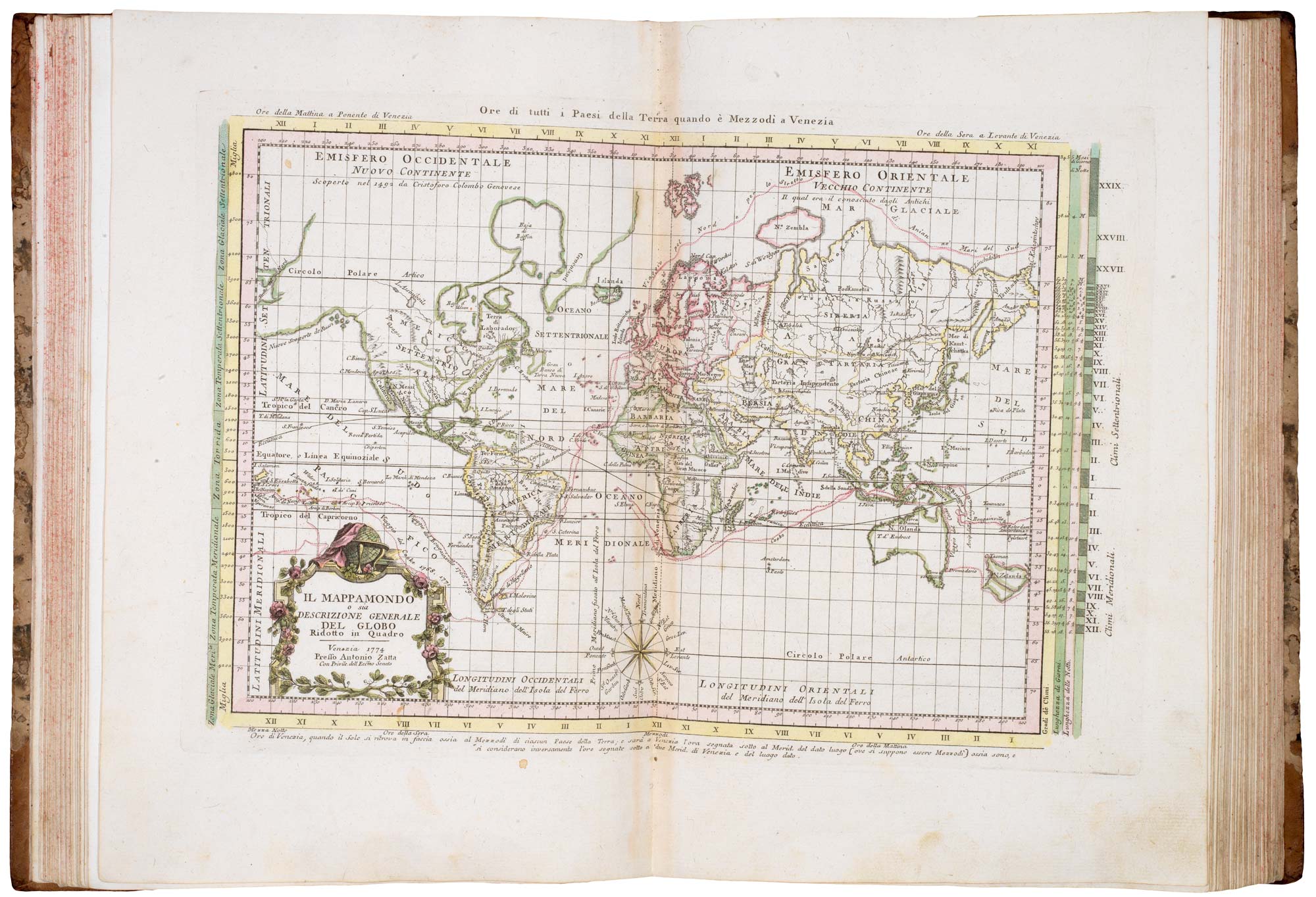
Venice: 1779-84. 4 vols, folio, contemporary half mottled calf gilt, maroon morocco gilt title labels, red speckled edges; Vol 1: hand coloured double-page frontis., pp. [vi]+xvi+50+(2), 70 coloured maps on 68 double-page sheets; Vol 2: engr. title, index, 49 maps; Vol 3: engr. title, 54 maps; Vol 4: engr. title, 42 maps on 46 sheets. Complete as indexed, including America appearing twice.
Old old ink ownership inscriptions on titles and Vol 1 frontis; Vol 1 lacking engraved title; Vol 2 with damp affecting prelims and top corner margins of first six maps; Vol 4 with old label pasted on front board.
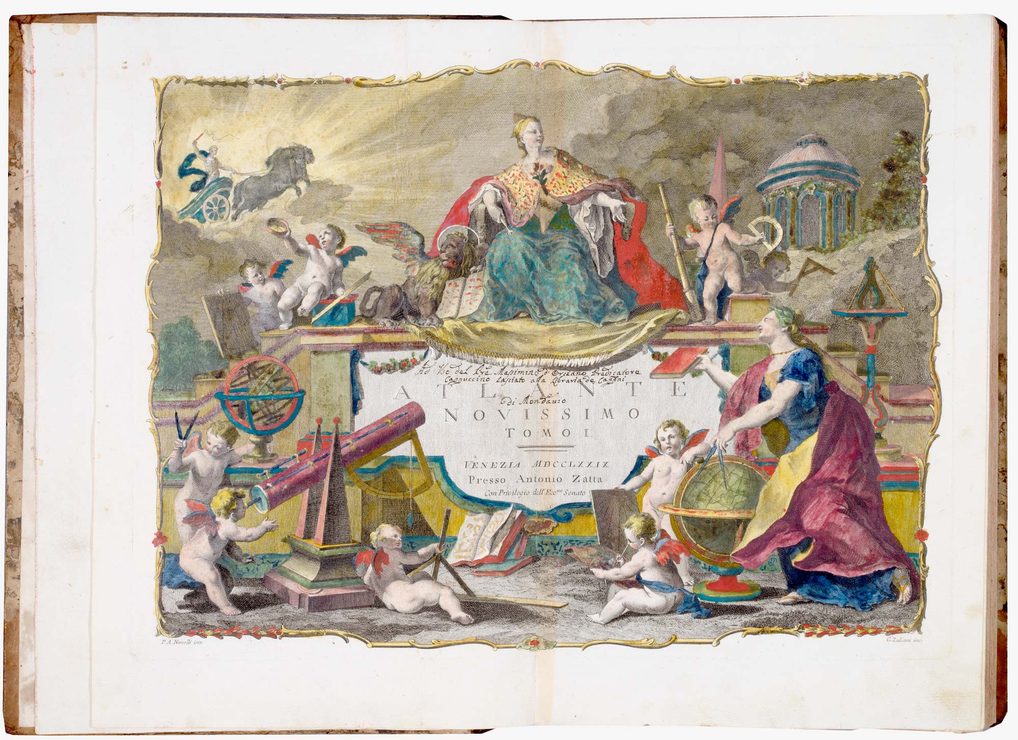
A fine example of this extensive atlas of the world, with original colour on the maps and contemporary hand colour on the frontispiece.
The atlas includes Zatta's celebrated 12-sheet 'Le Colonie Unite delle America Settentrie', the first map to name to United States, based on Mitchell's map of America (1775). This and the other regional maps of North America are placed in the first volume, with the maps of the British Isles, because they were British possessions. A note on the index of Volume 4 explains that at the time Volume 1 was published a war was being fought for these colonies: later editions of the atlas moved the maps to Volume 4.
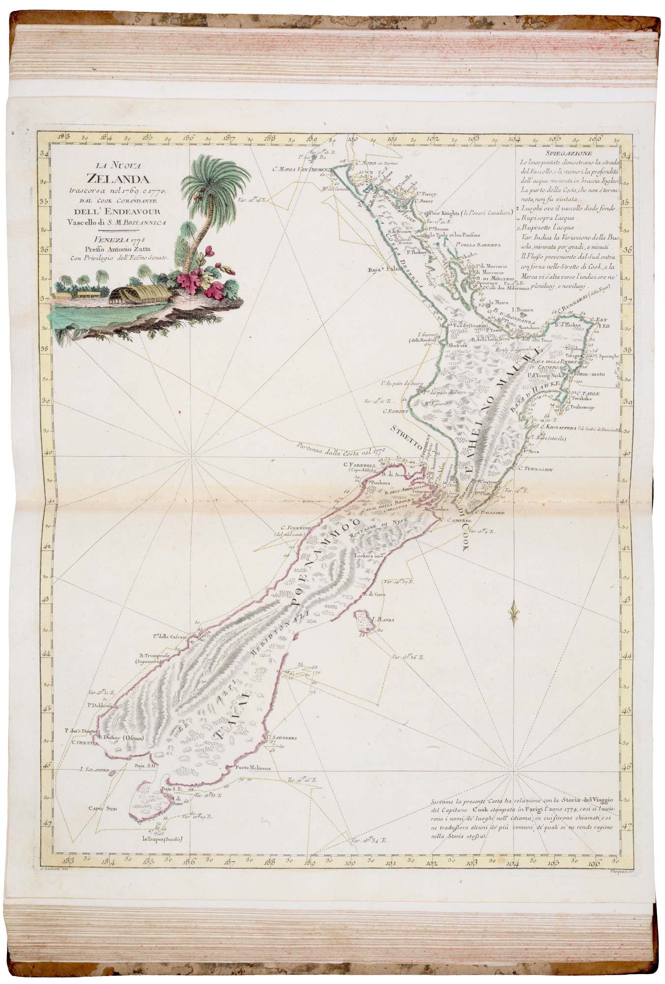
Another particularly important map is 'La Nuova Zelanda,' which was one of the first published versions of Cook's chart of New Zealand and certainly one of the most decorative.
Stock ID : 22904
SOLD
To see similar items click here

Zatta's famous 'Atlante Novissimo' in 4 volumes
ZATTA, Antonio.
Atlante Novissimo, Illustrato ed Accresciuto sulle Osservazioni, e Scoperte fatte dai piu' celebri e piu' recenti Geograf.
Venice: 1779-84. 4 vols, folio, contemporary half mottled calf gilt, maroon morocco gilt title labels, red speckled edges; Vol 1: hand coloured double-page frontis., pp. [vi]+xvi+50+(2), 70 coloured maps on 68 double-page sheets; Vol 2: engr. title, index, 49 maps; Vol 3: engr. title, 54 maps; Vol 4: engr. title, 42 maps on 46 sheets. Complete as indexed, including America appearing twice.
Old old ink ownership inscriptions on titles and Vol 1 frontis; Vol 1 lacking engraved title; Vol 2 with damp affecting prelims and top corner margins of first six maps; Vol 4 with old label pasted on front board.
A fine example of this extensive atlas of the world, with original colour on the maps and contemporary hand colour on the frontispiece.
The atlas includes Zatta's celebrated 12-sheet 'Le Colonie Unite delle America Settentrie', the first map to name to United States, based on Mitchell's map of America (1775). This and the other regional maps of North America are placed in the first volume, with the maps of the British Isles, because they were British possessions. A note on the index of Volume 4 explains that at the time Volume 1 was published a war was being fought for these colonies: later editions of the atlas moved the maps to Volume 4.
Another particularly important map is 'La Nuova Zelanda,' which was one of the first published versions of Cook's chart of New Zealand and certainly one of the most decorative.
Stock ID : 22904
SOLD
To see similar items click here


Altea Antique Maps & Charts
Altea Gallery Ltd, 35 St George Street
London
W1S 2FN
United Kingdom
Tel: +44 20 7491 0010
info@alteagallery.com
Sitemap :

