

The rare first issue of an important American atlas in fine original colour
TANNER, Henry Schenck.
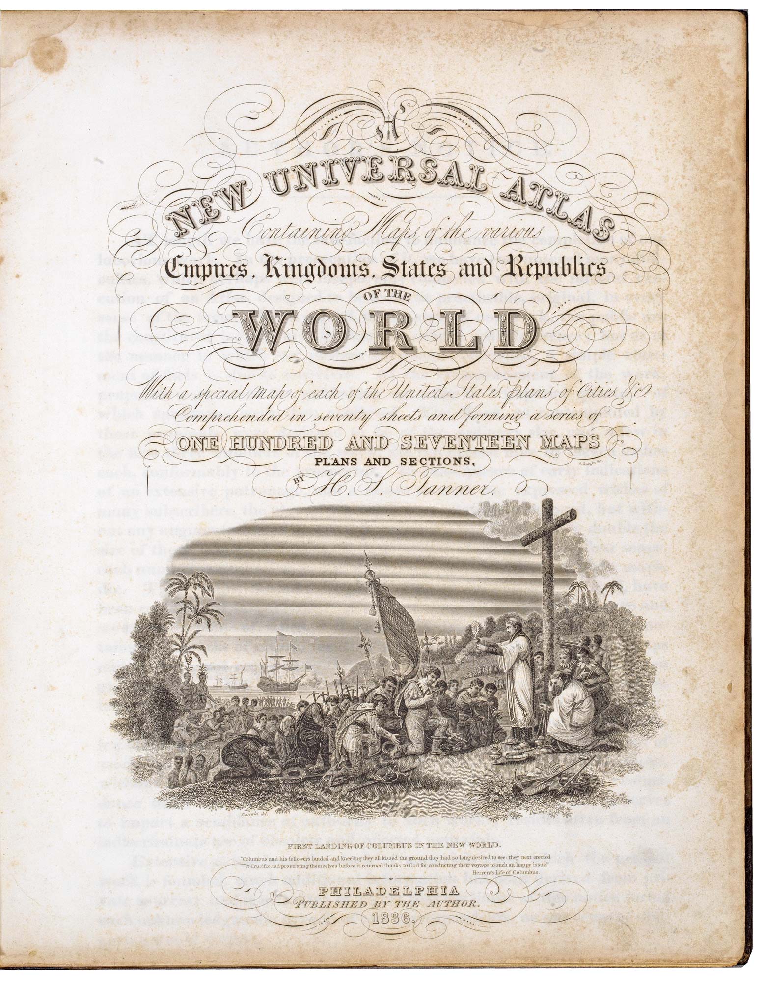
A New Universal Atlas Containing Maps of the various Empires, KIngdoms, States and Republics of the World With a special map of each of the United States, plans of Cities &c. Comprehended in seventy sheets and forming a series of One Hundred and Seventeen Maps, Plans and Sections.
Philadelphia, 1836, First Atlas Edition. Folio (400 x 330mm), original half morocco gilt; pp. (vi) + (6)(publisher's ads); engr. title with vignette, 68 numbered maps & town plans and one plate, all but title with bright original hand colour. Complete as index (70 plates including title).
Ink mss. initials on prelims.
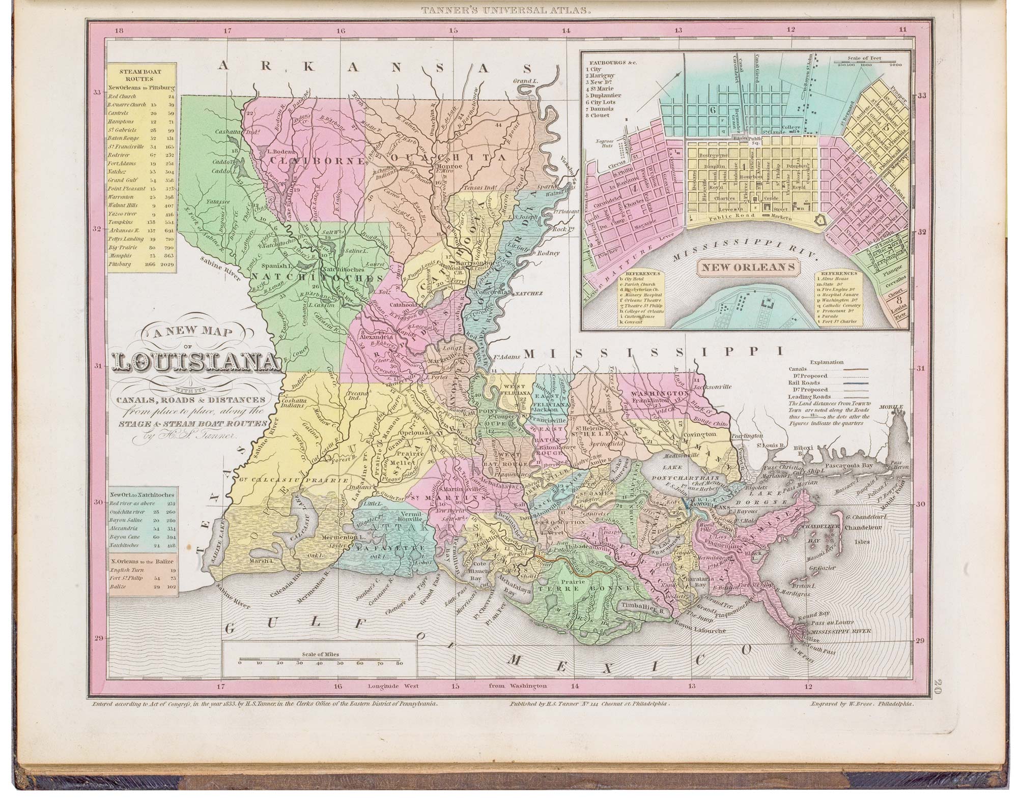
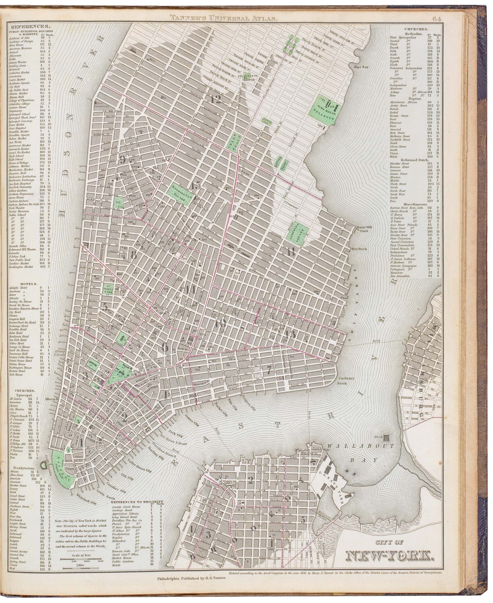
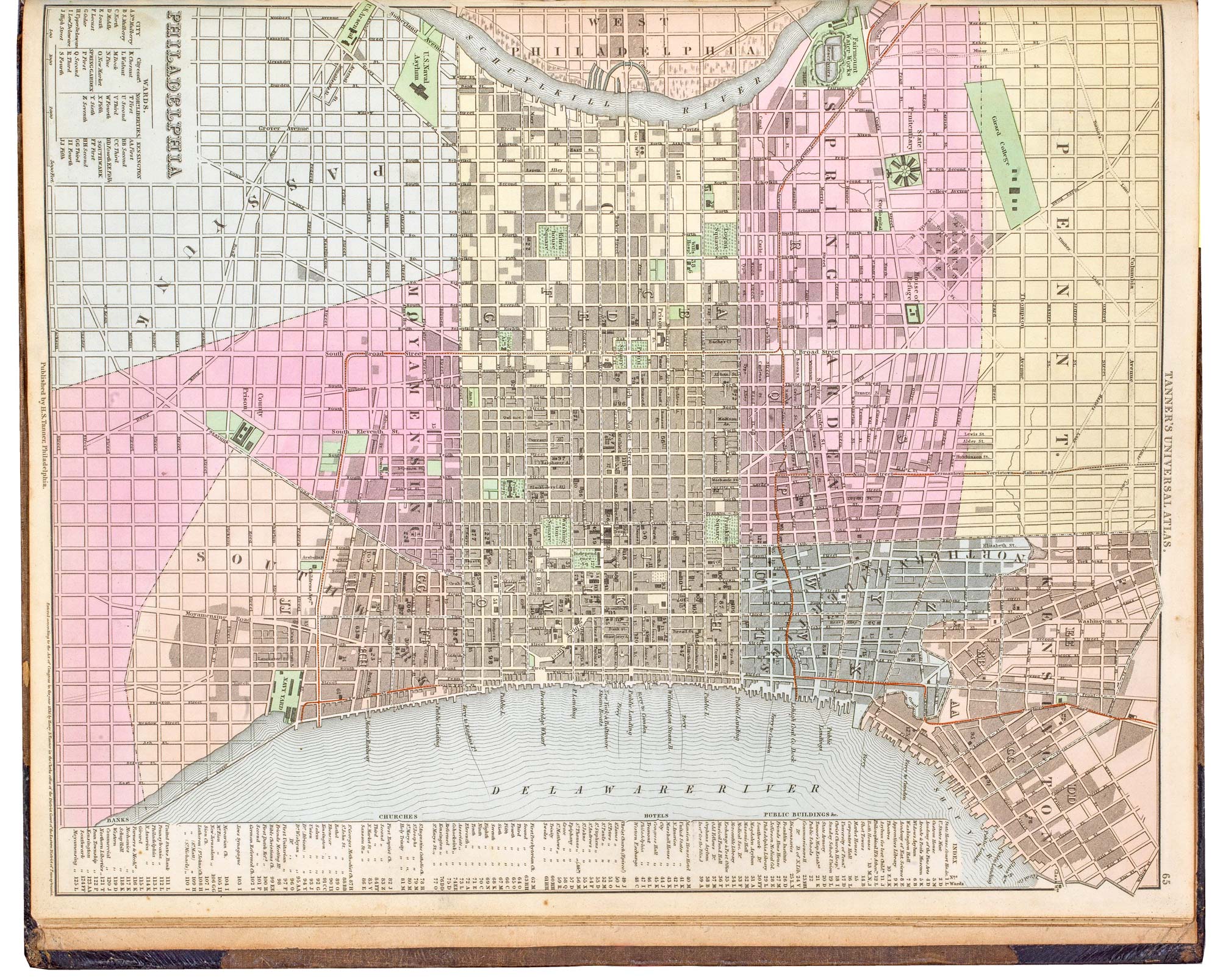
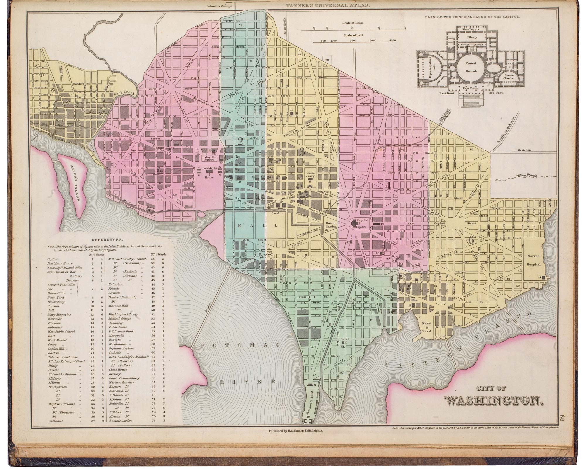
A fine example of an early American atlas, which includes maps of 27 American states and territories on 24 plates and town plans of New York, Philadelphia and Washington. The plate compares river lengths and mountain heights. The title vignette depicts the arrival of Columbus in the New World.
Tanner produced this smaller and more affordable format atlas to reach a wider market, issuing the maps in parts from 1834 although many of the maps have 1833 dates. This atlas appears to be an early first edition, compiled from the parts: the traces of blue paper on the back of the New York plan are likely to be from a wrapper. A second edition of 1838 still used the 1836 engraved title, but the dates of the maps were changed to 1836 (for example the world map). Later editions were published by Carey & Hart (from 1842) and Samuel Augustus Mitchell (from 1846).
Stock ID : 22905
£11,000
£11,000

The rare first issue of an important American atlas in fine original colour
TANNER, Henry Schenck.
A New Universal Atlas Containing Maps of the various Empires, KIngdoms, States and Republics of the World With a special map of each of the United States, plans of Cities &c. Comprehended in seventy sheets and forming a series of One Hundred and Seventeen Maps, Plans and Sections.
Philadelphia, 1836, First Atlas Edition. Folio (400 x 330mm), original half morocco gilt; pp. (vi) + (6)(publisher's ads); engr. title with vignette, 68 numbered maps & town plans and one plate, all but title with bright original hand colour. Complete as index (70 plates including title).
Ink mss. initials on prelims.
A fine example of an early American atlas, which includes maps of 27 American states and territories on 24 plates and town plans of New York, Philadelphia and Washington. The plate compares river lengths and mountain heights. The title vignette depicts the arrival of Columbus in the New World.
Tanner produced this smaller and more affordable format atlas to reach a wider market, issuing the maps in parts from 1834 although many of the maps have 1833 dates. This atlas appears to be an early first edition, compiled from the parts: the traces of blue paper on the back of the New York plan are likely to be from a wrapper. A second edition of 1838 still used the 1836 engraved title, but the dates of the maps were changed to 1836 (for example the world map). Later editions were published by Carey & Hart (from 1842) and Samuel Augustus Mitchell (from 1846).
Stock ID : 22905
£11,000
£11,000


Altea Antique Maps & Charts
Altea Gallery Ltd, 35 St George Street
London
W1S 2FN
United Kingdom
Tel: +44 20 7491 0010
info@alteagallery.com
Sitemap :

