
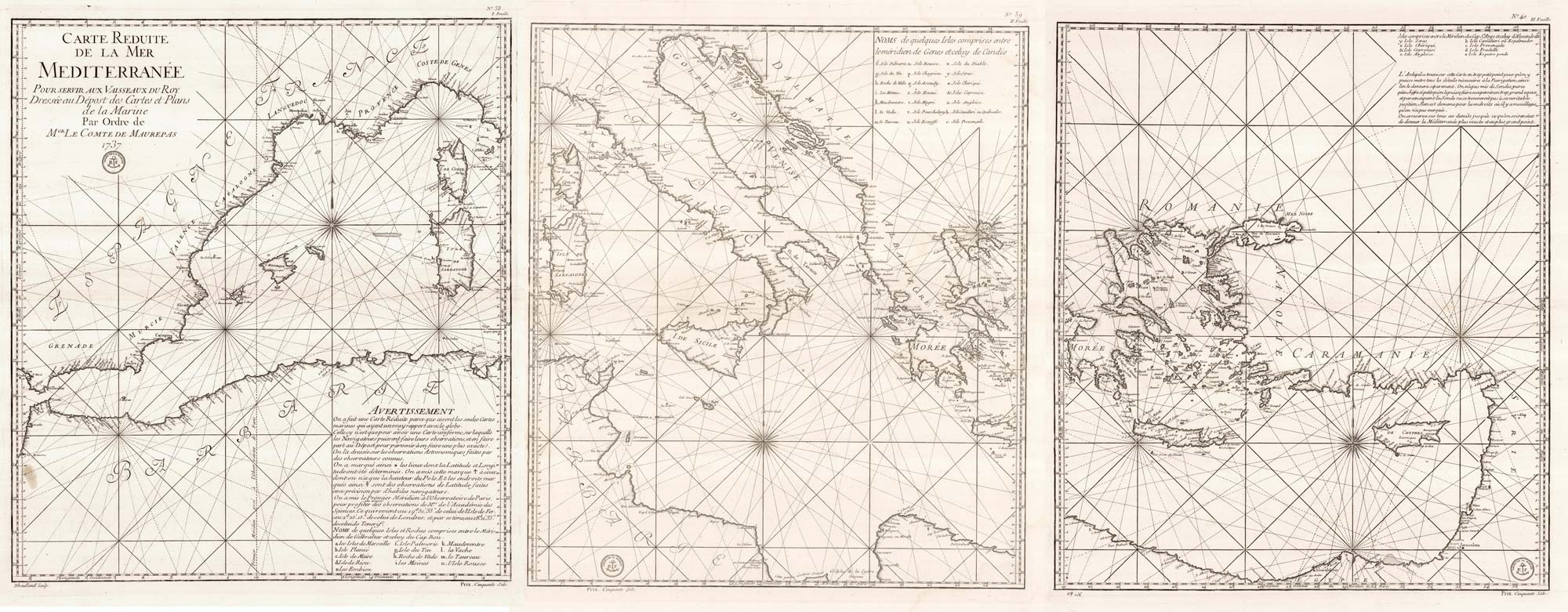
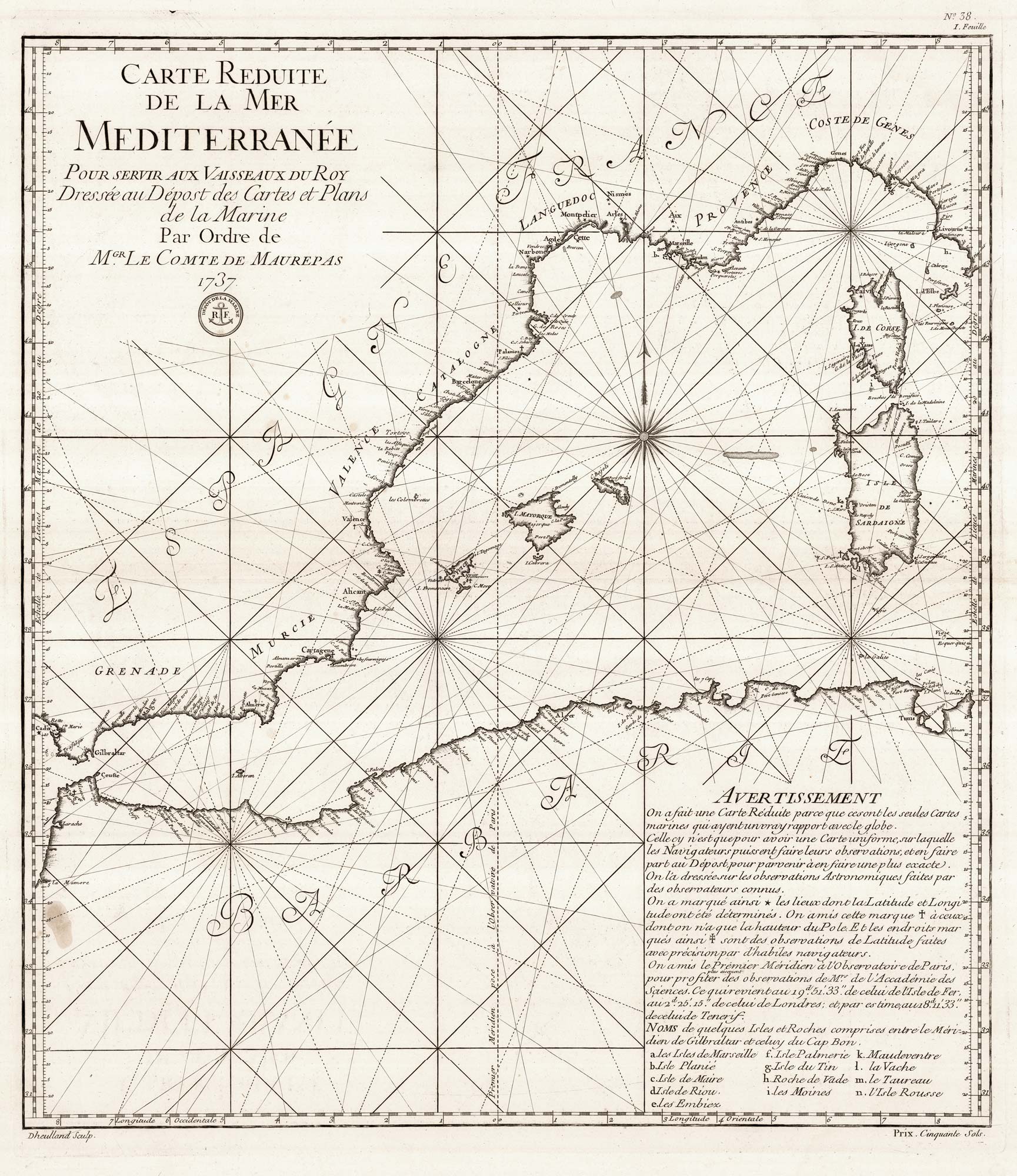

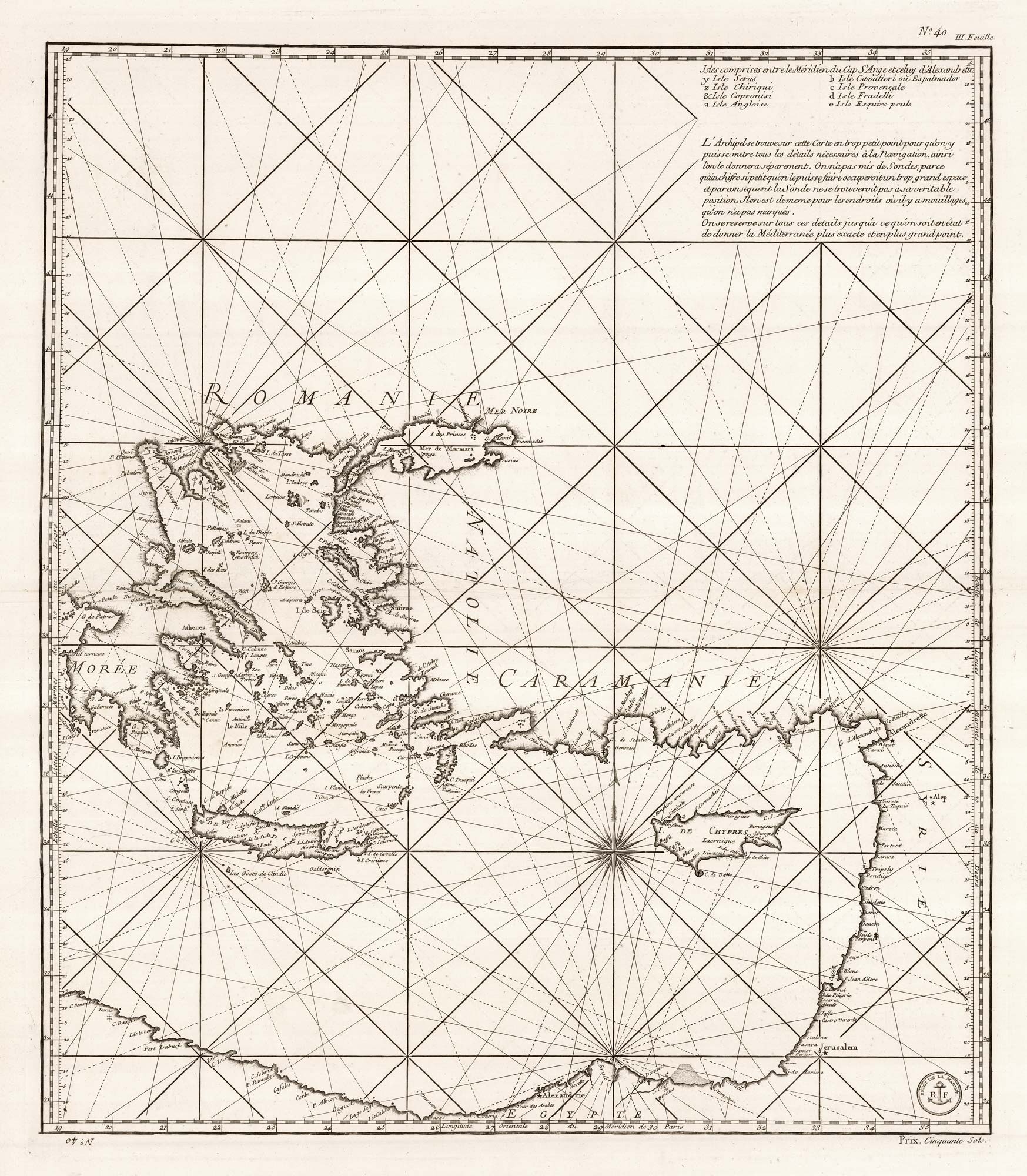
An 18th century three-sheet sea chart of the Mediterrean Sea
DHEULLAND, Guillaume.
Carte Reduite de la Mer Mediterranée Pour Servir aux Vaisseaux du Roy Dressée au Dépost des Cartes et Plans de la Marine Par Ordre de M.gr Le Comte de Maurepas 1737.
Paris: Depot de la Marine, c.1737. Three sheets, each plate c. 630 x 545mm, with good margins.
Grease stain on first sheet, faint damps stains on all three.
A large and detailed set of charts of the Mediterranean Sea, engraved by Dheulland for the Depot de la Marine, and published as both separate sheets (priced at 50 Sols each) and as part of Jacques-Nicolas Bellin's 'Neptune Francois' sea atlas.
The western sheet shows from Gibraltar to Corsica and Sardinia with the corresponding coast of Africa; the second Corsica and Sardinia, Italy and Greece; and the third Greece, Turkey, Cyprus & the Holy Land and Egypt.
As the mapping on the sheets overlap and they have borders with graduated Longitude and Latitude scales, the map is not suitable for joining.
Stock ID : 23353
£1,600
£1,600


Altea Antique Maps & Charts
Altea Gallery Ltd, 35 St George Street
London
W1S 2FN
United Kingdom
Tel: +44 20 7491 0010
info@alteagallery.com
Sitemap :

