
Showing 1–9 of 16 results
-

Vancouver’s mapping of the Pacific North West
£350VANCOUVER, Capt. George.
Published In 1820
Stock No. 24534 -

Van der Aa’s large format maps of the four Continents in superb colour
£7,500AA, Pieter van der.
Published In 1713
Stock No. 24369 -
Map of the United States with decorative vignettes
£300TALLIS, John.
Published In 1851
Stock No. 23481 -

17th century chart of the West Indies
£1,200JANSSON, Jan.
Published In 1638
Stock No. 21959 -

A 17th century map of Cape Breton Island
£160CORONELLI, Vincenzo Maria.
Published In 1696
Stock No. 21640 -

Scarce map of Denmark
£400WALCH, Johann.
Published In 1820
Stock No. 21119 -
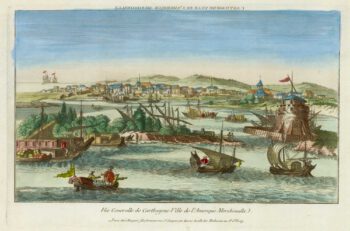
18th century vue d’optique of Cartagena
£280CHEREAU, Jacques.
Published In 1780
Stock No. 18981 -
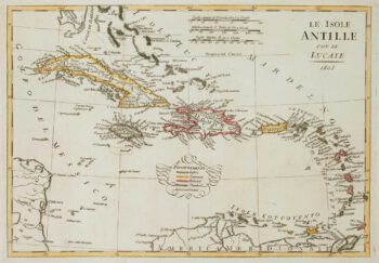
Early 19th century map of the West Indies
£150GUTHRIE, William.
Published In 1804
Stock No. 17251 -

Map of Panama with vignettes
£150TALLIS, John.
Published In 1851
Stock No. 16130