- Reset all
- Abruzzo
- Adriatic Sea
- Argentina
- Austria
- Balearics
- Black Sea
- Books about Maps
- British Isles
- Burma
- Calabria
- Campania
- Central America
- China
- Constantinople
- Cornwall
- Denmark
- Europe
- Gibraltar
- Greece
- Hispaniola
- Hungary
- Iberia
- Italy
- Latvia and Estonia
- London Environs
- Maritime
- Monaco
- Moon
- Munster
- Near East
- North Africa Maps
- North America
- Pacific and Australasia
- Panama
- Paris
- Prospects
- Provence
- Russia
- Scandinavia
- Scientific Instruments
- Shropshire
- Southern Italy
- Spain
- St Helena
- St Kitts
- Syria
- Turkey
- Virgin Islands
- Warwickshire
- Worcestershire
- Zodiac
Showing 1549–1560 of 1639 results
-

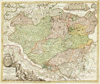
18th century map of Holstein
£200HOMANN, Johann Baptist.
Published In 1720
Stock No. 11370 -

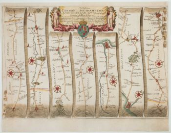
The road from Bagshot to Southampton and on to Salisbury
£380OGILBY, John.
Published In 1675
Stock No. 11367 -

Early 18th century map of Iberia
£160BION, Nicolas.
Published In 1710
Stock No. 11338 -

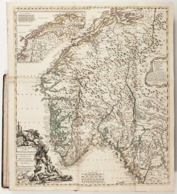
The Natural History of Norway, including sea-monsters!
£1,950PONTOPPIDAN, Erich.
Published In 1755
Stock No. 11264 -

A circular plan of London and Environs
£1,000PIGOT, James.
Published In 1832
Stock No. 11253 -

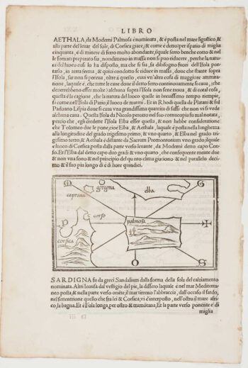
The first printed map of Corsica
£800BORDONE, Benedetto.
Published In 1534
Stock No. 11217 -

Cambrai in the C16th
£420BRAUN, Georg & HOGENBERG, Frans.
Published In 1596
Stock No. 11183 -

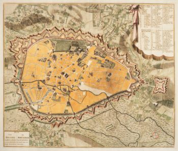
Town plan of Brussels in the 18th century
£500HUCHTENBURG, J. van.
Published In 1729
Stock No. 11162 -

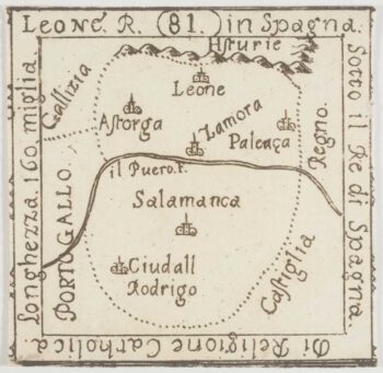
An extremely rare miniature map of Leon
£350FRESCHOT, Casimir Don.
Published In 1680
Stock No. 11161 -

18th century map of Finland
£400SEUTTER, Matthaus.
Published In 1730
Stock No. 11101 -
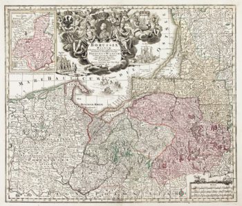
Detailed map of Prussia
£390SEUTTER, Matthaus.
Published In 1730
Stock No. 10985 -

A manuscript design for the new pier at Genoa
£500Anonymous.
Published In 1715
Stock No. 10882