- Reset all
- Abruzzo
- Aegean Islands
- Africa Continent
- Balkan maps
- Barbary Coast
- Bering Strait
- Bermuda
- Black Sea
- Bohemia
- Books about Maps
- Calabria
- Caspian Sea
- Central America
- Central Europe
- China
- Corsica
- Eastern Seaboard Maps
- Emilia Romagna
- Europe
- Finland
- Florida
- Hispaniola
- Hungary
- Iberia
- Iceland
- India
- Ireland
- Isle of Wight
- Italy
- Kent
- Leicestershire
- London Environs
- Maritime
- Mexico
- Monaco
- Near East
- North Africa Maps
- North America
- Northumberland
- Oxfordshire
- Pacific and Australasia
- Pacific Ocean
- Pennsylvania
- Poland
- Portugal
- Prints
- Provence
- Russia
- Scientific Instruments
- Somerset
- Southern Italy
- Spain
- St Kitts
- Staffordshire
- Surrey
- Sussex
- Syria
- Ukraine
- United States Maps
- Wales
- Worcestershire
- World
Showing 1477–1488 of 1565 results
-

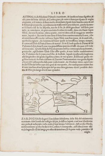
The first printed map of Corsica
£800BORDONE, Benedetto.
Published In 1534
Stock No. 11217 -

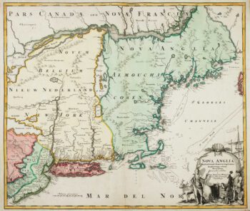
The English colonies on the north-east seaboard of America
£1,450HOMANN, Johann Baptist.
Published In 1725
Stock No. 11207 -

Cambrai in the C16th
£420BRAUN, Georg & HOGENBERG, Frans.
Published In 1596
Stock No. 11183 -

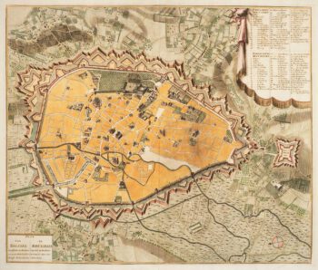
Town plan of Brussels in the 18th century
£500HUCHTENBURG, J. van.
Published In 1729
Stock No. 11162 -

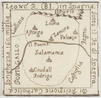
An extremely rare miniature map of Leon
£350FRESCHOT, Casimir Don.
Published In 1680
Stock No. 11161 -

An extremely rare miniature map of India
£400FRESCHOT, Casimir Don.
Published In 1680
Stock No. 11113 -

18th century map of Finland
£400SEUTTER, Matthaus.
Published In 1730
Stock No. 11101 -

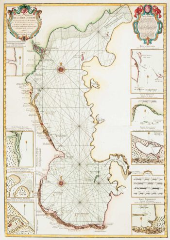
The first accurate map of the Caspian Sea
£800DELISLE, Guillaume.
Published In 1721
Stock No. 10995 -
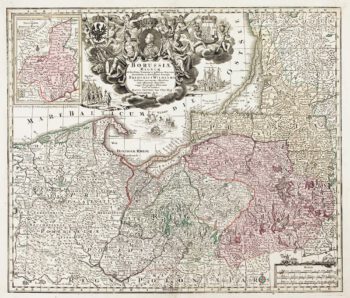
Detailed map of Prussia
£390SEUTTER, Matthaus.
Published In 1730
Stock No. 10985 -

A manuscript design for the new pier at Genoa
£500Anonymous.
Published In 1715
Stock No. 10882 -

Catalonia
£125BODENEHR, Gabriel.
Published In 1704
Stock No. 10878 -

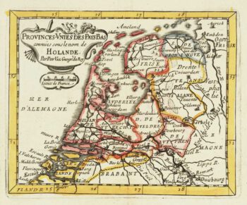
Miniature map of Holland
£140DU VAL, Pierre.
Published In 1682
Stock No. 10859