- Reset all
- Abruzzo
- Aegean Islands
- Africa Continent
- Bering Strait
- Bermuda
- Black Sea
- Books about Maps
- Calabria
- Campania
- Central America
- China
- Emilia Romagna
- Europe
- Hispaniola
- Hungary
- Iceland
- India
- Ireland
- Isle of Wight
- Italy
- Leicestershire
- London Environs
- Maritime
- Mexico
- Monaco
- Near East
- North Africa Maps
- North America
- Oxfordshire
- Pacific and Australasia
- Pennsylvania
- Poland
- Portugal
- Prints
- Provence
- Russia
- Scientific Instruments
- Somerset
- Southern Italy
- Spain
- Surrey
- Sussex
- Syria
- United States Maps
- Worcestershire
Showing 1345–1356 of 1467 results
-

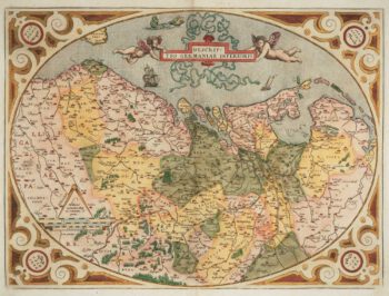
The Netherlands ‘Egg’ Map by Ortelius
£850ORTELIUS, Abraham.
Published In 1574
Stock No. 12887 -
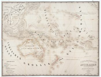
Wall map of Australasia
£600HOLLE, Leinhart.
Published In 1860
Stock No. 12843 -

Town plan of Messina in Sicily
£370BLAEU, Johannes.
Published In 1705
Stock No. 12823 -

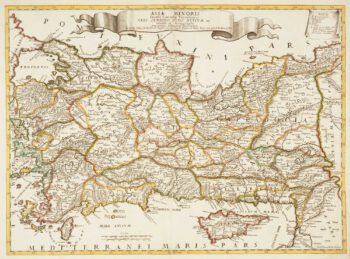
Map of Turkey and Cyprus
£680CANTELLI DA VIGNOLA, Giacomo.
Published In 1686
Stock No. 12796 -

Map of Turkey and Cyprus
£350CANTELLI DA VIGNOLA, Giacomo.
Published In 1686
Stock No. 12795 -

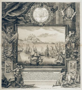
The Relief of Gibraltar by Admiral Leake
£600DECKER, Paul.
Published In 1720
Stock No. 12773 -

Map of Bermuda and other islands in the Atlantic, with vignettes
£100TALLIS, John.
Published In 1851
Stock No. 12631 -

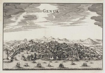
Miniature 17th century bird’s-eye view of Genoa
£250FURTTENBACH, Joseph.
Published In 1627
Stock No. 12590 -

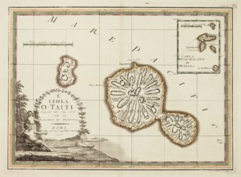
Cook’s mapping of Tahiti
£300CASSINI, Giovanni Maria.
Published In 1798
Stock No. 12534 -

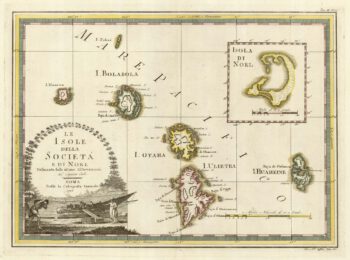
The Leeward Society Islands
£350CASSINI, Giovanni Maria.
Published In 1798
Stock No. 12533 -

Rare 19th centiury Spanish sea chart of China with Taiwan
£1,400FERREIRO, Martin
Published In 1863
Stock No. 12454 -

Sea chart of the East China Sea
£900BRYANT, Tomas.
Published In 1864
Stock No. 12452