- Reset all
- Abruzzo
- America
- Arctic
- Azores
- Bering Strait
- Black Sea
- Calabria
- Campania
- China
- Emilia Romagna
- Europe
- Games
- Hispaniola
- Hungary
- Italy
- London Environs
- London Transport Maps
- Marche
- Maritime
- Monaco
- North America
- Oxfordshire
- Pacific and Australasia
- Pennsylvania
- Poland
- Polar
- Provence
- Scandinavia
- Scientific Instruments
- Scotland Maps
- Somerset
- Syria
- United States Maps
- Worcestershire
- Zodiac
Showing 1321–1332 of 1407 results
-

Luxembourg
£150SEUTTER, Matthaus.
Published In 1744
Stock No. 11397 -

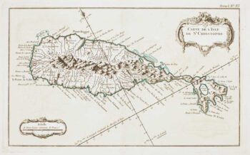
18th century French chart of St Kitts
£300BELLIN, Jacques-Nicolas.
Published In 1764
Stock No. 11377 -

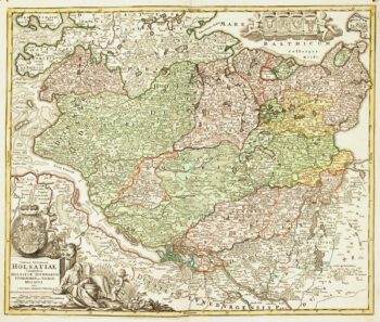
18th century map of Holstein
£200HOMANN, Johann Baptist.
Published In 1720
Stock No. 11370 -

Early 18th century map of Iberia
£160BION, Nicolas.
Published In 1710
Stock No. 11338 -

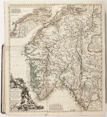
The Natural History of Norway, including sea-monsters!
£1,950PONTOPPIDAN, Erich.
Published In 1755
Stock No. 11264 -

A circular plan of London and Environs
£1,000PIGOT, James.
Published In 1832
Stock No. 11253 -

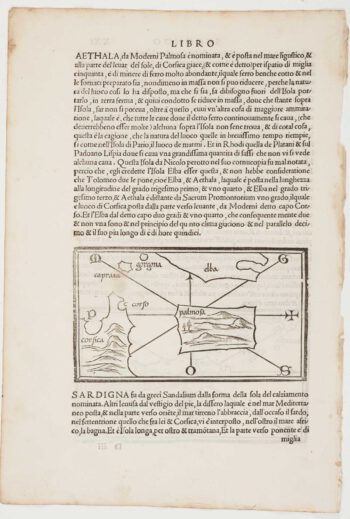
The first printed map of Corsica
£800BORDONE, Benedetto.
Published In 1534
Stock No. 11217 -

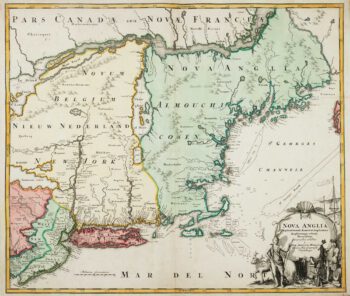
The English colonies on the north-east seaboard of America
£1,450HOMANN, Johann Baptist.
Published In 1725
Stock No. 11207 -

Cambrai in the C16th
£420BRAUN, Georg & HOGENBERG, Frans.
Published In 1596
Stock No. 11183 -

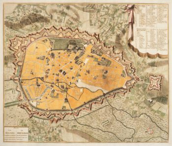
Town plan of Brussels in the 18th century
£500HUCHTENBURG, J. van.
Published In 1729
Stock No. 11162 -

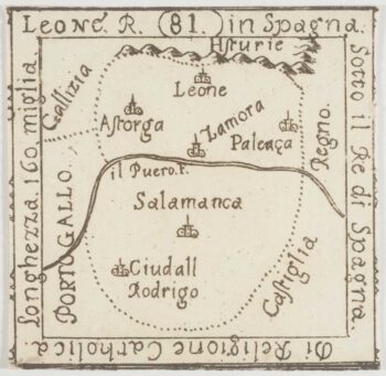
An extremely rare miniature map of Leon
£350FRESCHOT, Casimir Don.
Published In 1680
Stock No. 11161 -

18th century map of Finland
£400SEUTTER, Matthaus.
Published In 1730
Stock No. 11101