- Reset all
- Advertising
- Antigua
- Argentina
- Baltic Sea
- Bering Strait
- Bolivia
- British Isles
- Canada
- Canary Islands
- Devon
- Eastern Europe
- Eastern Seaboard Maps
- Elba
- Europe
- Frontispieces
- Gulf States
- Hertfordshire
- Lancashire
- Latvia and Estonia
- Leicestershire
- Madeira
- Maritime
- Mexico
- Morocco
- Netherlands
- North America Maps
- Northamptonshire
- Nottinghamshire
- Poland
- Prints
- Russia
- Scottish Islands
- Solar System
- St Kitts
- Switzerland
- Trentino
- Turkey
- United States
- Vietnam
- Virginia
- Westmorland
- World and Continents
Showing 1441–1452 of 1528 results
-

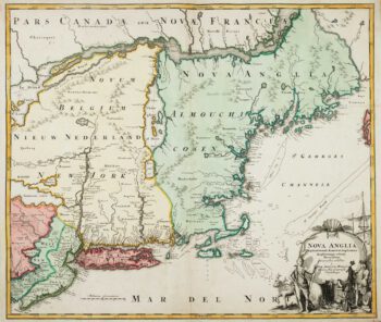
The English colonies on the north-east seaboard of America
£1,450HOMANN, Johann Baptist.
Published In 1725
Stock No. 11207 -

Cambrai in the C16th
£420BRAUN, Georg & HOGENBERG, Frans.
Published In 1596
Stock No. 11183 -

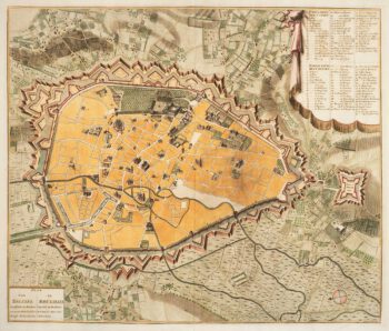
Town plan of Brussels in the 18th century
£500HUCHTENBURG, J. van.
Published In 1729
Stock No. 11162 -

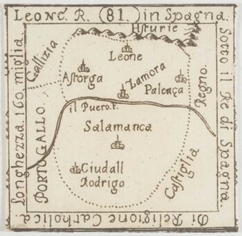
An extremely rare miniature map of Leon
£350FRESCHOT, Casimir Don.
Published In 1680
Stock No. 11161 -

18th century map of Finland
£400SEUTTER, Matthaus.
Published In 1730
Stock No. 11101 -
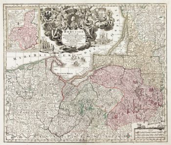
Detailed map of Prussia
£390SEUTTER, Matthaus.
Published In 1730
Stock No. 10985 -

A manuscript design for the new pier at Genoa
£500Anonymous.
Published In 1715
Stock No. 10882 -

Catalonia
£125BODENEHR, Gabriel.
Published In 1704
Stock No. 10878 -

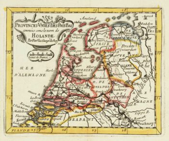
Miniature map of Holland
£140DU VAL, Pierre.
Published In 1682
Stock No. 10859 -

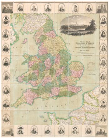
A decorative wall map of England & Wales
£1,500SEATON, Robert.
Published In 1835
Stock No. 10838 -

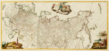
An impressive three-sheet map of the Russian Empire
£2,950TRESCOTT, John & SCHMIDT, Jakob.
Published In 1782
Stock No. 10643 -

Four-sheet folding map of England & Wales
£800CREIGHTON, R.
Published In 1839
Stock No. 10621