Showing 13–24 of 138 results
-

A 16th century Italian plan of Kannur, Kerala
£140VALEGIO, Francesco.
Published In 1598
Stock No. 24141 -

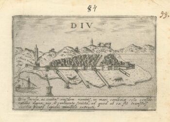
A 16th century Italian plan of Diu Island
£200VALEGIO, Francesco.
Published In 1598
Stock No. 24140 -

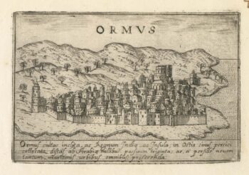
A 16th century Italian plan of Hormuz
£200VALEGIO, Francesco.
Published In 1598
Stock No. 24138 -

A 17th century map of Persia
£380MERIAN, Matthaus.
Published In 1650
Stock No. 20494 -

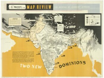
A political map of the Partition of British India
£1,800BUREAU OF CURRENT AFFAIRS.
Published In 1949
Stock No. 24485 -

A monumental sea chart of south-west England
£3,250HOOGHE, Romeyn de.
Published In 1693
Stock No. 24483 -

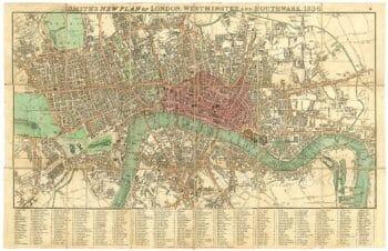
London in the reign of William IV
£550SMITH, Charles.
Published In 1836
Stock No. 24428 -

A rare 17th century Dutch sea chart of the British Isles
£1,400DONCKER, Hendrik.
Published In 1665
Stock No. 22272 -

A late 18th century map of India.
£700MANNERT, Konrad.
Published In 1797
Stock No. 24481 -

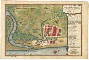
A plan of Puducherry at the beginning of the 18th century
£250FER, Nicolas de.
Published In 1705
Stock No. 24511 -

Early 19th century plan of London
£350Anonymous.
Published In 1810
Stock No. 24505 -

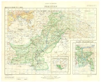
One of the first maps to show Pakistan as an independent state
£2,500SURVEY OF PAKISTAN.
Published In 1950
Stock No. 24297