Showing 265–276 of 298 results
-

Map of Grenada during the Seven Years’ War
£160RASPE, Gabriel Nikolaus.
Published In 1762
Stock No. 12916 -

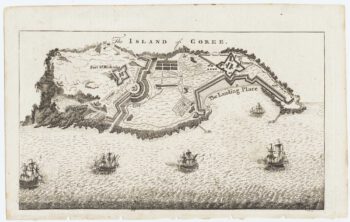
Map of the island of Gorée to illustrate news of the Seven Years’ War
£100Anonymous.
Published In 1759
Stock No. 14901 -

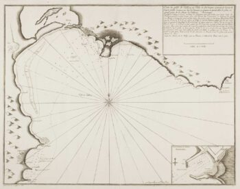
Scarce sea chart of Cagliari
£400AYROUARD, Jacques.
Published In 1732
Stock No. 14130 -

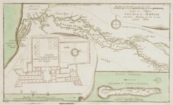
The British attack on the French Colony of St Louis, Senegal
£200RASPE, Gabriel Nikolaus.
Published In 1760
Stock No. 12902 -

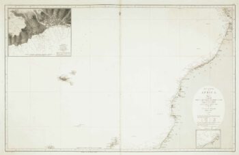
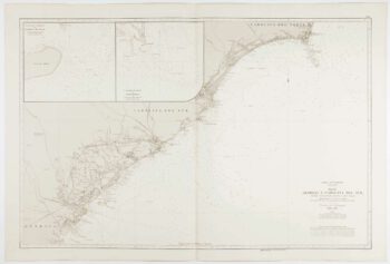
Sea chart of the African coast with Madeira
£400VIDAL, Alexander & ARLETT, William.
Published In 1867
Stock No. 12593 -

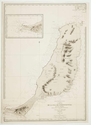
An uncommon 19th century Spanish sea chart of Fuerteventura
£1,500ARLETT, William.
Published In 1868
Stock No. 12576 -

An uncommon 19th century Spanish sea chart of three of the Canary Islands
£800VIDAL, Alexander.
Published In 1868
Stock No. 12573 -

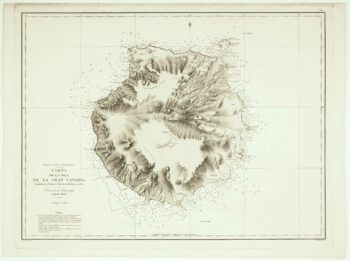
An uncommon Spanish sea chart of Gran Canaria
£1,400ARLETT, William.
Published In 1868
Stock No. 12572 -
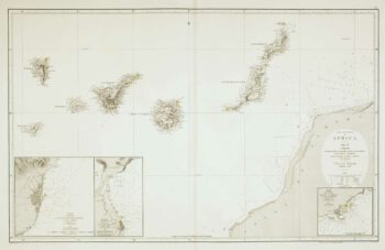
An uncommon 19th century Spanish sea chart of the Canary Islands
£1,450VIDAL, Alexander & ARLETT, William.
Published In 1855
Stock No. 12566 -

An uncommon Spanish sea chart of Georgia & South Carolina
£1,500DIRECCION HIDROGRAFICA DE MADRID.
Published In 1868
Stock No. 11862 -

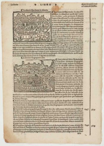
Early 16th century prospect of Athens
£120FORESTI, Giacomo.
Published In 1503
Stock No. 12059 -

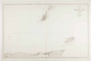
An uncommon 19th century Spanish sea chart of Grenada and Tobago
£800BREGANTE, S.
Published In 1868
Stock No. 11824