- Reset all
- African Islands
- Atlases
- Balearics
- Bolivia
- Buckinghamshire
- Burma
- Cyprus
- Devon
- Gibraltar
- Globes and Instruments
- Greece
- Gulf States
- Indonesia
- Ionian Islands
- Lancashire
- London Localities
- Madagascar
- Map Games
- Marche
- New York
- Panama
- Pennsylvania
- Rutland
- Scottish Islands
- Southern Europe
- Suffolk
- Sussex
- Switzerland
- Tuscany
- Ukraine
- World
Showing 649–660 of 756 results
-

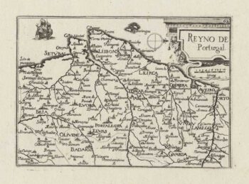
A 17th century miniature map of Portugal
£140TASSIN, Christophe.
Published In 1633
Stock No. 14932 -

A 17th century miniature map of Andalusia
£140TASSIN, Christophe.
Published In 1633
Stock No. 14928 -

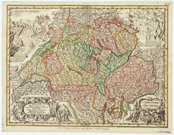
18th century map of Switzerland
£200SEUTTER, Matthaus.
Published In 1760
Stock No. 14744 -

Zocchi’s dramatic views of mid-18th century Florence
£24,500ZOCCHI, Giuseppe.
Published In 1754
Stock No. 14735 -

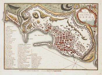
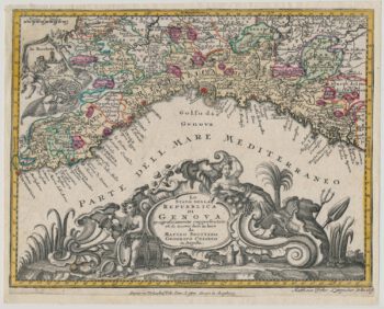
A late-18th century plan of Genoa during the Ligurian Republic
£130ANDREWS, John.
Published In 1800
Stock No. 14654 -

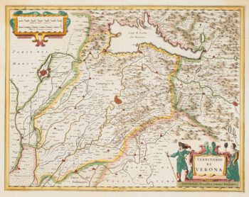
17th century map of the Province of Verona
£300JANSSON, Jan.
Published In 1636
Stock No. 14652 -

Two-sheet map of Sardinia in superb original colour
£880MORTIER, Pierre.
Published In 1705
Stock No. 14520 -

Mortier’s sea chart of Madagascar in full original colour
£1,100MORTIER, Pierre.
Published In 1700
Stock No. 14518 -

Decorative 18th century map of Liguria
£250SEUTTER, Matthaus.
Published In 1760
Stock No. 14512 -

A scarce Irish chart of the Western part of the Mediterranean
£2,000GRIERSON, George
Published In 1735
Stock No. 14456 -

A Georgian map of Tottenham
£300BOWLER & TRIQUET.
Published In 1818
Stock No. 14422 -

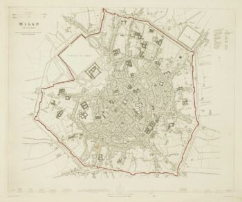
Detailed townplan of Milan
£130Society for the Diffusion of Useful Knowledge.
Published In 1862
Stock No. 14405