Showing 1–12 of 122 results
-

A late Victorian plan of Brighton.
£1,100TREACHER, H. & C.
Published In 1890
Stock No. 24546 -

18th century Italian map of the West Indies
£550CASSINI, Giovanni Maria.
Published In 1798
Stock No. 24532 -

A scarce 17th century prospect of Villefranche-sur-Mer
£1,500BLAEU, Johannes.
Published In 1682
Stock No. 24159 -

A 17th century Dutch map of the West Indies
£1,250VISSCHER, Nicolas.
Published In 1710
Stock No. 24608 -

The building of the Uptown Hudson Tubes in New York
£450Anonymous.
Published In 1890
Stock No. 24556 -

Vancouver’s mapping of the Pacific North West
£350VANCOUVER, Capt. George.
Published In 1820
Stock No. 24534 -

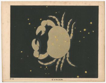
Chart of the Zodiac sign Cancer
£275BLUNT, Charles F.
Published In 1845
Stock No. 24288 -

‘The Buffalo map’ of the Mississippi
£2,000HOMANN, Johann Baptist.
Published In 1720
Stock No. 24427 -

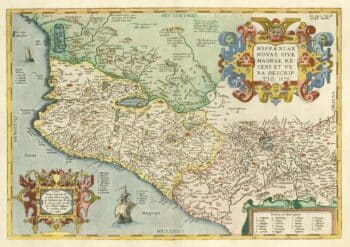
A 16th century map of the colony of New Spain
£750ORTELIUS, Abraham.
Published In 1584
Stock No. 24448 -

A large scale map of Sussex in fine colour
£2,800GREENWOOD, C. & J.
Published In 1825
Stock No. 24224 -

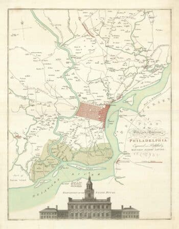
A map of Philadelphia as the capital of the Revolution
£3,400LOTTER, Matthaus Albrecht.
Published In 1777
Stock No. 24398 -

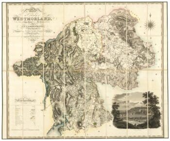
A large scale map of Westmorland in fine colour
£1,500GREENWOOD, C. & J.
Published In 1824
Stock No. 24069