Showing 409–420 of 479 results
-

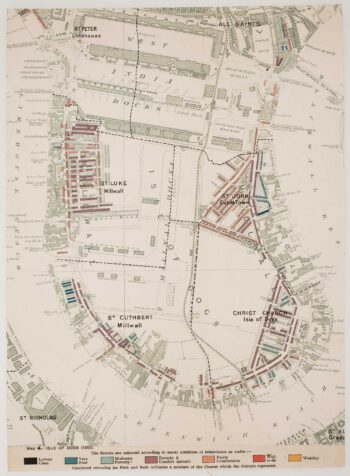
The Isle of Dogs from Booth’s Poverty Map of London
£280BOOTH, Charles.
Published In 1900
Stock No. 16083 -

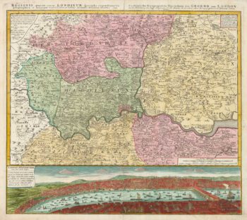
The environs of London, with a prospect of the city
£750HOMANN HEIRS.
Published In 1741
Stock No. 16043 -

A mid-19th century map of the environs of London
£1,500SMITH, Charles & Son.
Published In 1849
Stock No. 16034 -

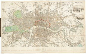
A Victorian plan of London
£1,200PAYNE, Albert Henry.
Published In 1846
Stock No. 15892 -

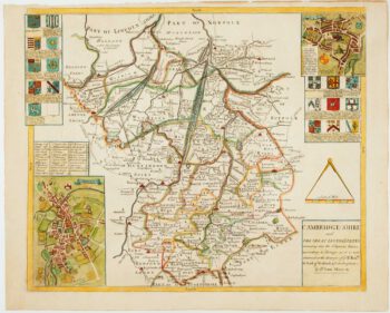
Uncommon map of Cambridgeshire from a Saxton county atlas
£1,250WILLDEY, George.
Published In 1749
Stock No. 15847 -

Mid-Victorian map of London with vignettes
£700Society for the Diffusion of Useful Knowledge.
Published In 1836
Stock No. 15496 -

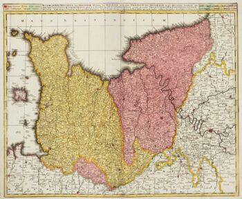
Complete set of six maps of Calabria from the ‘Atlante Geografico del Regno di Napoli’
£650RIZZI-ZANNONI, Giovanni Antonio.
Published In 1812
Stock No. 15474 -

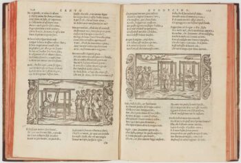
An important Italian translation of Ovid’s ‘Metamorphoses’
£1,800DOLCE, Lodovico.
Published In 1557
Stock No. 15464 -

Early 18th century map of Normandy in fine colour
£250VALK, Gerard & Leonard.
Published In 1700
Stock No. 15399 -

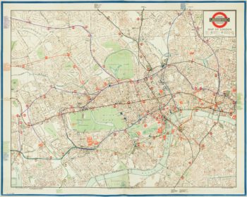
The first leaflet map of the ‘London Underground’
£850METROPOLITAN RAILWAY.
Published In 1908
Stock No. 15226 -

A two-sheet map of the Prussian province of ‘Lithuania Minor’
£1,200BETGEN, Johann Friedrich.
Published In 1735
Stock No. 15112 -

The Quad-Royal poster map with Central London’s Underground
£3,000BACON, George Washington.
Published In 1934
Stock No. 14983