Showing 1–12 of 40 results
-

A two-sheet map of North America
£2,950JAILLOT, Alexis-Hubert.
Published In 1705
Stock No. 24062 -

A two-sheet map of North America
£2,250JAILLOT, Alexis-Hubert.
Published In 1674
Stock No. 24482 -

An 18th century map of the Americas
£550EULER, Leonhard.
Published In 1753
Stock No. 24536 -

A rare Italian edition of Hennepin’s landmark map of Louisiana
£2,800HENNEPIN, Louis.
Published In 1691
Stock No. 24027 -

One of the earliest maps to depict America
£42,500WALDSEEMULLER, Martin.
Published In 1513
Stock No. 24130 -

The first atlas issue of this 17th century map of America
£2,200HONDIUS, Jodocus II.
Published In 1636
Stock No. 19628 -

Speed’s landmark map of America
£3,950SPEED, John.
Published In 1665
Stock No. 23980 -

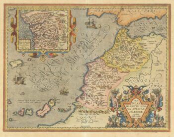
A 16th century map of Morocco
£700ORTELIUS, Abraham.
Published In 1601
Stock No. 23718 -

The European colonies in North America in the 18th century
£1,400SEUTTER, Matthaus.
Published In 1735
Stock No. 24089 -

A superbly decorated map of the Americas
£6,500HONDIUS, Jodocus.
Published In 1628
Stock No. 23601 -

A Dutch edition of rhe first printed map to accurately plot the Mississippi River
£1,700DELISLE, Guillaume.
Published In 1722
Stock No. 23463 -

The scarce second Galle plate for America used in the ‘Epitome’
£470ORTELIUS, Abraham.
Published In 1598
Stock No. 23190