- Reset all
- America
- Argentina
- Atlases and Books
- Beijing
- Bering Strait
- Bolivia
- Books
- Calabria
- Canada
- Derbyshire
- Dominica
- Dorset
- French Regions
- Iceland
- Korea
- Latvia and Estonia
- London
- Luxembourg
- Martinique
- Mexico
- Middlesex
- North Africa
- Panama
- Surrey
- Switzerland
- The Guianas
- Wales
- West Indies
- Wind Roses
- World
Showing 577–588 of 614 results
-

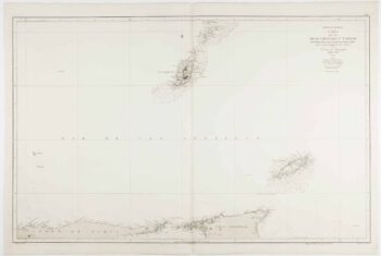
An uncommon 19th century Spanish sea chart of Grenada and Tobago
£800BREGANTE, S.
Published In 1868
Stock No. 11824 -

18th century view of Westminster from the Thames
£1,100FARINGTON, Joseph.
Published In 1790
Stock No. 11595 -

Luxembourg
£150SEUTTER, Matthaus.
Published In 1744
Stock No. 11397 -

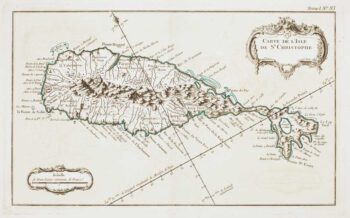
18th century French chart of St Kitts
£300BELLIN, Jacques-Nicolas.
Published In 1764
Stock No. 11377 -

A circular plan of London and Environs
£1,000PIGOT, James.
Published In 1832
Stock No. 11253 -

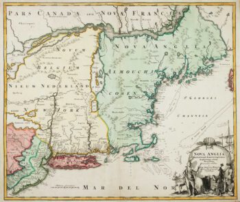
The English colonies on the north-east seaboard of America
£1,450HOMANN, Johann Baptist.
Published In 1725
Stock No. 11207 -

Cambrai in the C16th
£420BRAUN, Georg & HOGENBERG, Frans.
Published In 1596
Stock No. 11183 -
Miniature map of Guiana
£125DU VAL, Pierre.
Published In 1682
Stock No. 10856 -

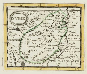
Miniature map of Nubia
£80DU VAL, Pierre.
Published In 1682
Stock No. 10830 -

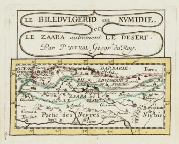
Miniature map of Mauretania & the Sahara
£80DU VAL, Pierre.
Published In 1682
Stock No. 10828 -

Miniature map of Peru
£80DU VAL, Pierre.
Published In 1682
Stock No. 10824 -

Abyssinia, with the mythical kingdom of Prester John
£280MONTANUS, Arnoldus.
Published In 1670
Stock No. 10724