- Reset all
- Antarctic
- Argentina
- Austria
- Bering Strait
- Bristol
- Canary Islands
- Eastern Europe
- Georgia
- Hertfordshire
- Holy Land
- Hungary
- Lancashire
- Latvia and Estonia
- London Transport Maps
- Morocco
- Netherlands
- North America Maps
- Northamptonshire
- Nottinghamshire
- Old World
- Oxfordshire
- Solar System
- St Lucia
- United States
- Vietnam
- Westmorland
- World and Continents
Showing 313–324 of 343 results
-

Scarce Spanish sea chart of the Rio de la Plata
£650DE LORENZO, J.
Published In 1865
Stock No. 13691 -

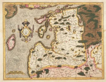
Mercator’s map of Latvia in fine original colour
£620MERCATOR, Gerard.
Published In 1595
Stock No. 13056 -

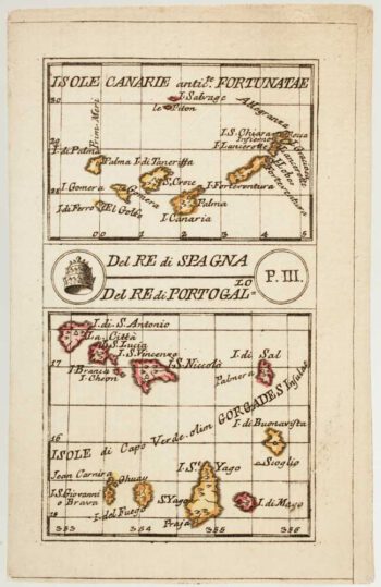
An 18th century playing-card map of the Canaries and Cape Verde Islands
£350RABATTA, Augusto & BAILOU, Jean Baptist de.
Published In 1779
Stock No. 13004 -

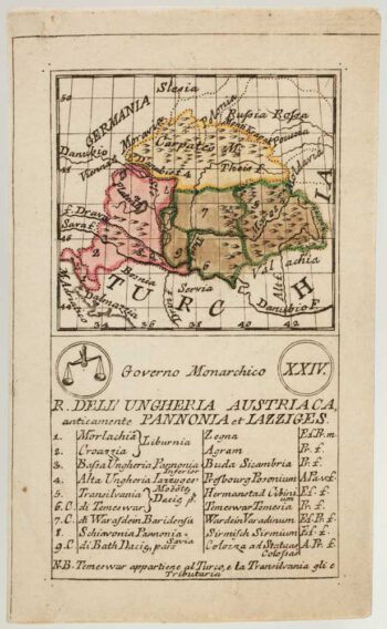
An 18th century playing-card map of Hungary
£380RABATTA, Augusto & BAILOU, Jean Baptist de.
Published In 1779
Stock No. 13003 -

An 18th century playing-card map of Russia
£300RABATTA, Augusto & BAILOU, Jean Baptist de.
Published In 1779
Stock No. 12978 -

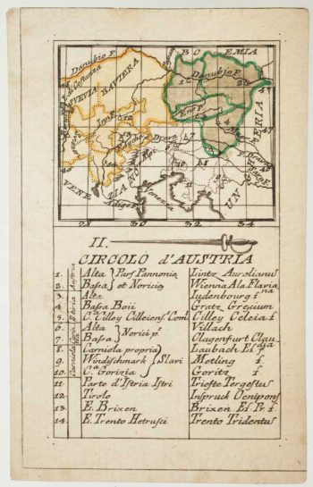
An 18th century playing-card map of Austria
£150RABATTA, Augusto & BAILOU, Jean Baptist de.
Published In 1779
Stock No. 12961 -

Map of St Lucia during the Seven Years’ War
£160RASPE, Gabriel Nikolaus.
Published In 1762
Stock No. 12920 -

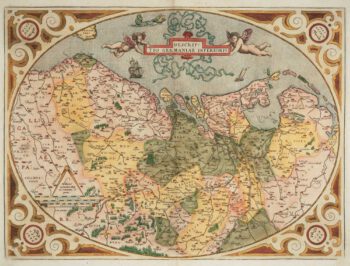
The Netherlands ‘Egg’ Map by Ortelius
£850ORTELIUS, Abraham.
Published In 1574
Stock No. 12887 -

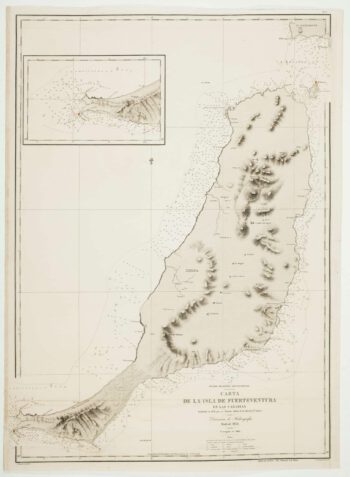
An uncommon 19th century Spanish sea chart of Fuerteventura
£1,500ARLETT, William.
Published In 1868
Stock No. 12576 -

An uncommon 19th century Spanish sea chart of three of the Canary Islands
£800VIDAL, Alexander.
Published In 1868
Stock No. 12573 -

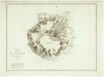
An uncommon Spanish sea chart of Gran Canaria
£1,400ARLETT, William.
Published In 1868
Stock No. 12572 -

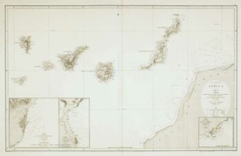
An uncommon 19th century Spanish sea chart of the Canary Islands
£1,450VIDAL, Alexander & ARLETT, William.
Published In 1855
Stock No. 12566