Showing 1–12 of 178 results
-

A political map of the Partition of British India
£1,800BUREAU OF CURRENT AFFAIRS.
Published In 1949
Stock No. 24485 -

A late 18th century map of India.
£700MANNERT, Konrad.
Published In 1797
Stock No. 24481 -

A late-18th century plan of Vienna
£230ANDREWS, John.
Published In 1800
Stock No. 24512 -

A plan of Puducherry at the beginning of the 18th century
£250FER, Nicolas de.
Published In 1705
Stock No. 24511 -

One of the first maps to show Pakistan as an independent state
£2,500SURVEY OF PAKISTAN.
Published In 1950
Stock No. 24297 -

Set of three gores covering Australia from Coronelli’s 42 inch globe
£4,500CORONELLI, Vincenzo Maria.
Published In 1693
Stock No. 23726 -

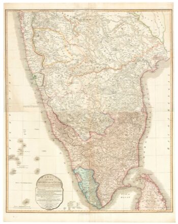
A large and detailed map of India
£1,500WALKER, J. & C.
Published In 1844
Stock No. 24341 -

A detailed 19th century survey of South Australia
£950HARRIS, W.G.
Published In 1862
Stock No. 24105 -

Folding map of Australia with fine colour
£980WYLD, James.
Published In 1833
Stock No. 24071 -

A four-sheet map of India in the 18th century
£2,800JEFFERYS, Thomas.
Published In 1768
Stock No. 23966 -

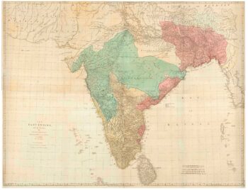
A two-sheet map of India
£620FADEN, William.
Published In 1824
Stock No. 23848 -

A two-sheet sea chart of the coast between Mumbai and Karachi
£1,800IMRAY, James & Son.
Published In 1867
Stock No. 23377