- Reset all
- Argentina
- Baltic Sea
- Bering Strait
- Bolivia
- Bristol
- British Isles
- Canada
- Canary Islands
- Caspian Sea
- Catalonia
- Devon
- Eastern Europe
- Eastern Seaboard Maps
- Elba
- Frontispieces
- Georgia
- Gulf States
- Hertfordshire
- Ireland
- Latvia and Estonia
- Madeira
- Maritime
- Morocco
- Netherlands
- North America Maps
- Northamptonshire
- Nottinghamshire
- Poland
- Prints
- Russia
- Sardinia
- Scottish Islands
- Solar System
- Switzerland
- Trentino
- United States
- Vietnam
- Virginia
- Westmorland
- World and Continents
- World Maps
Showing 733–744 of 790 results
-

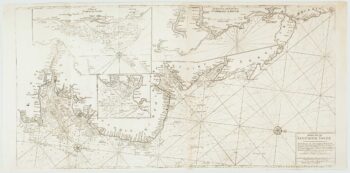
An important chart of the east coasts of England
£650MOUNT & PAGE.
Published In 1747
Stock No. 15582 -

An early English chart of northern Canada with Hudson Bay
£300THORNTON, John.
Published In 1748
Stock No. 15550 -

Sea chart of the Firth of Forth from the first English sea-atlas
£480COLLINS, Greenvile.
Published In 1750
Stock No. 14900 -

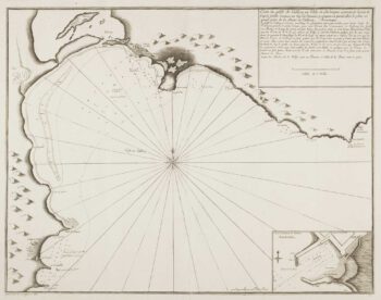
Scarce sea chart of Cagliari
£400AYROUARD, Jacques.
Published In 1732
Stock No. 14130 -

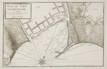
A scarce sea chart of Barcelona Harbour
£300AYROUARD, Jacques.
Published In 1746
Stock No. 14127 -

Rare map of Middlesex, Essex and Herts
£1,100WARBURTON, John.
Published In 1726
Stock No. 12907 -

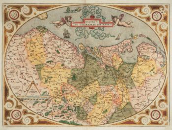
The Netherlands ‘Egg’ Map by Ortelius
£850ORTELIUS, Abraham.
Published In 1574
Stock No. 12887 -

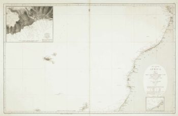
Sea chart of the African coast with Madeira
£400VIDAL, Alexander & ARLETT, William.
Published In 1867
Stock No. 12593 -

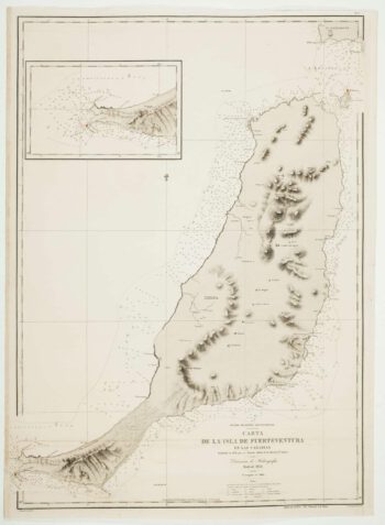
An uncommon 19th century Spanish sea chart of Fuerteventura
£1,500ARLETT, William.
Published In 1868
Stock No. 12576 -

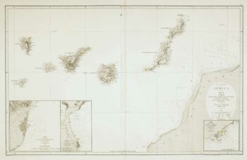
An uncommon 19th century Spanish sea chart of three of the Canary Islands
£800VIDAL, Alexander.
Published In 1868
Stock No. 12573 -

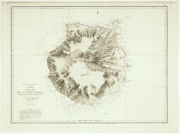
An uncommon Spanish sea chart of Gran Canaria
£1,400ARLETT, William.
Published In 1868
Stock No. 12572 -
An uncommon 19th century Spanish sea chart of the Canary Islands
£1,450VIDAL, Alexander & ARLETT, William.
Published In 1855
Stock No. 12566