- Reset all
- Argentina
- Bering Strait
- Bolivia
- Burma
- Canada
- Canary Islands
- Cyprus
- Devon
- Eastern Europe
- Elba
- Far East Maps
- France
- Georgia
- Gloucestershire
- Gulf States
- Hertfordshire
- Holy Land
- Italian Islands
- Lancashire
- Latvia and Estonia
- Leinster
- Liguria
- Madeira
- Morocco
- Netherlands
- North America Maps
- Northamptonshire
- Nottinghamshire
- Prints
- Russia
- Solar System
- Surrey
- Tartary
- Trentino
- Ukraine
- United States
- Vietnam
- Westmorland
- World and Continents
- World Maps
Showing 37–48 of 681 results
-

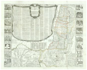
A rare wall map of the Holy Land
£9,000NOLIN, Jean Baptiste.
Published In 1785
Stock No. 24500 -

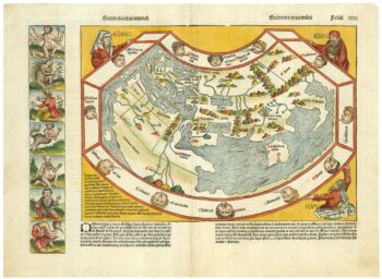
One of the earliest world maps available to the collector
£15,000SCHEDEL, D. Hartmann.
Published In 1493
Stock No. 24528 -

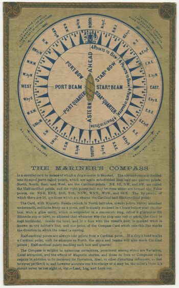
An instructional card explaining shipboard directions
£220Anonymous.
Published In 1840
Stock No. 24472 -

An advert for an American railway
£750Anonymous.
Published In 1865
Stock No. 24455 -

The First Edition of Ortelius’s map of the Spice Islands
£4,000ORTELIUS, Abraham.
Published In 1570
Stock No. 24431 -

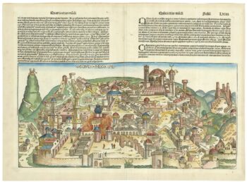
An incunable prospect of Jerusalem
£1,600SCHEDEL, D. Hartmann.
Published In 1493
Stock No. 24425 -

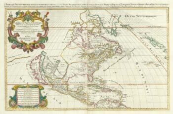
A two-sheet map of North America
£2,950JAILLOT, Alexis-Hubert.
Published In 1705
Stock No. 24062 -

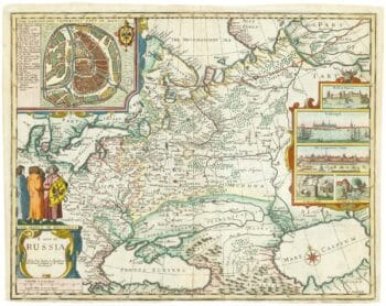
Russia, from the first English atlas of the World
£2,200SPEED, John.
Published In 1676
Stock No. 23731 -
A racist satire of an African American fire brigade
£325CURRIER & IVES.
Published In 1910
Stock No. 24443 -

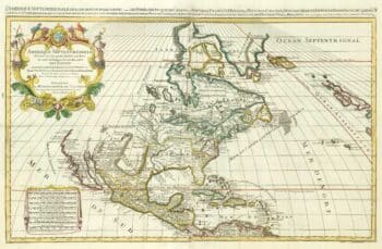
A two-sheet map of North America
£2,250JAILLOT, Alexis-Hubert.
Published In 1674
Stock No. 24482 -

An 18th century ‘vue d’optique’ of Quebec
£750LEIZELT, Balthasar Frederick.
Published In 1775
Stock No. 24523 -

Miniature map of Cyprus and the islands of the Aegean
£350HONDIUS, Jodocus II.
Published In 1610
Stock No. 24510