- Reset all
- Argentina
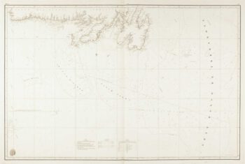
- Bering Strait
- Canada
- Canary Islands
- Devon
- Eastern Europe
- Elba
- Georgia
- Gulf States
- Hertfordshire
- Holy Land
- Lancashire
- Latvia and Estonia
- Madeira
- Morocco
- Netherlands
- North America Maps
- Northamptonshire
- Nottinghamshire
- Prints
- Russia
- Solar System
- Trentino
- United States
- Vietnam
- Westmorland
- World and Continents
- World Maps
Showing 409–420 of 437 results
-

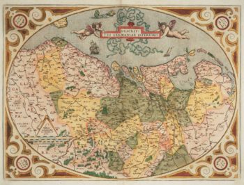
The Netherlands ‘Egg’ Map by Ortelius
£850ORTELIUS, Abraham.
Published In 1574
Stock No. 12887 -

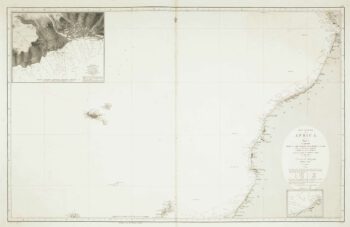
Sea chart of the African coast with Madeira
£400VIDAL, Alexander & ARLETT, William.
Published In 1867
Stock No. 12593 -

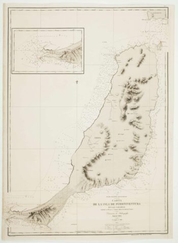
An uncommon 19th century Spanish sea chart of Fuerteventura
£1,500ARLETT, William.
Published In 1868
Stock No. 12576 -

An uncommon 19th century Spanish sea chart of three of the Canary Islands
£800VIDAL, Alexander.
Published In 1868
Stock No. 12573 -

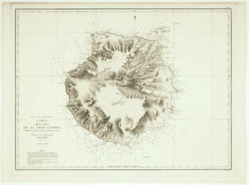
An uncommon Spanish sea chart of Gran Canaria
£1,400ARLETT, William.
Published In 1868
Stock No. 12572 -
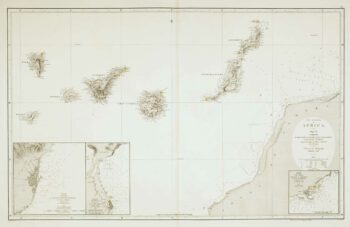
An uncommon 19th century Spanish sea chart of the Canary Islands
£1,450VIDAL, Alexander & ARLETT, William.
Published In 1855
Stock No. 12566 -

An uncommon Spanish sea chart of Georgia & South Carolina
£1,500DIRECCION HIDROGRAFICA DE MADRID.
Published In 1868
Stock No. 11862 -
An uncommon Spanish sea chart of North Carolina
£2,000DE LORENZO, J.
Published In 1868
Stock No. 11861 -

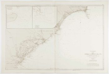
An uncommon Spanish sea chart of the Eastern Seaboard
£550NOGUERA, C.
Published In 1860
Stock No. 11859 -
An uncommon Spanish sea chart of the Eastern Seaboard
£1,700NOGUERA, C.
Published In 1860
Stock No. 11858 -

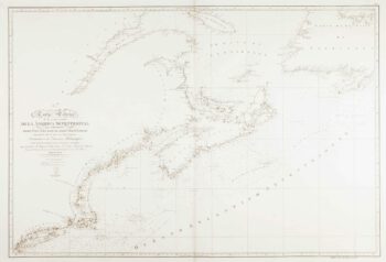
A scarce Spanish two-sheet sea chart of Newfoundland
£1,200MORENO, Miguel.
Published In 1860
Stock No. 11852 -

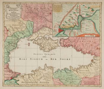
Map of the Black Sea in original colour
£580LOTTER, Tobias Conrad.
Published In 1760
Stock No. 12175