- Reset all
- Argentina
- Bering Strait
- Canary Islands
- Devon
- Eastern Europe
- Georgia
- Hertfordshire
- Holy Land
- Lancashire
- Latvia and Estonia
- Madeira
- Morocco
- Netherlands
- North America Maps
- Northamptonshire
- Nottinghamshire
- Persia
- Russia
- Solar System
- United States
- Vietnam
- Westmorland
- World and Continents
- World Maps
Showing 37–48 of 355 results
-

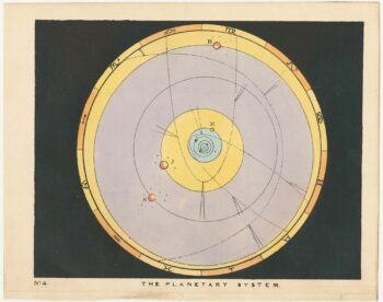
Chart of the Planetary System
£175BLUNT, Charles F.
Published In 1845
Stock No. 24250 -

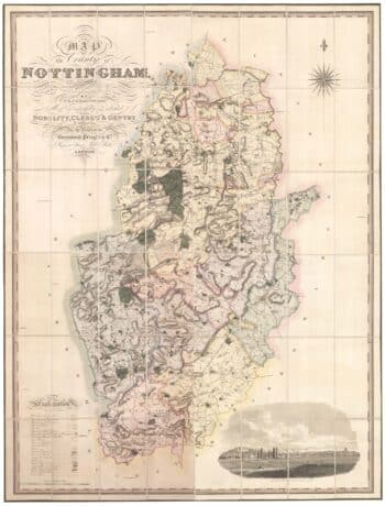
A large scale map of Nottinghamshire in fine colour
£1,800SANDERSON, George.
Published In 1836
Stock No. 24067 -

An extremely rare example of the first printed plan of Exeter
£4,500HOOKER, John.
Published In 1587
Stock No. 24437 -

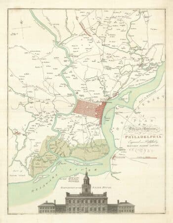
A map of Philadelphia as the capital of the Revolution
£3,400LOTTER, Matthaus Albrecht.
Published In 1777
Stock No. 24398 -

A map of the Russo-Turkish War of 1877-8
£250ILLUSTRATED LONDON NEWS.
Published In 1877
Stock No. 24378 -
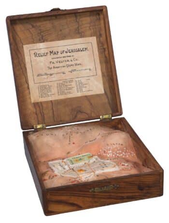
A plaster relief map of Jerusalem in a box
£1,200VESTER, Frederick.
Published In 1910
Stock No. 24365 -

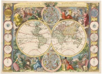
A highly decorative separate-issue world map
£4,500BAILLEUL, Nicolas (le Jeune).
Published In 1750
Stock No. 24097 -

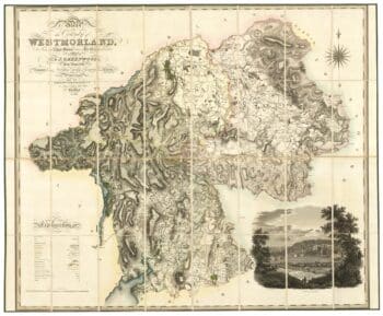
A large scale map of Westmorland in fine colour
£1,500GREENWOOD, C. & J.
Published In 1824
Stock No. 24069 -

A large scale map of Nottinghamshire in fine colour
£2,000GREENWOOD, C. & J.
Published In 1826
Stock No. 24066 -

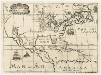
A rare Italian edition of Hennepin’s landmark map of Louisiana
£2,800HENNEPIN, Louis.
Published In 1691
Stock No. 24027 -

A rare issue of Speed’s map of Lancashire
£1,650SPEED, John.
Published In 1646
Stock No. 24002 -

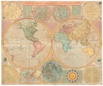
A late 18th century wall map of the world on four sheets
£6,000DUNN, Samuel.
Published In 1799
Stock No. 23965