Showing 301–312 of 333 results
-

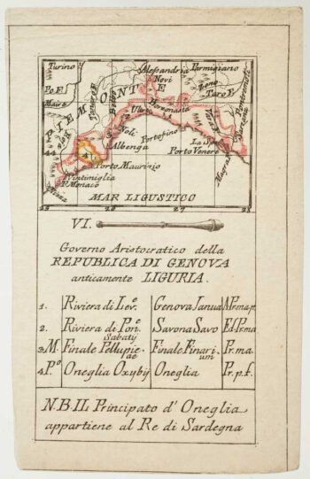
An 18th century playing-card map of Genoa
£250RABATTA, Augusto & BAILOU, Jean Baptist de.
Published In 1779
Stock No. 12971 -

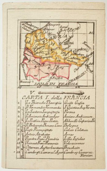
An 18th century playing-card map of France and Flanders
£150RABATTA, Augusto & BAILOU, Jean Baptist de.
Published In 1779
Stock No. 12963 -

Sea chart of the Firth of Forth from the first English sea-atlas
£480COLLINS, Greenvile.
Published In 1750
Stock No. 14900 -

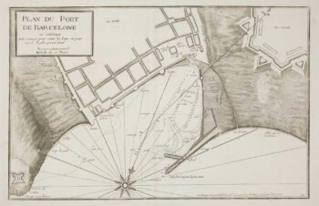
A scarce sea chart of Barcelona Harbour
£300AYROUARD, Jacques.
Published In 1746
Stock No. 14127 -

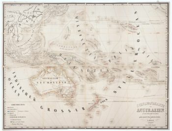
Wall map of Australasia
£600HOLLE, Leinhart.
Published In 1860
Stock No. 12843 -

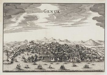
Miniature 17th century bird’s-eye view of Genoa
£250FURTTENBACH, Joseph.
Published In 1627
Stock No. 12590 -

Road map from Stony Stratford to Derby
£250OGILBY, John.
Published In 1675
Stock No. 12372 -

A decorative four-sheet map of France in fine colour
£2,000INSELIN, Charles.
Published In 1713
Stock No. 11666 -

A scarce bird’s-eye view of Paris
£1,200Anonymous.
Published In 1680
Stock No. 11573 -

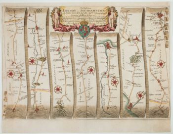
The road from Bagshot to Southampton and on to Salisbury
£380OGILBY, John.
Published In 1675
Stock No. 11367 -

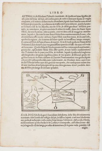
The first printed map of Corsica
£800BORDONE, Benedetto.
Published In 1534
Stock No. 11217 -

Cambrai in the C16th
£420BRAUN, Georg & HOGENBERG, Frans.
Published In 1596
Stock No. 11183