Showing 1–12 of 99 results
-

18th century map of the Eastern Seaboard
£750ROBERT DE VAUGONDY, Didier.
Published In 1770
Stock No. 24555 -

A 16th century town plan of Bruges
£240VALEGIO, Francesco.
Published In 1598
Stock No. 24204 -

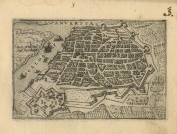
A 16th century town plan of Antwerp
£250VALEGIO, Francesco.
Published In 1598
Stock No. 24203 -

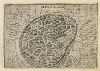
A 16th century town plan of Brussels
£250VALEGIO, Francesco.
Published In 1598
Stock No. 24202 -

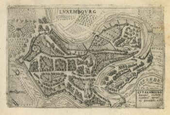
A 16th century town plan of Luxembourg
£300VALEGIO, Francesco.
Published In 1598
Stock No. 24201 -

Mid 19th century map of Belgium with decorative vignettes
£120TALLIS, John.
Published In 1851
Stock No. 21637 -

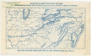
An advert for an American railway
£750Anonymous.
Published In 1865
Stock No. 24455 -

An 18th century ‘vue d’optique’ of Quebec
£750LEIZELT, Balthasar Frederick.
Published In 1775
Stock No. 24523 -

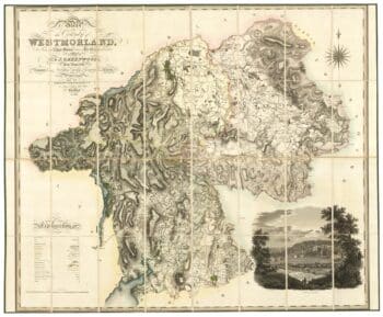
A large scale map of Westmorland in fine colour
£1,500GREENWOOD, C. & J.
Published In 1824
Stock No. 24069 -

An impressive 16th century two-sheet plan of Antwerp
£1,500HOEFNAGEL, Joris.
Published In 1596
Stock No. 23372 -
A rare issue of Speed’s map of Westmorland
£550SPEED, John.
Published In 1665
Stock No. 24006 -

Classic carte-?-figure map of the Netherlands & Belgium
£1,300SPEED, John.
Published In 1665
Stock No. 23992