Showing 1–12 of 96 results
-

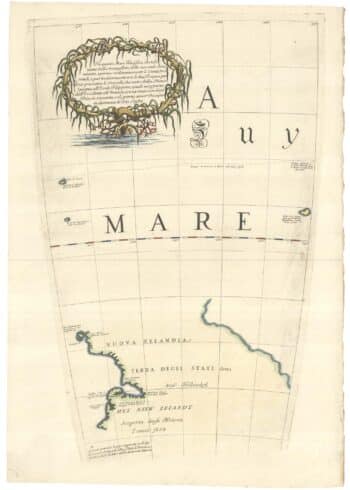
Zatta’s important map showing Cook’s charting of New Zealand
£1,750ZATTA, Antonio.
Published In 1778
Stock No. 24601 -

Four scarce Italian playing cards depicting Norway
£850Anonymous.
Published In 1790
Stock No. 24246 -

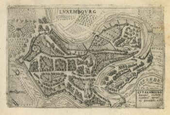
A 16th century town plan of Luxembourg
£300VALEGIO, Francesco.
Published In 1598
Stock No. 24201 -

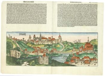
An incunable prospect of Prague
£1,450SCHEDEL, D. Hartmann.
Published In 1493
Stock No. 24451 -

An 18th century ‘vue d’optique’ of Quebec
£750LEIZELT, Balthasar Frederick.
Published In 1775
Stock No. 24523 -

The New Zealand gore from Coronelli’s 42 inch globe
£2,200CORONELLI, Vincenzo Maria.
Published In 1693
Stock No. 23716 -

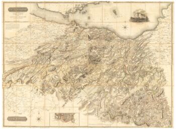
A large four-sheet map of Midlothian
£750KNOX, James.
Published In 1821
Stock No. 23326 -

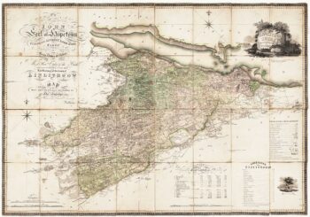
A Georgian folding map of Linlithgowshire
£800FORREST, William.
Published In 1818
Stock No. 22680 -

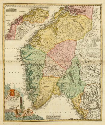
Decorative 18th century map of Norway
£460HOMANN, Johann Baptist.
Published In 1720
Stock No. 24171 -
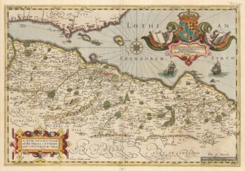
The only map by Timothy Pont published in his lifetime
£450PONT, Timothy.
Published In 1638
Stock No. 23842 -

A 16th century miniature map of Luxembourg
£70LANGENES, Barent.
Published In 1599
Stock No. 21155 -

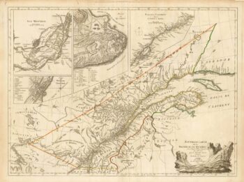
A French edition of an important map of the St Lawrence valley
£1,600CARVER, Jonathan.
Published In 1777
Stock No. 23477