Showing 97–108 of 111 results
-

Sea chart of the Firth of Forth from the first English sea-atlas
£480COLLINS, Greenvile.
Published In 1750
Stock No. 14900 -

Rare map of Middlesex, Essex and Herts
£1,100WARBURTON, John.
Published In 1726
Stock No. 12907 -

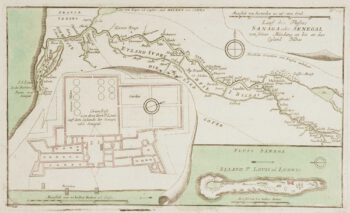
The British attack on the French Colony of St Louis, Senegal
£200RASPE, Gabriel Nikolaus.
Published In 1760
Stock No. 12902 -

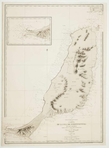
An uncommon 19th century Spanish sea chart of Fuerteventura
£1,500ARLETT, William.
Published In 1868
Stock No. 12576 -

An uncommon 19th century Spanish sea chart of three of the Canary Islands
£800VIDAL, Alexander.
Published In 1868
Stock No. 12573 -

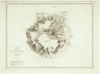
An uncommon Spanish sea chart of Gran Canaria
£1,400ARLETT, William.
Published In 1868
Stock No. 12572 -

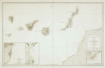
An uncommon 19th century Spanish sea chart of the Canary Islands
£1,450VIDAL, Alexander & ARLETT, William.
Published In 1855
Stock No. 12566 -

Luxembourg
£150SEUTTER, Matthaus.
Published In 1744
Stock No. 11397 -

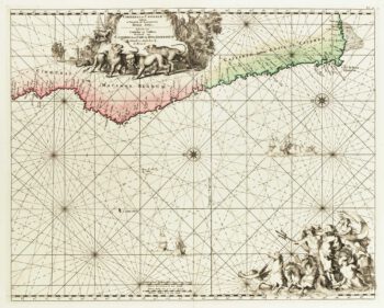
Sea chart of south west Africa
£650DE WIT, Frederick.
Published In 1715
Stock No. 11340 -

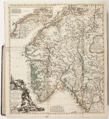
The Natural History of Norway, including sea-monsters!
£1,950PONTOPPIDAN, Erich.
Published In 1755
Stock No. 11264 -

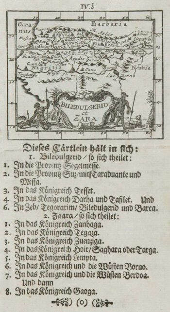
Uncommon miniature map of West Africa
£80MULLER, Johann Ulrich.
Published In 1692
Stock No. 8831 -

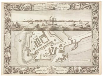
Fine plan of the naval dockyard at Sheerness, Kent
£600MILTON, Thomas.
Published In 1755
Stock No. 8492