Showing 373–384 of 436 results
-

Complete set of six maps of Calabria from the ‘Atlante Geografico del Regno di Napoli’
£650RIZZI-ZANNONI, Giovanni Antonio.
Published In 1812
Stock No. 15474 -

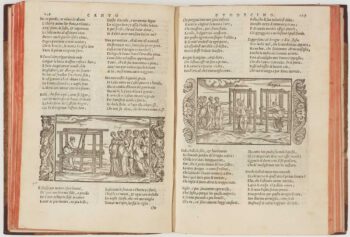
An important Italian translation of Ovid’s ‘Metamorphoses’
£1,800DOLCE, Lodovico.
Published In 1557
Stock No. 15464 -

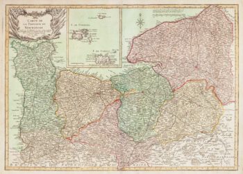
Early 18th century map of Normandy in fine colour
£250VALK, Gerard & Leonard.
Published In 1700
Stock No. 15399 -

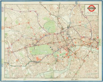
The first leaflet map of the ‘London Underground’
£850METROPOLITAN RAILWAY.
Published In 1908
Stock No. 15226 -

A two-sheet map of the Prussian province of ‘Lithuania Minor’
£1,200BETGEN, Johann Friedrich.
Published In 1735
Stock No. 15112 -

The Quad-Royal poster map with Central London’s Underground
£3,000BACON, George Washington.
Published In 1934
Stock No. 14983 -
Detailed map of Silesia
£450JANSSON, Jan.
Published In 1645
Stock No. 14909 -

Pre-war London Transport poster
£1,500LONDON TRANSPORT.
Published In 1935
Stock No. 14870 -

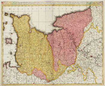
Scarce map of Normandy in fine colour
£450DUPERRIER.
Published In 1780
Stock No. 14771 -

A fine prospect of the Savoyard fortress of Montmélian
£700HOOGHE, Romeyn de.
Published In 1697
Stock No. 14678 -

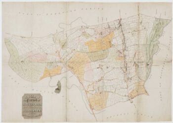
A Georgian map of Tottenham
£300BOWLER & TRIQUET.
Published In 1818
Stock No. 14422 -

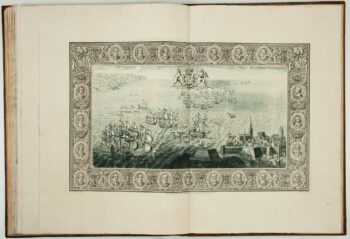
The story of the Spanish Armada from the House of Lords tapestries
£16,000PINE, John.
Published In 1739
Stock No. 14002