Showing 1–12 of 45 results
-

A Dutch satirical board game of the Second Boer War
£450SCHLETTE, E.G.
Published In 1900
Stock No. 24484 -

An 18th century ‘vue d’optique’ of Quebec
£750LEIZELT, Balthasar Frederick.
Published In 1775
Stock No. 24523 -

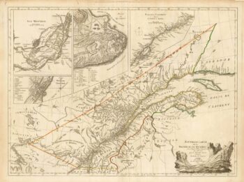
A French edition of an important map of the St Lawrence valley
£1,600CARVER, Jonathan.
Published In 1777
Stock No. 23477 -

A rare early 19th century geographical card game
£950JOUY, Victor-Joseph Etienne de.
Published In 1806
Stock No. 23826 -

A Georgian ‘make your own landscape’ pastime
£950CLARK, John Heaviside.
Published In 1824
Stock No. 23843 -

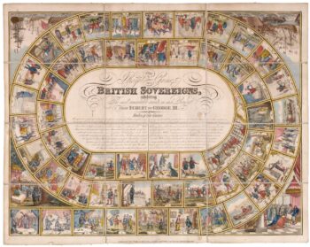
Original board game based on the British monarchy
£750WALLIS, J. & E.
Published In 1820
Stock No. 23564 -

A mid 19th century map of West Canada with vignettes
£160TALLIS, John.
Published In 1851
Stock No. 23498 -

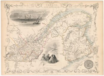
Map of Eastern Canada with vignettes
£150TALLIS, John.
Published In 1851
Stock No. 23482 -

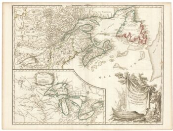
A late 18th century map of Canada and the Great Lakes
£550ROBERT DE VAUGONDY, Didier.
Published In 1793
Stock No. 23279 -
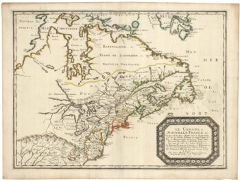
Sanson’s map of Canada with an early depiction of the Great Lakes
£4,750SANSON, Nicolas.
Published In 1662
Stock No. 23067 -

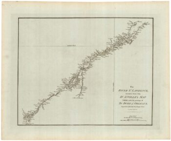
A detailed 18th century plan of the St Lawrence River
£420HARRISON, John.
Published In 1784
Stock No. 22812 -

A plan of the British attack on Quebec in October 1690 by a defender
£550LAHONTAN, Louis-Armande de.
Published In 1741
Stock No. 22562