Showing 1–12 of 136 results
-

The English edition of Du Halde’s map of Guangdong
£1,600DU HALDE, Johann Baptiste.
Published In 1738
Stock No. 24558 -

A 16th century woodcut prospect of Rome
£400MUNSTER, Sebastian.
Published In 1572
Stock No. 24577 -

A 16th century woodcut map of Classical Rome
£220MUNSTER, Sebastian.
Published In 1572
Stock No. 24572 -

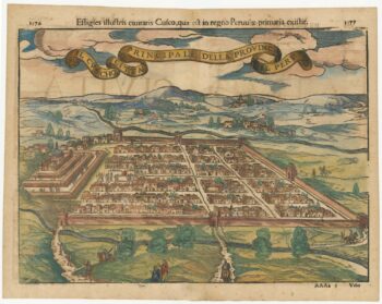
Early decorative birdseye view of Cusco
£380MUNSTER, Sebastian.
Published In 1572
Stock No. 24566 -

18th century map of China
£320TIRION, Isaak.
Published In 1740
Stock No. 24547 -

A 16th century town plan of classical Rome
£140VALEGIO, Francesco.
Published In 1598
Stock No. 24195 -

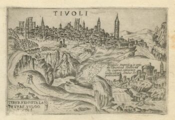
A 16th century town plan of Tivoli
£140VALEGIO, Francesco.
Published In 1598
Stock No. 24192 -

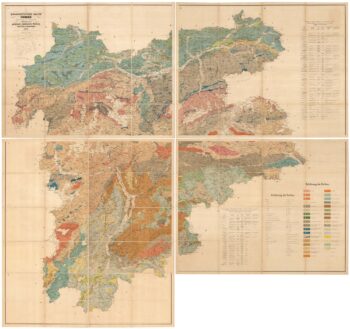
A geological map of the Duchy of Tyrol
£2,350STOTTER, Michael.
Published In 1851
Stock No. 23050 -

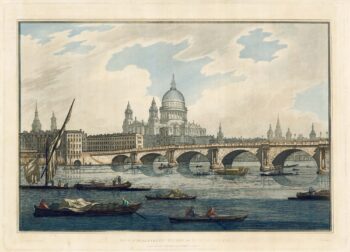
18th century view of the City from the Thames
£1,500FARINGTON, Joseph.
Published In 1790
Stock No. 24557 -

Victorian map of China with views of Hong Kong and Canton
£250TALLIS, John.
Published In 1851
Stock No. 23537 -

An 18th century ‘vue d’optique’ of Quebec
£750LEIZELT, Balthasar Frederick.
Published In 1775
Stock No. 24523 -

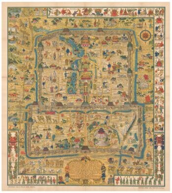
A pictorial map of Beijing in the 1930s
£3,000DORN, Frank.
Published In 1936
Stock No. 24392