Showing 1–12 of 95 results
-

An 18th century ‘vue d’optique’ of Quebec
£750LEIZELT, Balthasar Frederick.
Published In 1775
Stock No. 24523 -

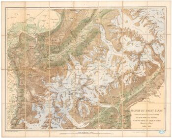
A detailed plan of the Mont-Blanc massif
£1,600BARBEY, Albert.
Published In 1924
Stock No. 22980 -

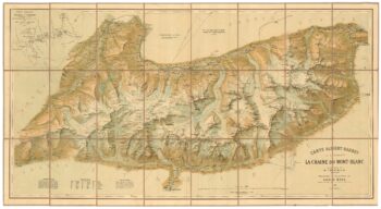
An important map of the Mont Blanc Massif
£950MIEULET, Jean-Joseph.
Published In 1865
Stock No. 24076 -

A French edition of an important map of the St Lawrence valley
£1,600CARVER, Jonathan.
Published In 1777
Stock No. 23477 -

One of the earliest versions of Sophianos’s map of Greece
£14,000BERTELLI, Ferrando
Published In 1564
Stock No. 24220 -

A decorative 18th century map of Greece
£500SEUTTER, Matthaus.
Published In 1750
Stock No. 22308 -

A large and decorative map of Corfu
£750CORONELLI, Vincenzo Maria.
Published In 1690
Stock No. 24095 -

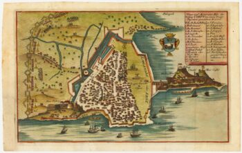
Rare town-plan of Corfu under siege by the Ottomans
£340WIERING, Thomas von.
Published In 1716
Stock No. 23665 -

An 18th century chart of Corfu
£110ROUX, Joseph.
Published In 1804
Stock No. 23636 -

Map of Ancient Greece by Ortelius, rare first printing
£1,000ORTELIUS, Abraham.
Published In 1587
Stock No. 23549 -

A mid 19th century map of West Canada with vignettes
£160TALLIS, John.
Published In 1851
Stock No. 23498 -

Map of Eastern Canada with vignettes
£150TALLIS, John.
Published In 1851
Stock No. 23482