Showing 1–12 of 45 results
-

An 18th century ‘vue d’optique’ of Quebec
£750LEIZELT, Balthasar Frederick.
Published In 1775
Stock No. 24523 -

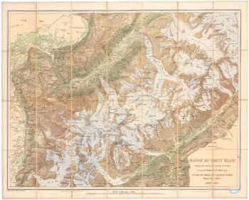
A detailed plan of the Mont-Blanc massif
£1,600BARBEY, Albert.
Published In 1924
Stock No. 22980 -

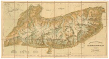
An important map of the Mont Blanc Massif
£950MIEULET, Jean-Joseph.
Published In 1865
Stock No. 24076 -

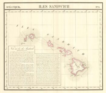
The largest representation of Hawaii to appear in an atlas
£900VANDERMAELEN, Philippe.
Published In 1827
Stock No. 24396 -

The scarce second state of the Lhuyd-Hondius map of Wales
£550LHUYD, Humfrey.
Published In 1638
Stock No. 23841 -

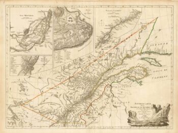
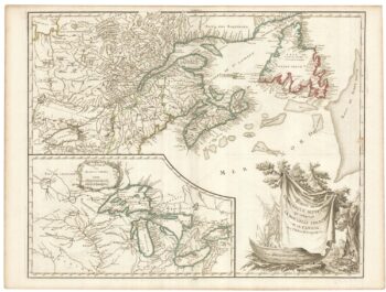
A French edition of an important map of the St Lawrence valley
£1,600CARVER, Jonathan.
Published In 1777
Stock No. 23477 -

The first British atlas map of Wales
£1,700SPEED, John.
Published In 1665
Stock No. 23789 -

A mid 19th century map of West Canada with vignettes
£160TALLIS, John.
Published In 1851
Stock No. 23498 -

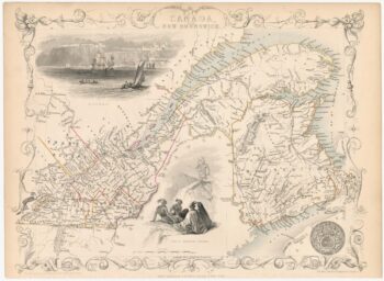
Map of Eastern Canada with vignettes
£150TALLIS, John.
Published In 1851
Stock No. 23482 -
A late 18th century map of Canada and the Great Lakes
£550ROBERT DE VAUGONDY, Didier.
Published In 1793
Stock No. 23279 -

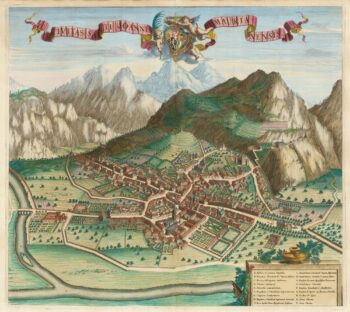
A scarce 17th century prospect of Saint-Jean-de-Maurienne in superb colour
£400BLAEU, Johannes.
Published In 1682
Stock No. 23269 -

Miniature map of Cardiganshire, Randorshire and Brecknockshire
£75PERROT, Aristide Michel.
Published In 1828
Stock No. 23106