Showing 1–12 of 226 results
-

A political map of the Partition of British India
£1,800BUREAU OF CURRENT AFFAIRS.
Published In 1949
Stock No. 24485 -

An early 19th century map of Cornwall
£225CARY, John.
Published In 1805
Stock No. 24114 -

A late 18th century map of India.
£700MANNERT, Konrad.
Published In 1797
Stock No. 24481 -

A plan of Puducherry at the beginning of the 18th century
£250FER, Nicolas de.
Published In 1705
Stock No. 24511 -

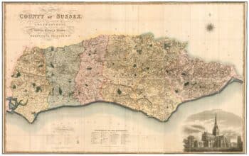
A large scale map of Sussex in fine colour
£2,800GREENWOOD, C. & J.
Published In 1825
Stock No. 24224 -

A large scale map of Nottinghamshire in fine colour
£1,800SANDERSON, George.
Published In 1836
Stock No. 24067 -

An extremely rare example of the first printed plan of Exeter
£4,500HOOKER, John.
Published In 1587
Stock No. 24437 -

One of the first maps to show Pakistan as an independent state
£2,500SURVEY OF PAKISTAN.
Published In 1950
Stock No. 24297 -

A large scale map of Westmorland in fine colour
£1,500GREENWOOD, C. & J.
Published In 1824
Stock No. 24069 -

A large scale map of Warwickshire in fine colour
£1,600GREENWOOD, C. & J.
Published In 1822
Stock No. 24068 -

A large scale map of Nottinghamshire in fine colour
£2,000GREENWOOD, C. & J.
Published In 1826
Stock No. 24066 -

A large scale map of Leicestershire in fine colour
£2,200GREENWOOD, C. & J.
Published In 1826
Stock No. 24064