Showing 1–12 of 126 results
-

Vrients’s scarce map of England, Wales & Ireland
£4,250VRIENTS, Jan Baptist.
Published In 1612
Stock No. 20271 -

A political map of the Partition of British India
£1,800BUREAU OF CURRENT AFFAIRS.
Published In 1949
Stock No. 24485 -

A rare lifetime printing of Blaeu’s view of Vesuvius erupting in 1631
£1,400BLAEU, Johannes.
Published In 1663
Stock No. 24506 -

A late 18th century map of India.
£700MANNERT, Konrad.
Published In 1797
Stock No. 24481 -

A plan of Puducherry at the beginning of the 18th century
£250FER, Nicolas de.
Published In 1705
Stock No. 24511 -

A scarce two-sheet map of England and Wales with side panels
£3,000WILLDEY, George.
Published In 1715
Stock No. 24165 -

One of the first maps to show Pakistan as an independent state
£2,500SURVEY OF PAKISTAN.
Published In 1950
Stock No. 24297 -

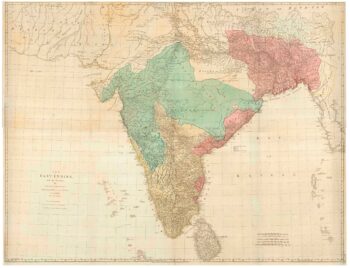
A large and detailed map of India
£1,500WALKER, J. & C.
Published In 1844
Stock No. 24341 -

A rare map of the Middle East, published by Lafreri
£27,500GASTALDI, Giacomo.
Published In 1561
Stock No. 23975 -

A four-sheet map of India in the 18th century
£2,800JEFFERYS, Thomas.
Published In 1768
Stock No. 23966 -

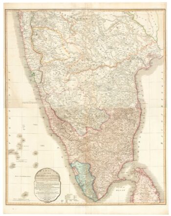
A two-sheet map of India
£620FADEN, William.
Published In 1824
Stock No. 23848 -

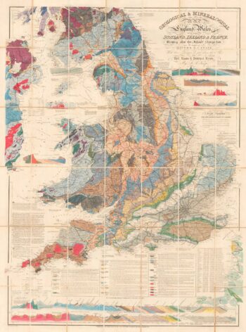
A detailed geological map of England and Wales
£1,500KNIPE, James Alexander.
Published In 1870
Stock No. 23418