


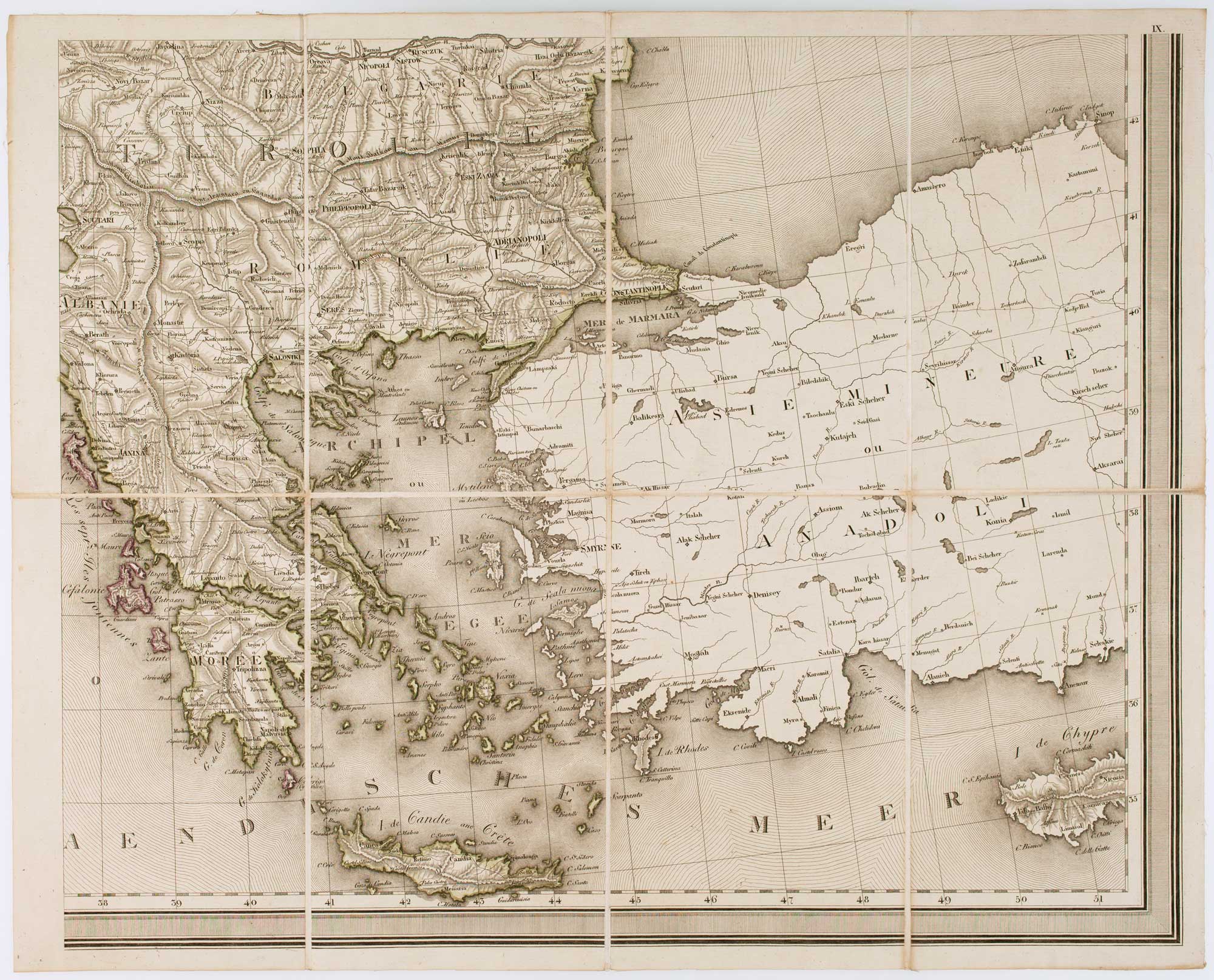
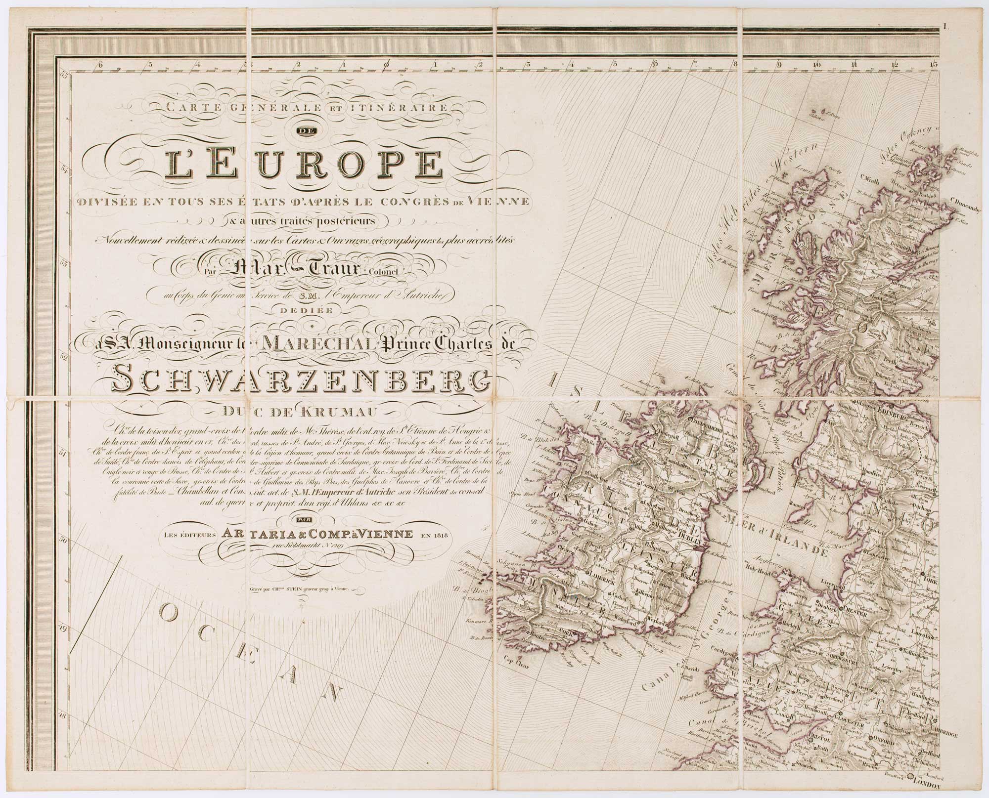
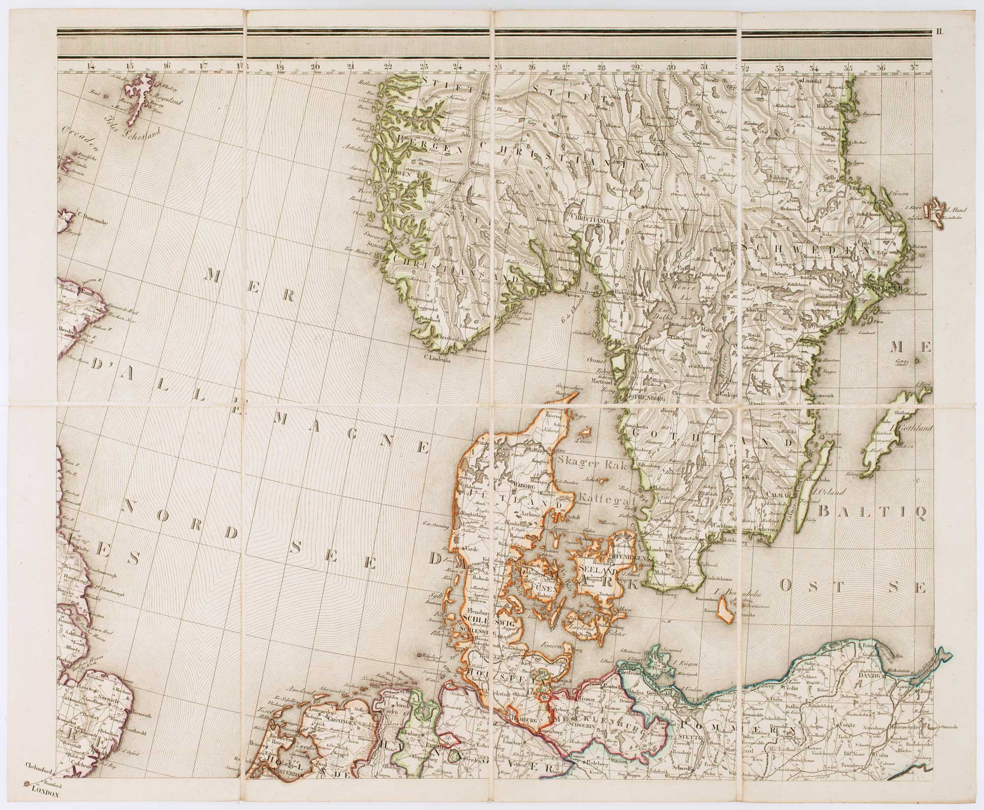
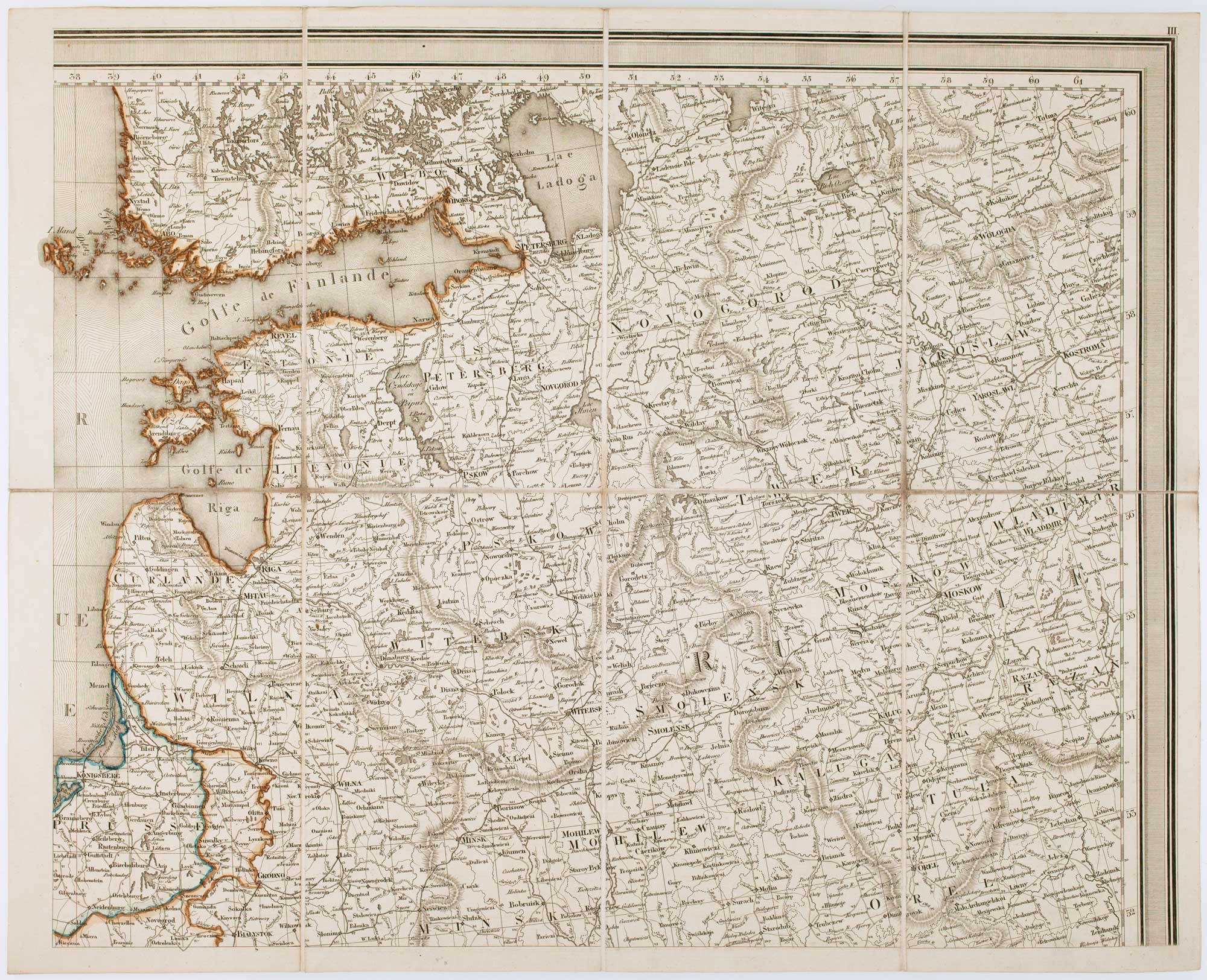
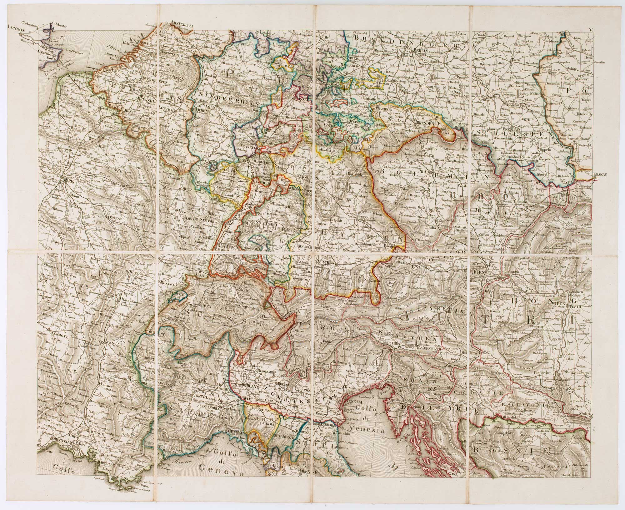

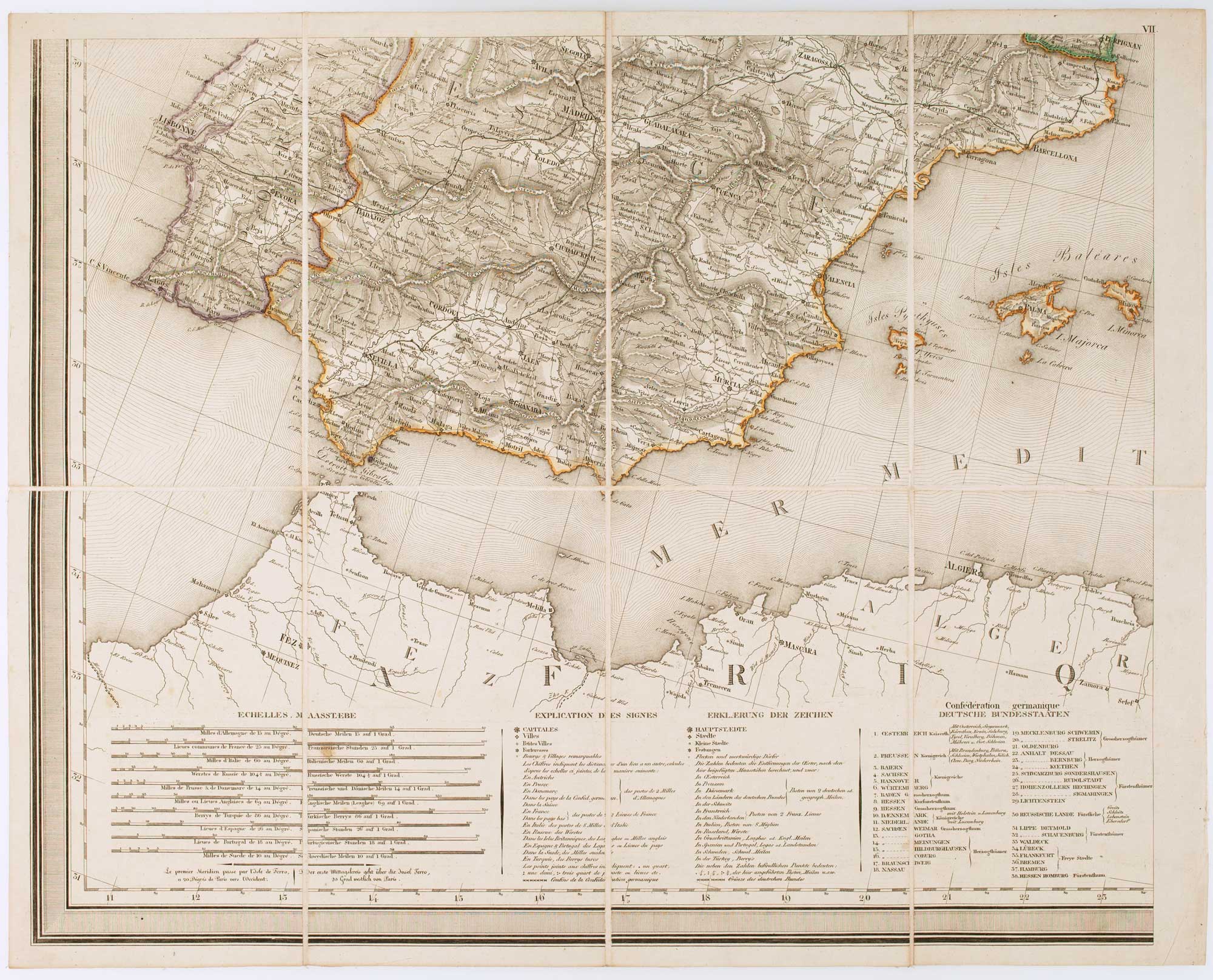
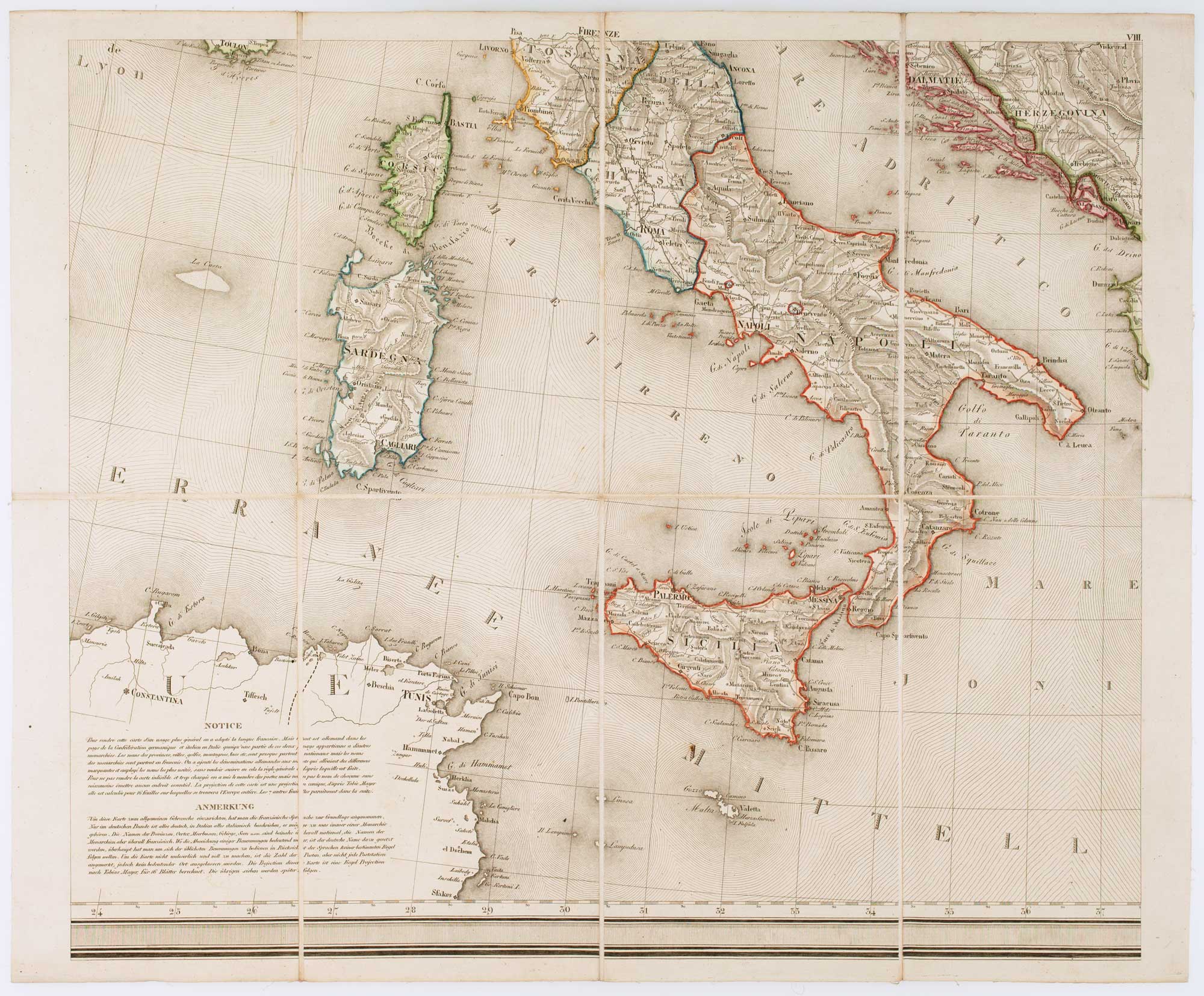
A wall map of Europe according to the Congress of Vienna
TRAUX, Maximilian de.
Carte Générale et Itinéraire de L'Europe Divisée en Tous les États d'après le Congrèss sw Vienne & autres traités postérieurs.
Vienna: Artaria & Comp., 1818. Original colour. Dissected and laid on linen in nine sections as issued, total if joined 1400 x 1740mm.
A large and detailed wall map, depicting the boundaries of Europe as settled by the Congress of Vienna (1814-5), settling the changes caused by the Napoleonic War. Besides these borders this map is interesting for its depiction of the coach roads and use of hachuring to display relief.
Maximilian de Traux (c.1765-c1830) was a colonel of the Austrian military engineers. From 1803 he was active in Dalmatia, improving the defences of Zadar, but also surveying Dalmatia (with a map published 1810) and its cities.
Stock ID : 17177
£1,400
£1,400


Altea Antique Maps & Charts
Altea Gallery Ltd, 35 St George Street
London
W1S 2FN
United Kingdom
Tel: +44 20 7491 0010
info@alteagallery.com
Sitemap :

