
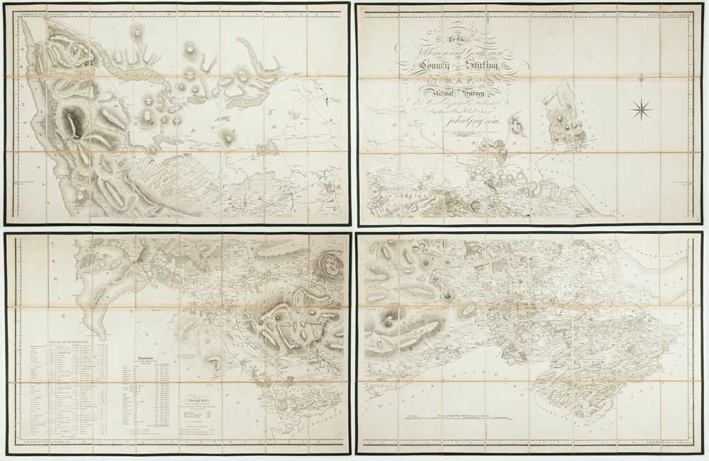
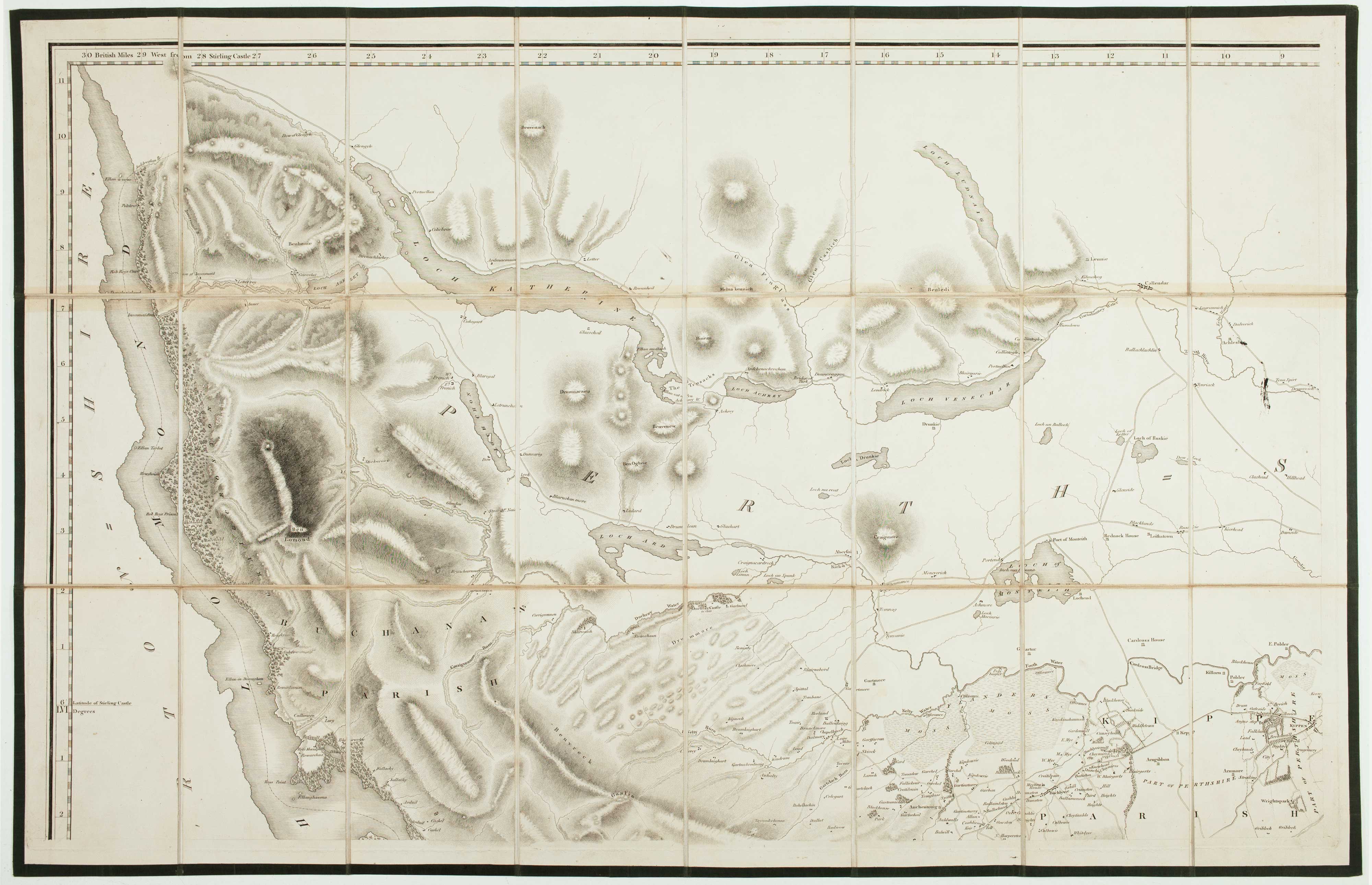
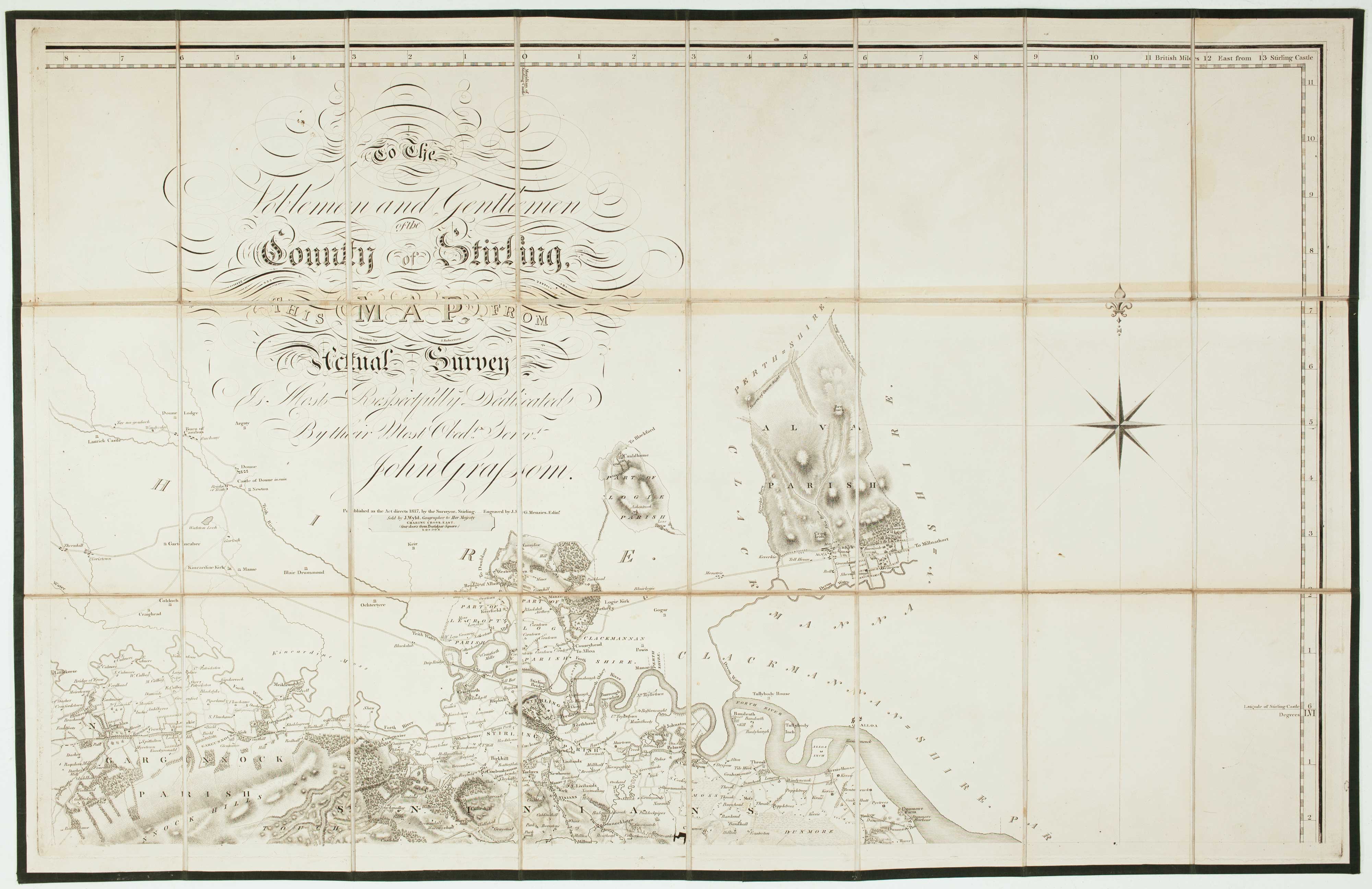
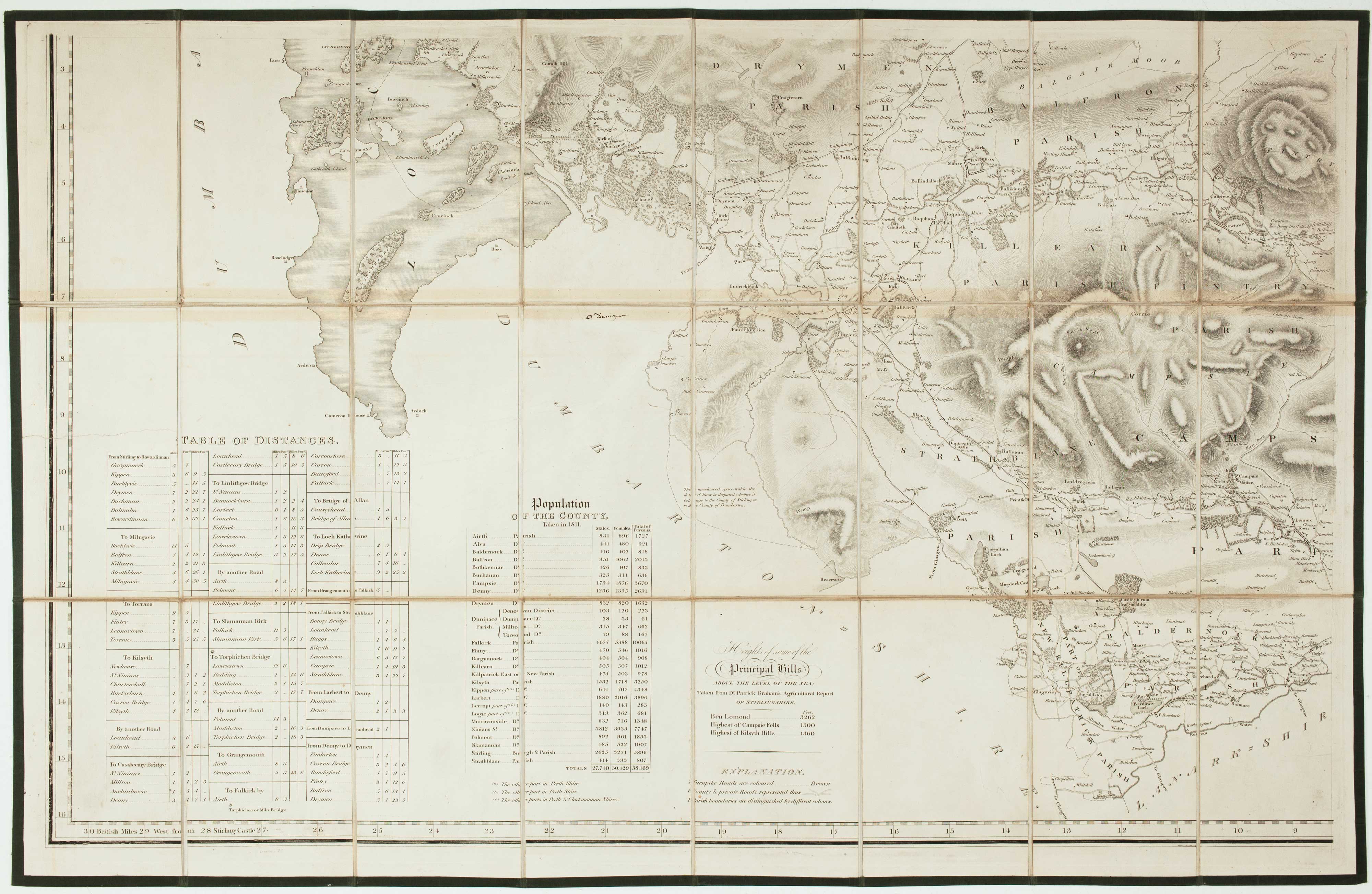
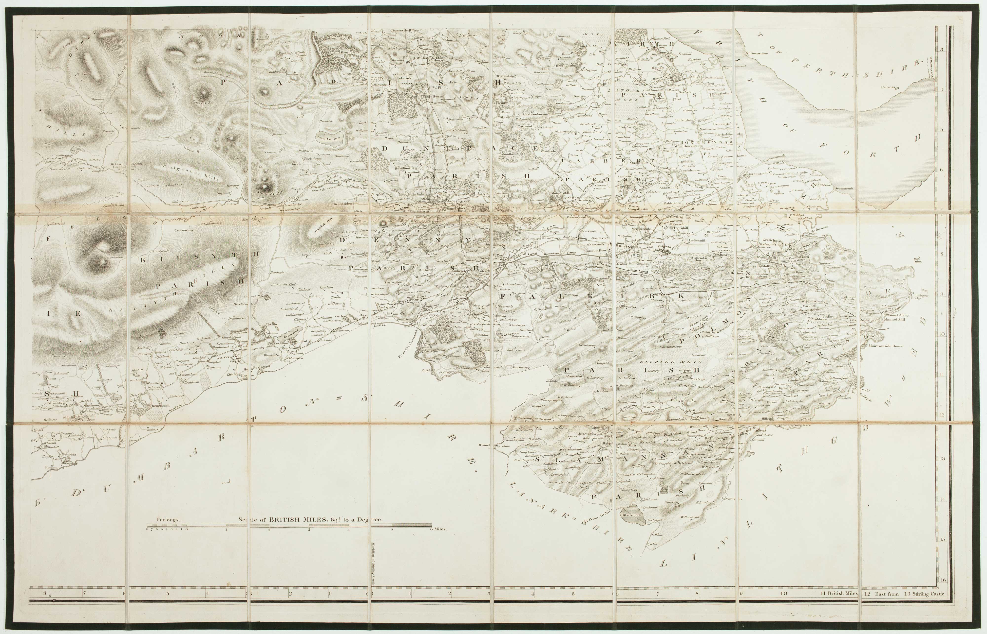
A four-sheet map of Georgian Stirlingshire
GRASSOM, John.
To the Noblemen and Gentlemen of the County of Stirling, this Map from Actual Survey, is Most Respectfully Dedicated...
Stirling: Grassom, 1817. Folding map, dissected and laid on linen in four sections, edged with green silk, total if joined 1180 x 1820mm, in slipcase with James Wyld's label.
Some slight discolouration at folds, slipcase scuffed.
A scarce large-scale map of Stirlingshire, on a scale of 1.5 inches to a mile, engraved by J. & G. Menzies. Grassom, a local surveyor, also surveyed the town of Stirling. His plan appeared on John Thomson's map of the county, the accuracy of which Grassom also 'attested'.
Stock ID : 22658
£1,500
£1,500


Altea Antique Maps & Charts
Altea Gallery Ltd, 35 St George Street
London
W1S 2FN
United Kingdom
Tel: +44 20 7491 0010
info@alteagallery.com
Sitemap :

