


Rare set of six Spanish sea charts of the Red Sea
ELWON, T. & MORESBY, Robert.
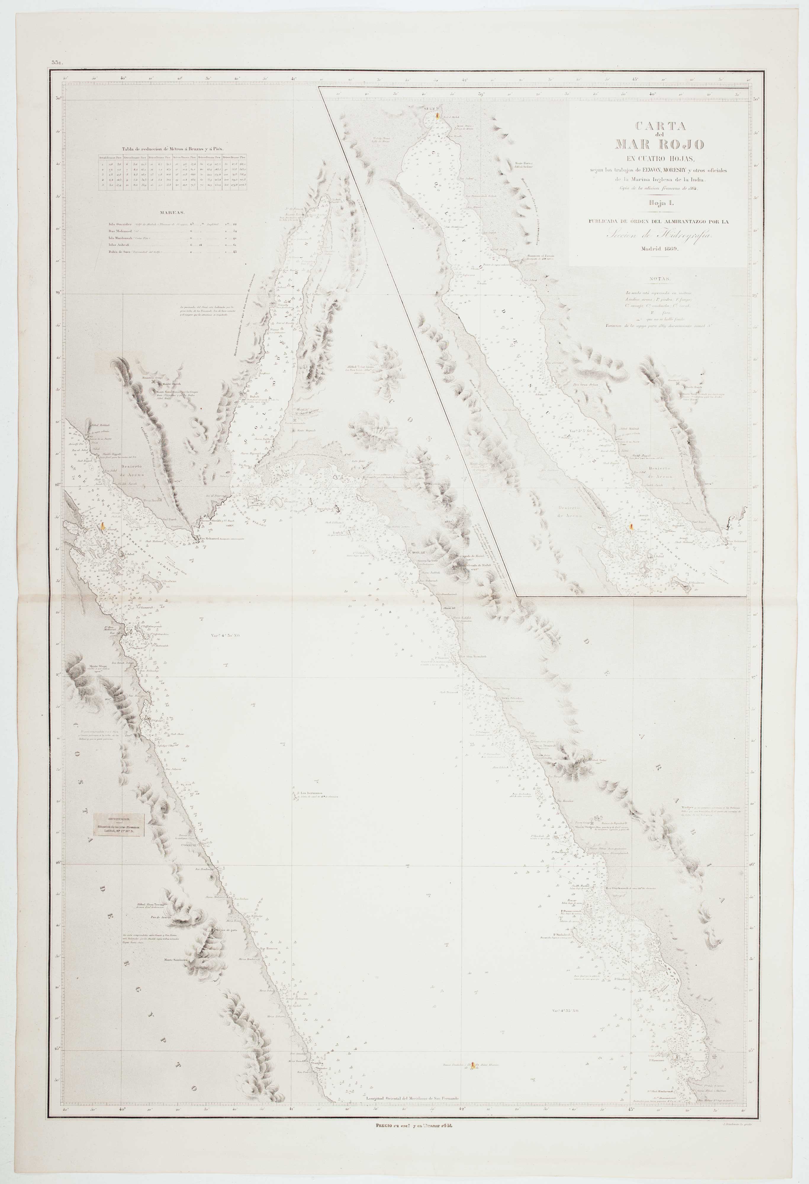
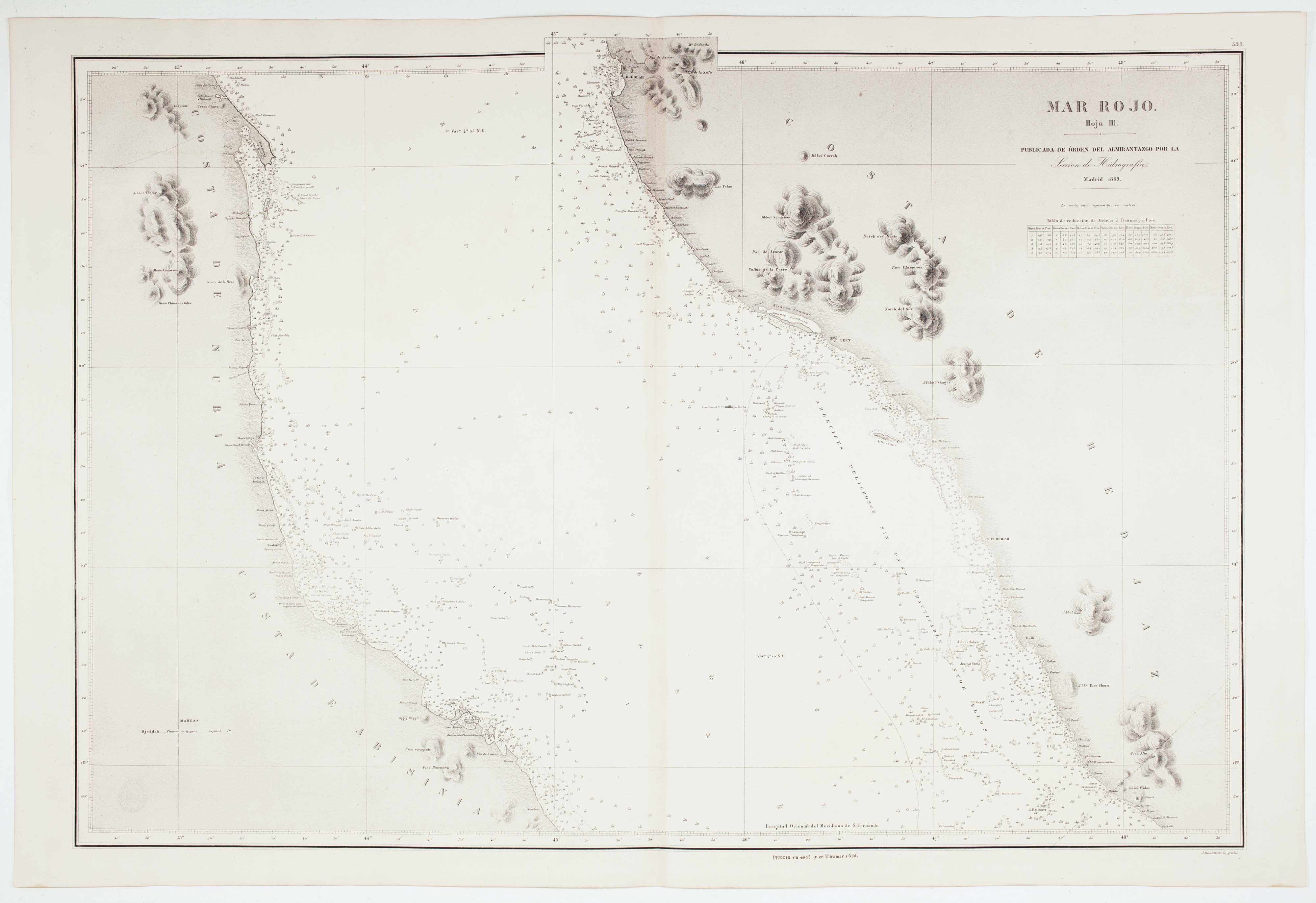
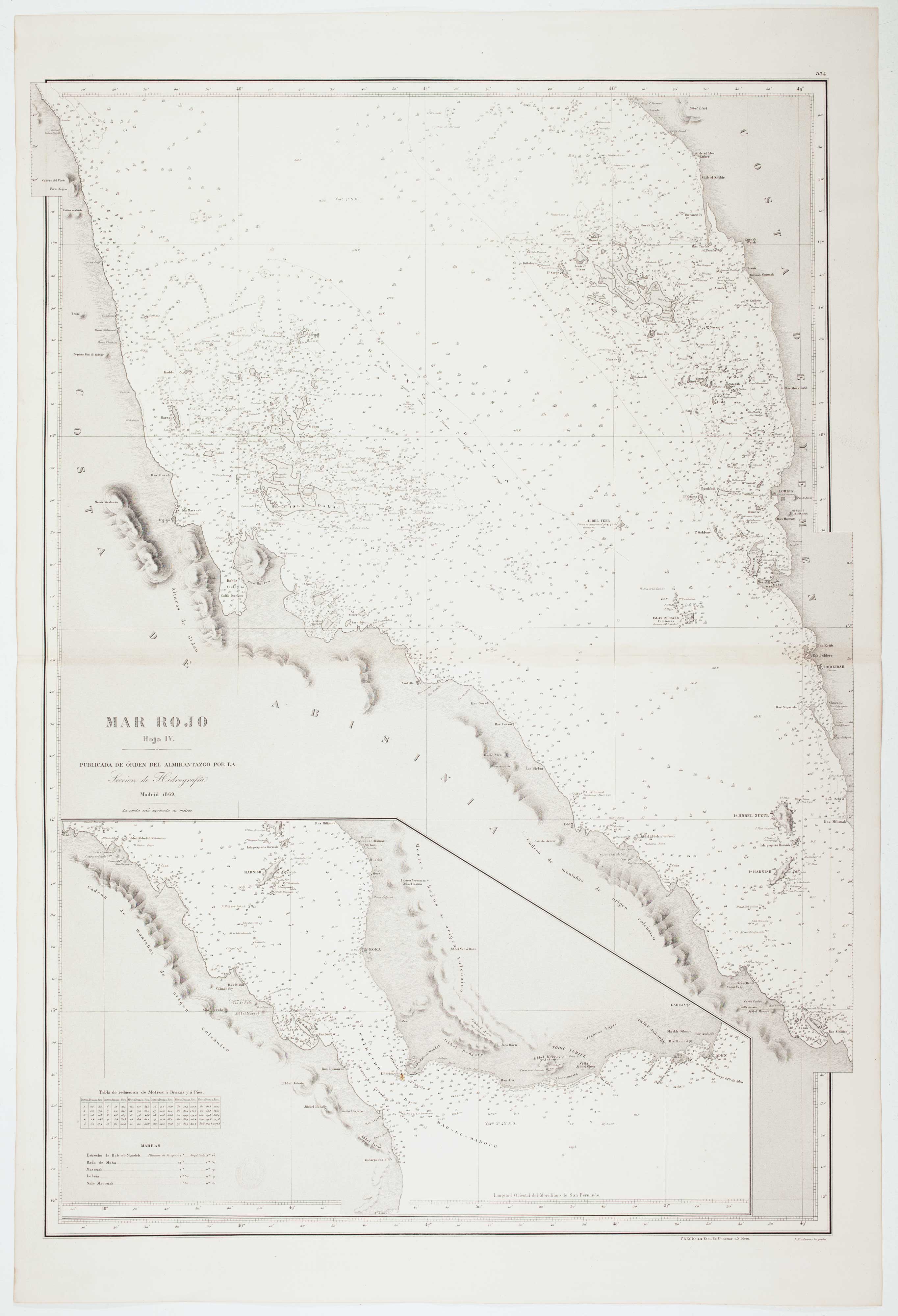
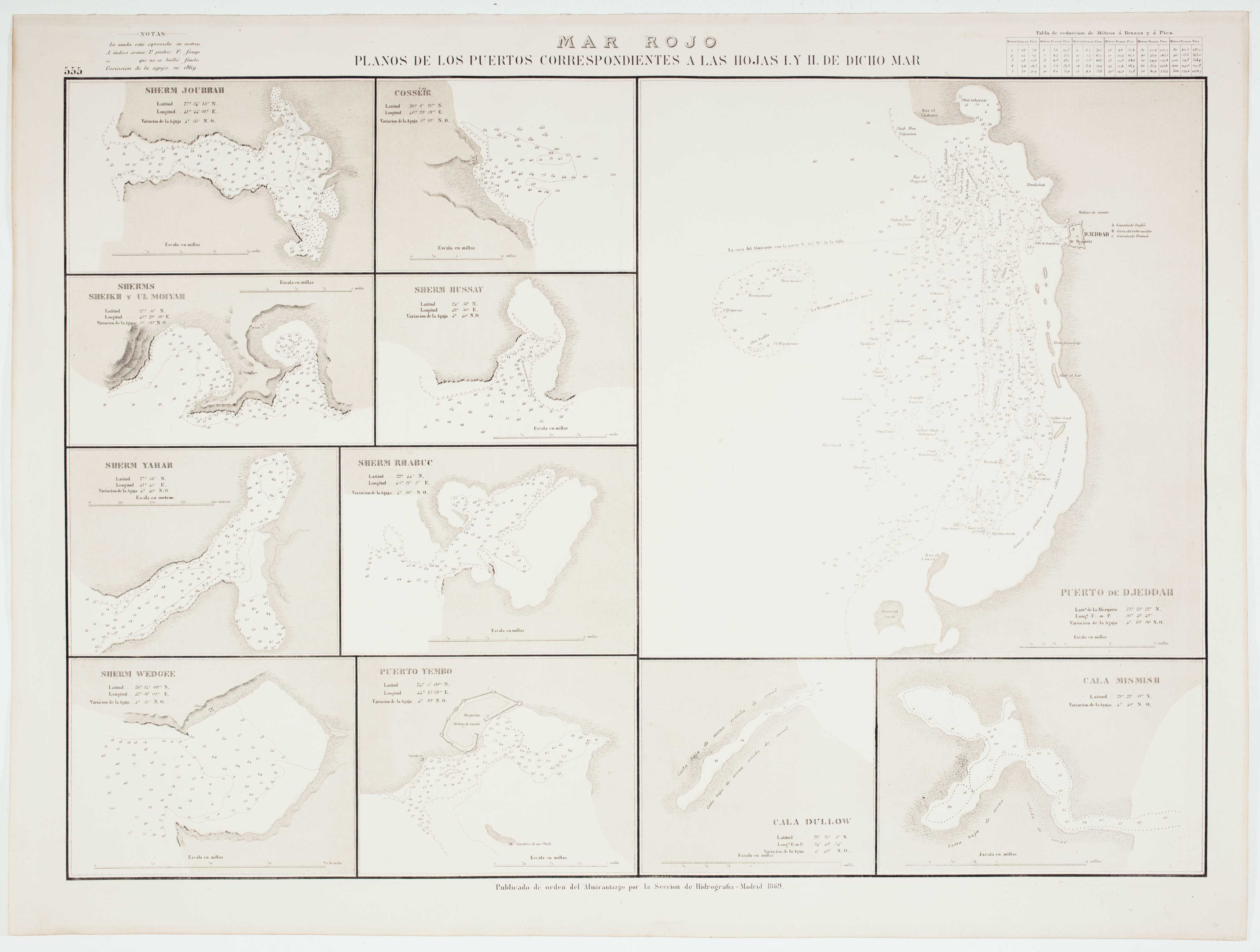
Carta del Mar Rojo en Cuatro Hojas, segun los trabajos de Elwon, Moresby y otros oficiales de la Marina Inglesa de la India. Copia de la edition francesa de 1864.
Madrid: Direccion de Hidrografia, 1869. Six lithographic charts, four double-page, with touches of original colour. Four sheets ea. c. 630 x 920mm, two sheets 500 x 660mm, all with blind stamps of the Direccion de Hidrografia.
Faint toning at centrefolds of the double page sheets.
A set of six sheets, consisting of four charts of the Red Sea and two sheets of details of harbours, all based on English charts compiled by lieutenants in the Indian Navy, via a French edition of their work. Among the details is the Port of Jeddah, one of the few western maps to show the city in any detail. Lighthouses are marked in colour.
The Red Sea was surveyed by officers of 'Her Majesty's Indian Navy' (created in 1830 from the East India Company's Marine), with the purpose of making the new 'Overland Route' (via Suez) to India safer. Two brigs, the 'Benares' under Elwon and 'Palinurus' under Moresby, performed this trigonometical survey of the Red Sea. It was hard and dangerous work: Moresby wrote of 'This heated funnel of reef-bound sea' and reported that the Benares caught on reefs 42 times in the first two years. Both Elwon and Moresby were frequently ill, and Pinching, Elwon's assistant surveyor, died of smallpox in 1833 off Aden. Elwon was then transferred to the Persian Gulf, leaving Moresby to complete the Red Sea Survey.
Stock ID : 12274
SOLD
To see similar items click here

Rare set of six Spanish sea charts of the Red Sea
ELWON, T. & MORESBY, Robert.
Carta del Mar Rojo en Cuatro Hojas, segun los trabajos de Elwon, Moresby y otros oficiales de la Marina Inglesa de la India. Copia de la edition francesa de 1864.
Madrid: Direccion de Hidrografia, 1869. Six lithographic charts, four double-page, with touches of original colour. Four sheets ea. c. 630 x 920mm, two sheets 500 x 660mm, all with blind stamps of the Direccion de Hidrografia.
Faint toning at centrefolds of the double page sheets.
A set of six sheets, consisting of four charts of the Red Sea and two sheets of details of harbours, all based on English charts compiled by lieutenants in the Indian Navy, via a French edition of their work. Among the details is the Port of Jeddah, one of the few western maps to show the city in any detail. Lighthouses are marked in colour.
The Red Sea was surveyed by officers of 'Her Majesty's Indian Navy' (created in 1830 from the East India Company's Marine), with the purpose of making the new 'Overland Route' (via Suez) to India safer. Two brigs, the 'Benares' under Elwon and 'Palinurus' under Moresby, performed this trigonometical survey of the Red Sea. It was hard and dangerous work: Moresby wrote of 'This heated funnel of reef-bound sea' and reported that the Benares caught on reefs 42 times in the first two years. Both Elwon and Moresby were frequently ill, and Pinching, Elwon's assistant surveyor, died of smallpox in 1833 off Aden. Elwon was then transferred to the Persian Gulf, leaving Moresby to complete the Red Sea Survey.
Stock ID : 12274
SOLD
To see similar items click here


Altea Antique Maps & Charts
Altea Gallery Ltd, 35 St George Street
London
W1S 2FN
United Kingdom
Tel: +44 20 7491 0010
info@alteagallery.com
Sitemap :

