

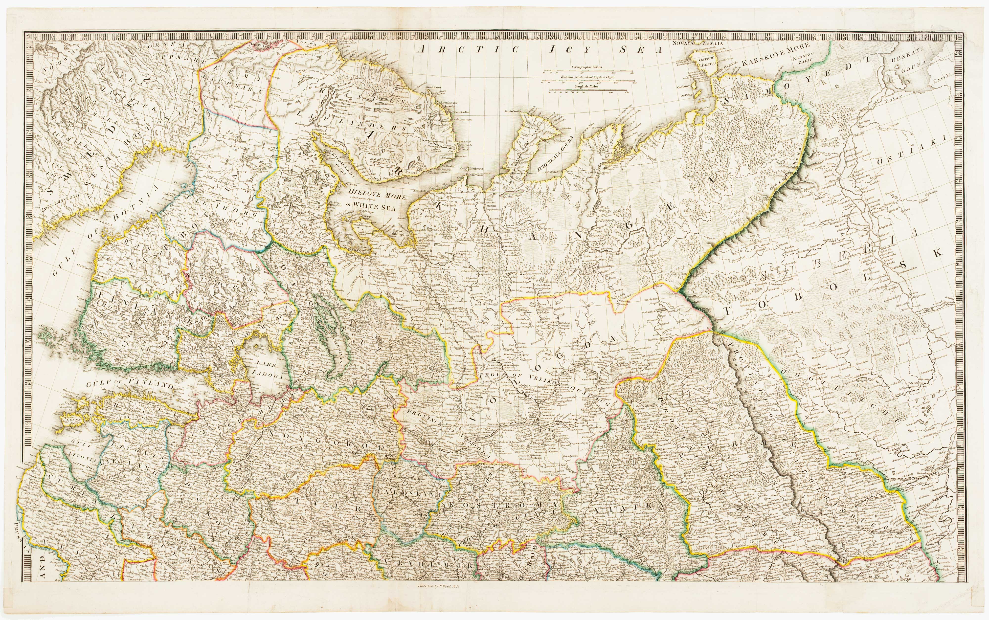
Two-sheet map of the Russian Empire
NANTIAT, Jasper.
The Russian Dominions in Europe, drawn from the latest Maps, printed, by the Academy of Sciences, St. Petersburg; revised and corrected, with the Post Roads & New Governments, from the Russian Atlas of 1806.
London, James Wyld, 1843. Original colour. Pair of steel engravings, each c.560 x 940mm.
Minor repairs to binding folds.
A large and detailed map, extending west to east from the Baltic to the Urals and north to south from the Arctic Ocean to Georgia. Originally published in 1808 the recent imperialist rivalry with Russia, especially in Central Asia (the 'Great Game'), had renewed British interest in that country. The tensions led to the Crimean War a little over a decade later.
Normally this map is found dissected and laid on linen, so this is a better than usual example.
Stock ID : 8576
SOLD
To see similar items click here
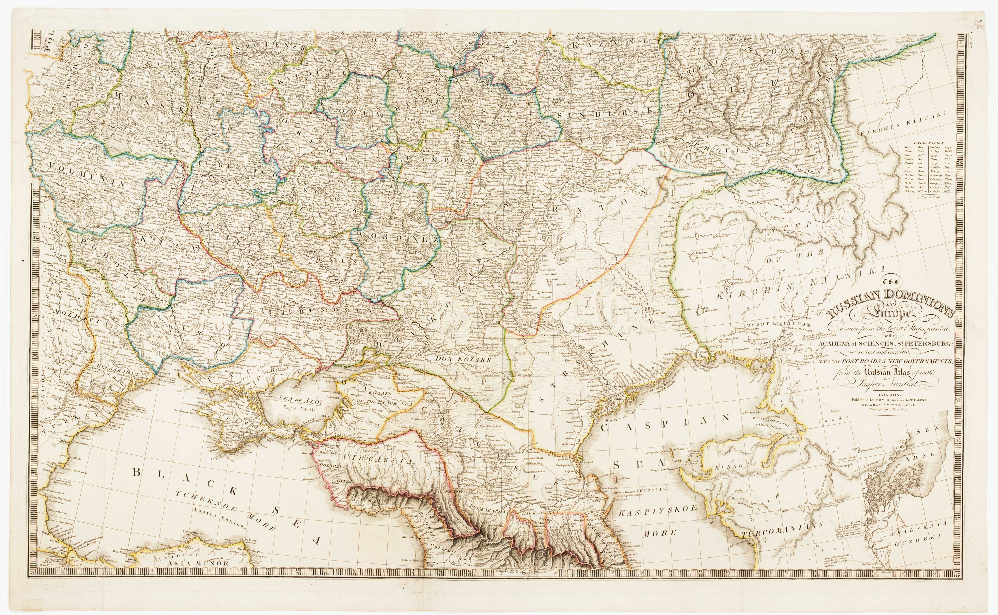


Altea Antique Maps & Charts
Altea Gallery Ltd, 35 St George Street
London
W1S 2FN
United Kingdom
Tel: +44 20 7491 0010
info@alteagallery.com
Sitemap :

