
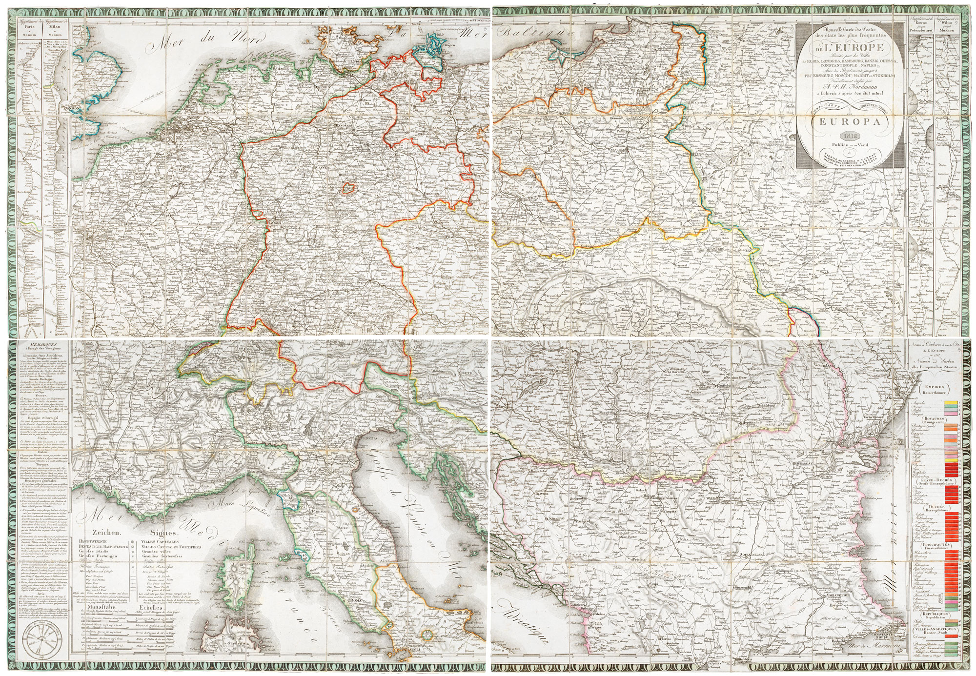

A folding map of the post roads of Central and Eastern Europe
NORDMANN, A.P.H.
Nouvelle Carte des Postes des états les plus frèquentès de l'Europe Limitée par les Villes de Paris, Londres, Hambourg, Danzig, Odessam Constantinople, Naples &c, Avec des Sipplément jusqu'a Petersbourg, Moscou, Madrit et Stockholm,..
Vienna, Artaria & Co; Mannheim, Domenico Artaria; Milan, Ferdinando Artaria, 1812. Original colour. Dissected and laid on linen in four sections, total 980 x 1410mm, with original marbled box and chemise.
Slight wear to box.
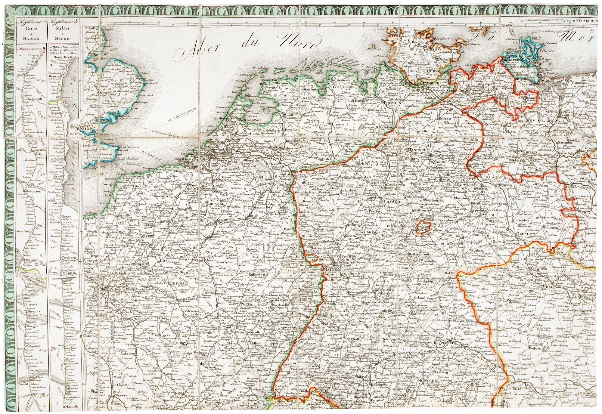
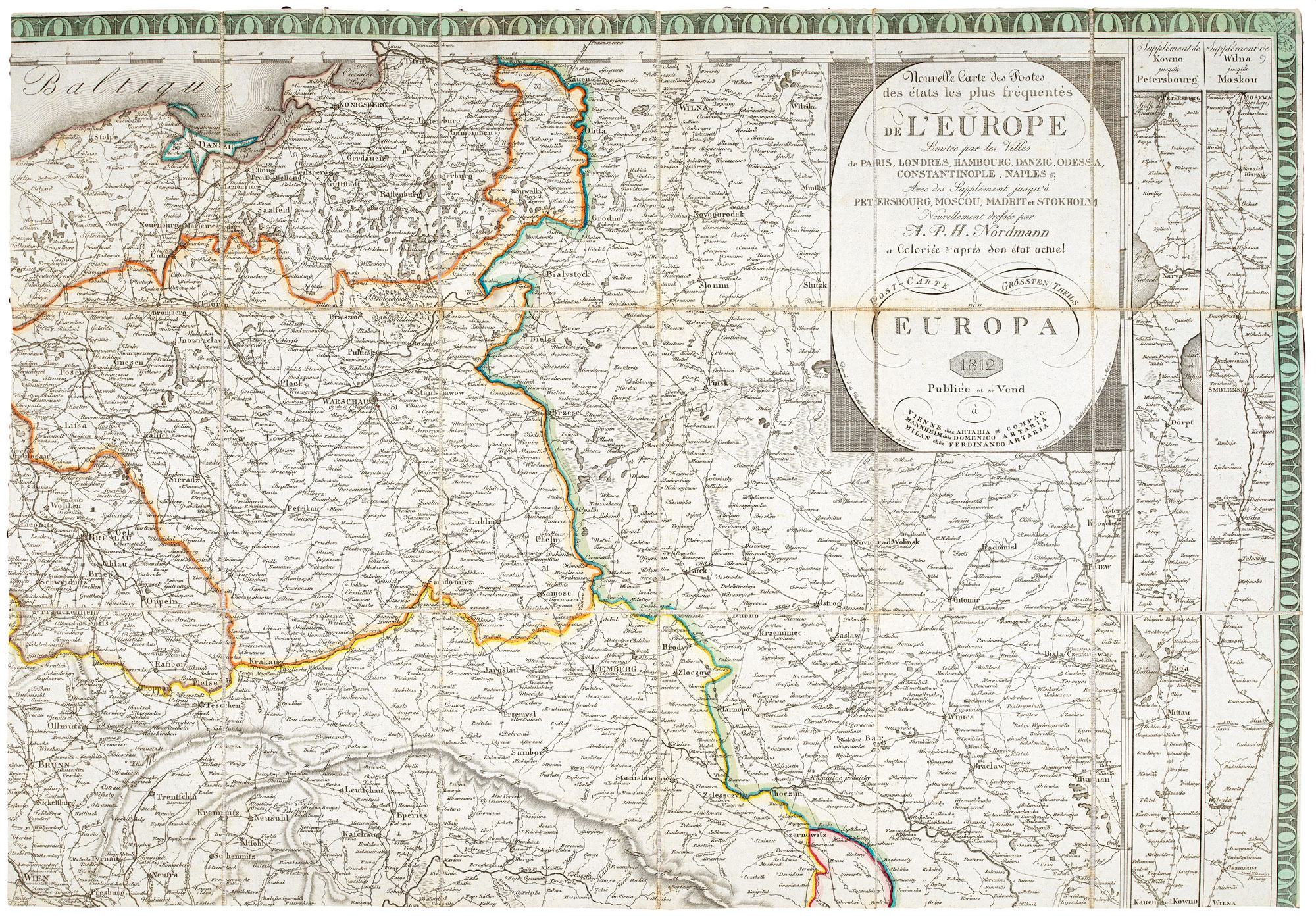
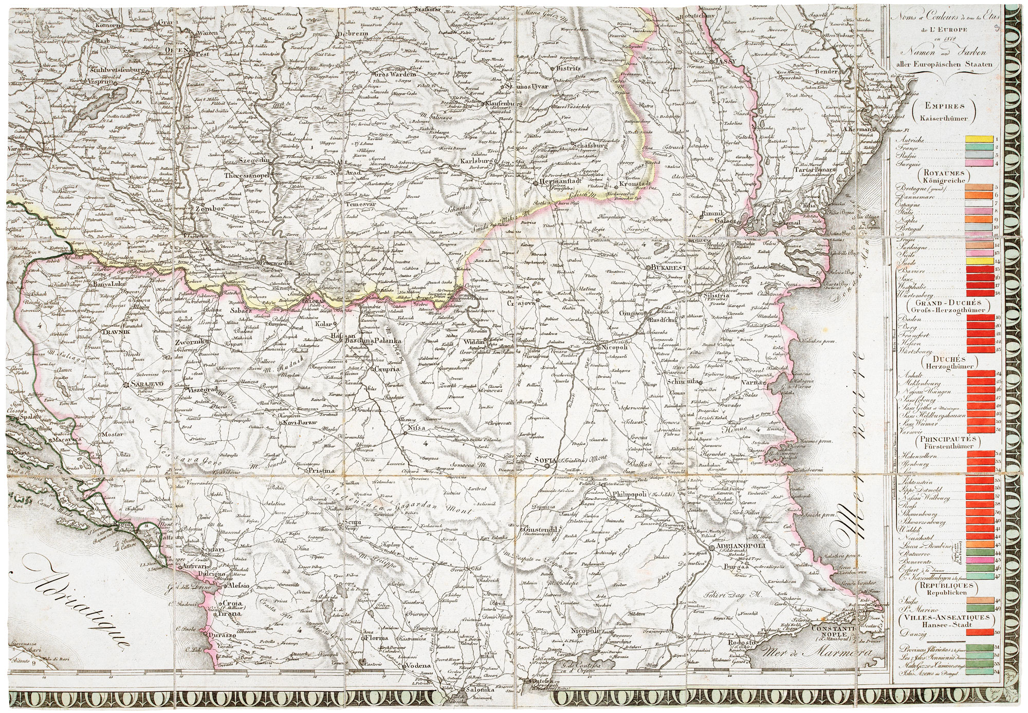
A fine example of the map of the post roads of central and east Europe, from London and Paris in the west, to Hamburg and Kalingrad in the north, Kiev and Bucharest in the east, and Constantinople and Naples in the south. Down the left side of the top left sheet are supplemental strips showing the roads from Paris to Madrid and from Milan to Madrid; opposite are Kaunas to Moscow and Vilnius to Moscow. Bottom left are engraved 'Remarques'; bottom right is a list of empire, kingdoms, grand duchies, etc.
This map was published in 1812, the year of Napoleon's disastrous Russian offensive; in 1816 it was reissued with changes according to the Congress of Vienna and the Treaty of Paris that ended the Napoleonic Wars.
.
Stock ID : 20640
SOLD
To see similar items click here

A folding map of the post roads of Central and Eastern Europe
NORDMANN, A.P.H.
Nouvelle Carte des Postes des états les plus frèquentès de l'Europe Limitée par les Villes de Paris, Londres, Hambourg, Danzig, Odessam Constantinople, Naples &c, Avec des Sipplément jusqu'a Petersbourg, Moscou, Madrit et Stockholm,..
Vienna, Artaria & Co; Mannheim, Domenico Artaria; Milan, Ferdinando Artaria, 1812. Original colour. Dissected and laid on linen in four sections, total 980 x 1410mm, with original marbled box and chemise.
Slight wear to box.
A fine example of the map of the post roads of central and east Europe, from London and Paris in the west, to Hamburg and Kalingrad in the north, Kiev and Bucharest in the east, and Constantinople and Naples in the south. Down the left side of the top left sheet are supplemental strips showing the roads from Paris to Madrid and from Milan to Madrid; opposite are Kaunas to Moscow and Vilnius to Moscow. Bottom left are engraved 'Remarques'; bottom right is a list of empire, kingdoms, grand duchies, etc.
This map was published in 1812, the year of Napoleon's disastrous Russian offensive; in 1816 it was reissued with changes according to the Congress of Vienna and the Treaty of Paris that ended the Napoleonic Wars.
.
Stock ID : 20640
SOLD
To see similar items click here


Altea Antique Maps & Charts
Altea Gallery Ltd, 35 St George Street
London
W1S 2FN
United Kingdom
Tel: +44 20 7491 0010
info@alteagallery.com
Sitemap :

