
A map of North America after the American War of Independence
SAYER, Robert.
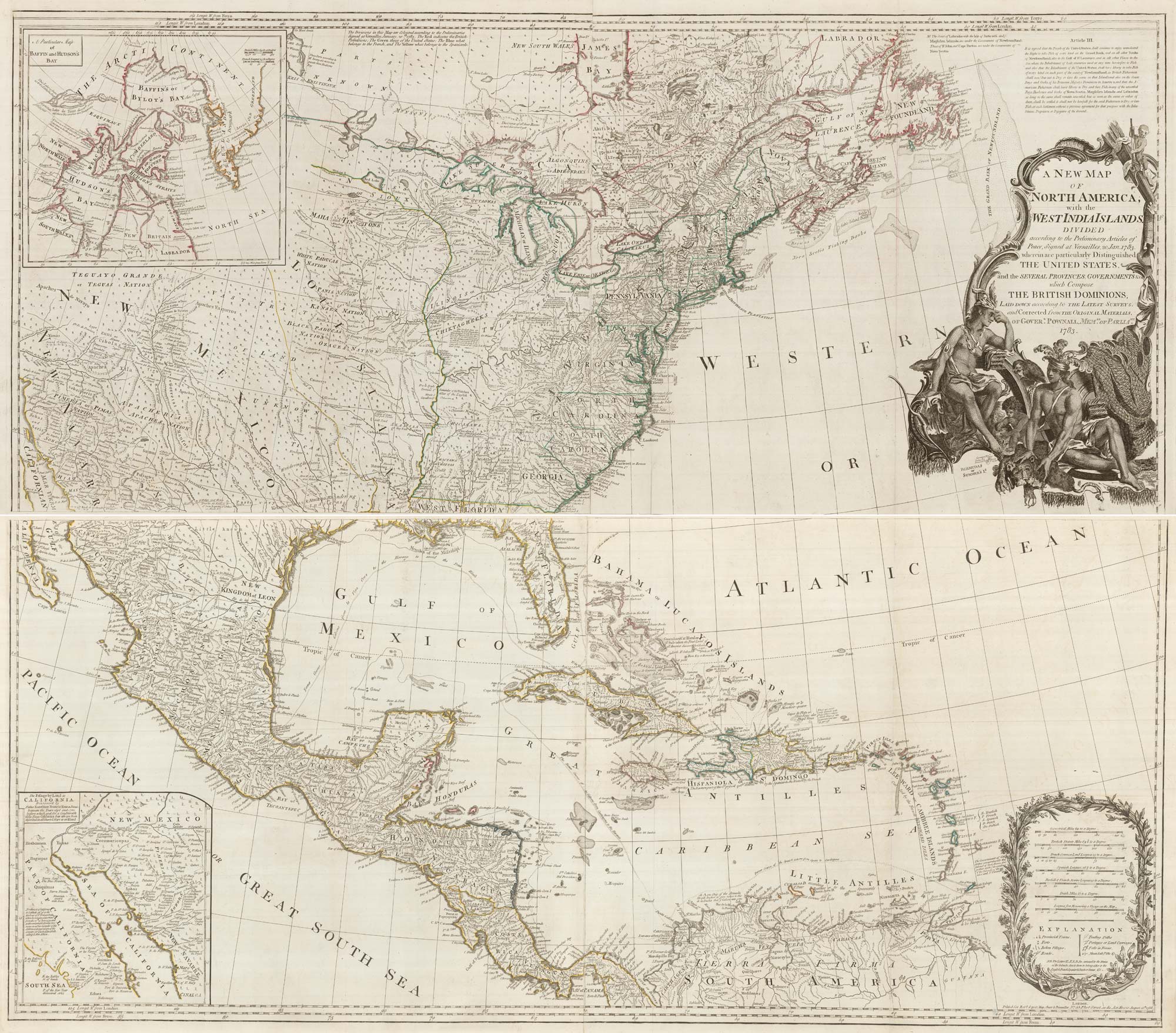
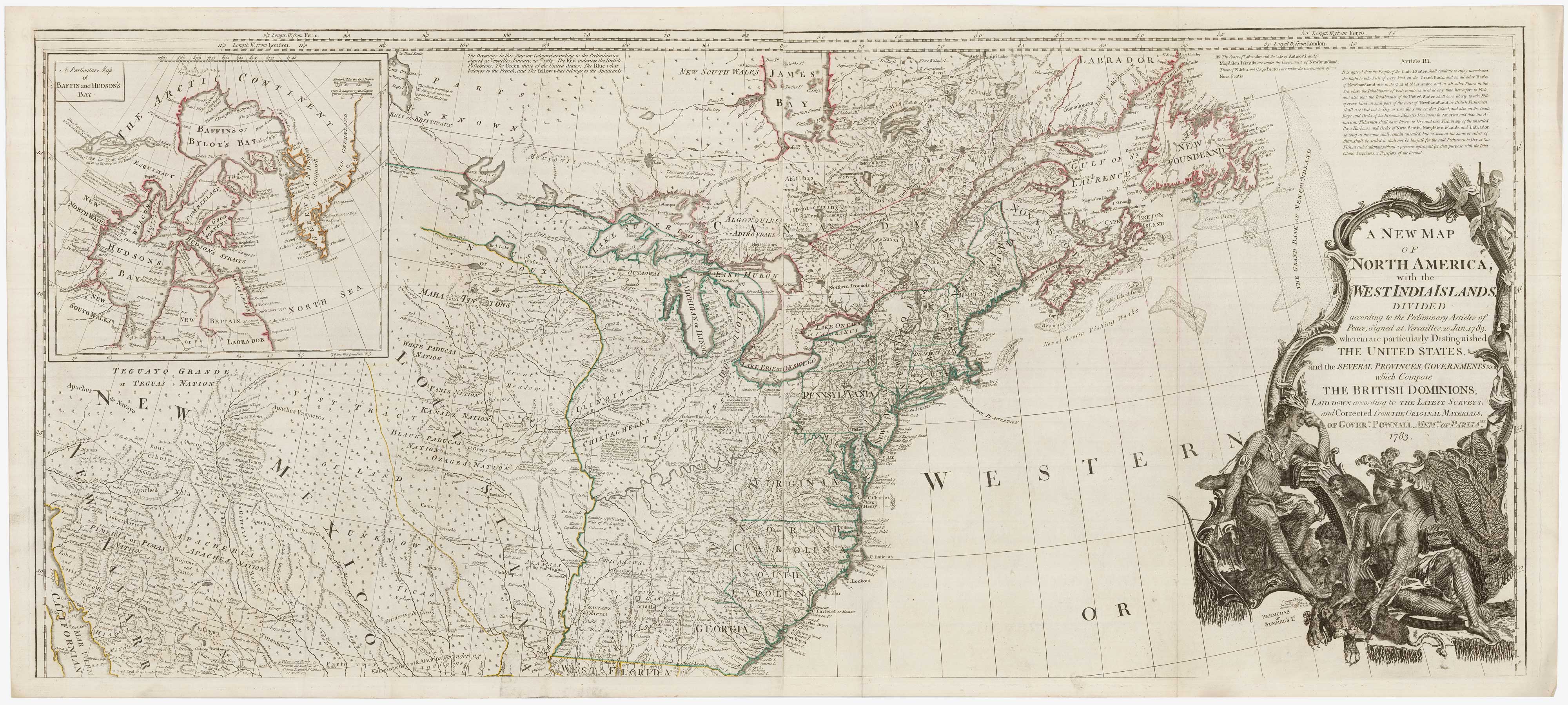
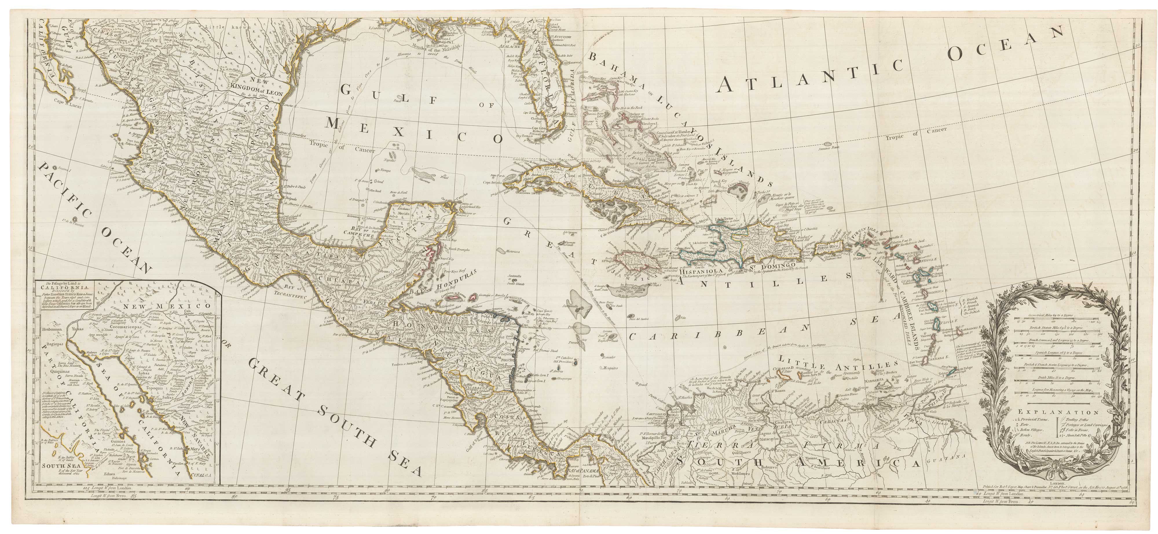
A New Map of North America, with the West India Islands. Divided according to the Preliminary Articles of Peace, Signed at Versailles, 20, Jan. 1783, wherein are particularly Distinguished The United States, and the Several Provinces, Governments &ca which Compose the British Dominions. Laid Down according to the Latest Surveys, and Corrected from the Original Materials, or Gover.r Pownell, Mem.br of Parli.mt. 1783.
London: Sayer, 1786. Original outline colour. Printed on 4 sheets, joined in pairs laterally , as issued, each pair with a total printed area of 520 x 1180mm.
A very fine example
A large and detailed map published to show the borders between the USA and Canada agreed after the War of Independence. Article III of the treaty is transcribed, detailing that Newfoundland would be open to fishermen from both countries. An inset map shows the discoveries of Father Kino, who proved that California was not an island. Another shows Hudson Bay and a comment about de Fonte: 'all these discoveries are imaginary'. The title is within a fine cartouche featuring fanciful depictions of two First Nation tribesmen.
Stock ID : 22290
SOLD
To see similar items click here

A map of North America after the American War of Independence
SAYER, Robert.
A New Map of North America, with the West India Islands. Divided according to the Preliminary Articles of Peace, Signed at Versailles, 20, Jan. 1783, wherein are particularly Distinguished The United States, and the Several Provinces, Governments &ca which Compose the British Dominions. Laid Down according to the Latest Surveys, and Corrected from the Original Materials, or Gover.r Pownell, Mem.br of Parli.mt. 1783.
London: Sayer, 1786. Original outline colour. Printed on 4 sheets, joined in pairs laterally , as issued, each pair with a total printed area of 520 x 1180mm.
A very fine example
A large and detailed map published to show the borders between the USA and Canada agreed after the War of Independence. Article III of the treaty is transcribed, detailing that Newfoundland would be open to fishermen from both countries. An inset map shows the discoveries of Father Kino, who proved that California was not an island. Another shows Hudson Bay and a comment about de Fonte: 'all these discoveries are imaginary'. The title is within a fine cartouche featuring fanciful depictions of two First Nation tribesmen.
Stock ID : 22290
SOLD
To see similar items click here


Altea Antique Maps & Charts
Altea Gallery Ltd, 35 St George Street
London
W1S 2FN
United Kingdom
Tel: +44 20 7491 0010
info@alteagallery.com
Sitemap :

