
Two maps of Ireland from the collection of Louis Philippe I, king of the French
BEAUFORT, Daniel Augustus.
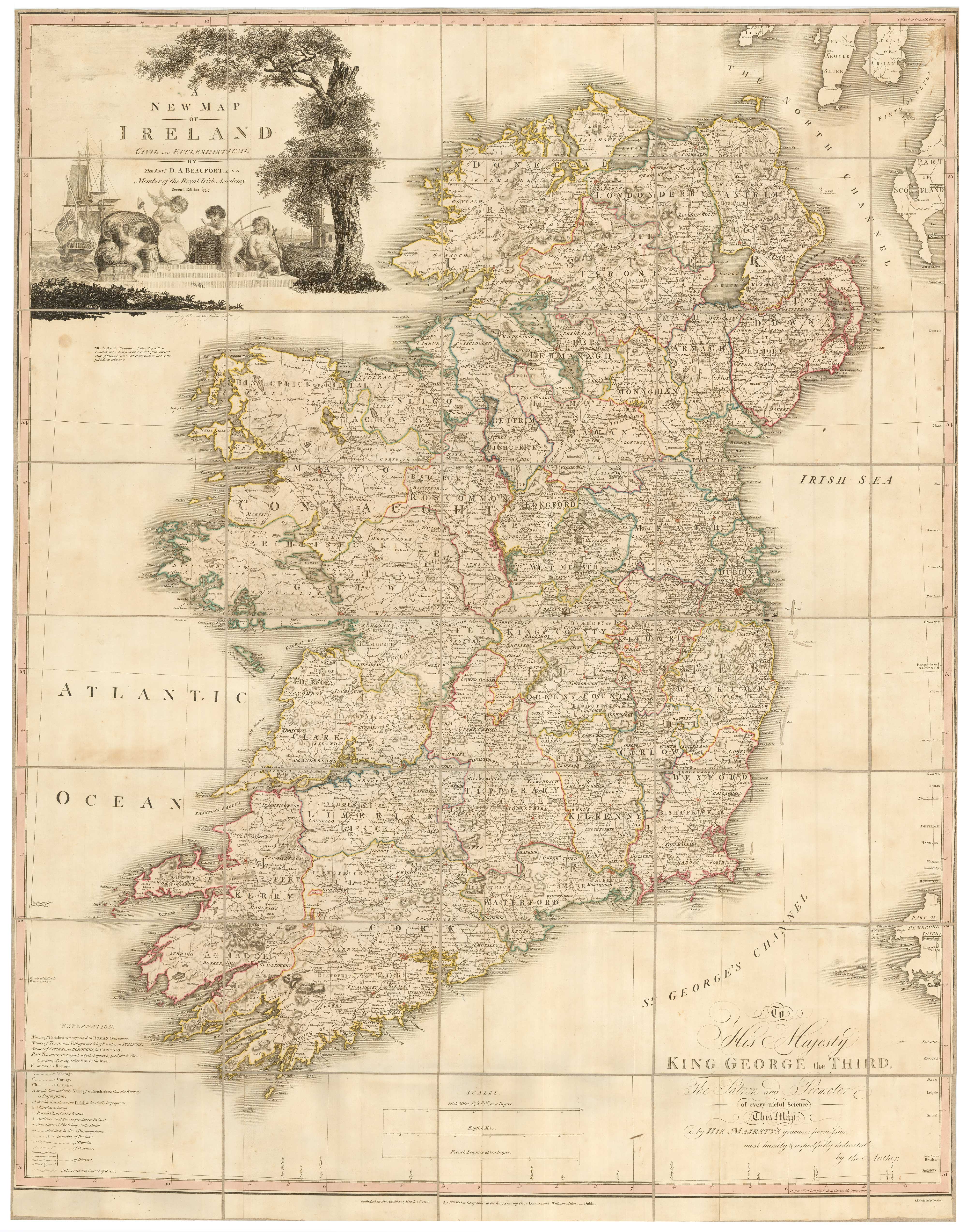
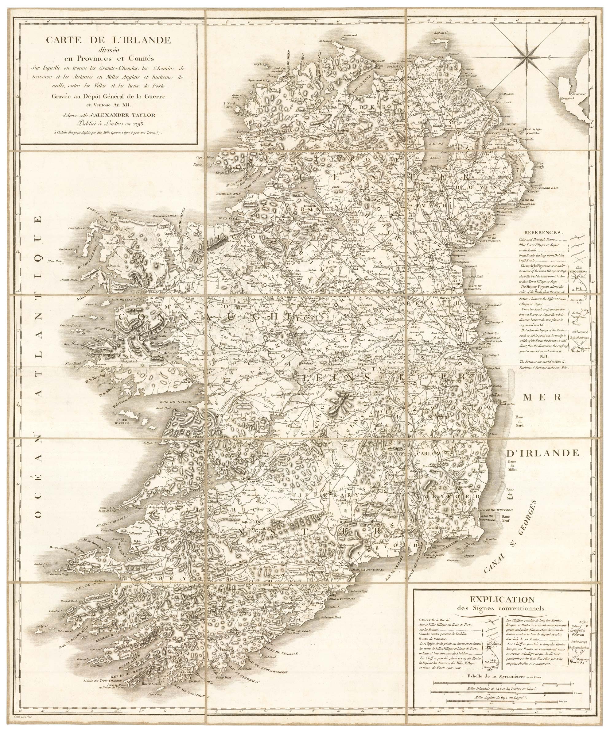
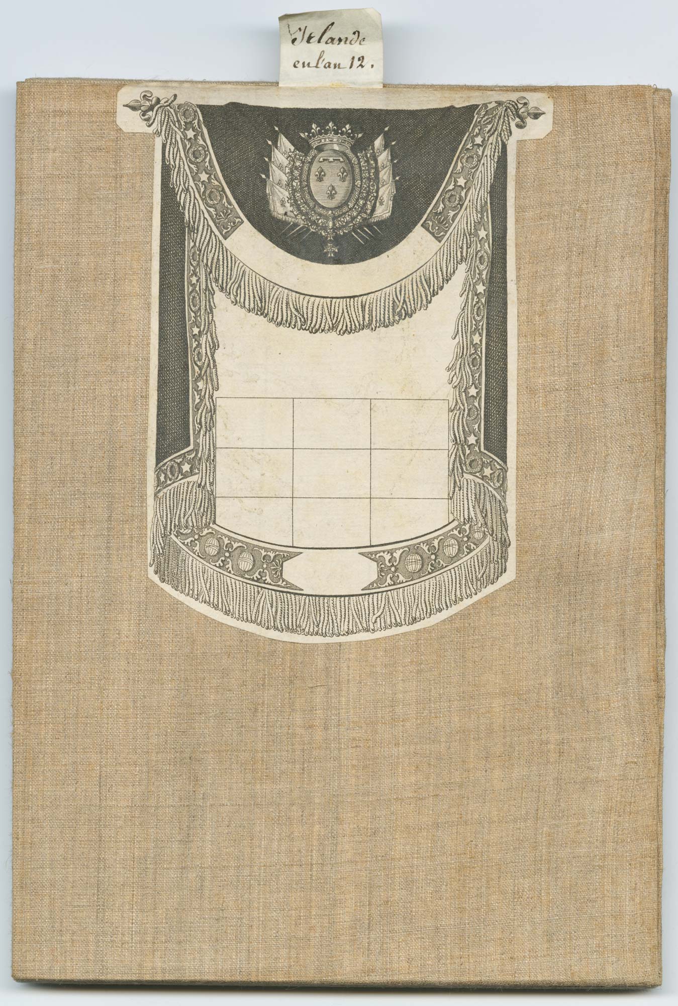
A New Map of Ireland Civil and Ecclesiastical. Second Edition 1797. [With] Carte de l'Irlande divisée en Provences et Comtés... d'Aprés celle d'Alexandre Taylor Publiée à Londres en 1793.
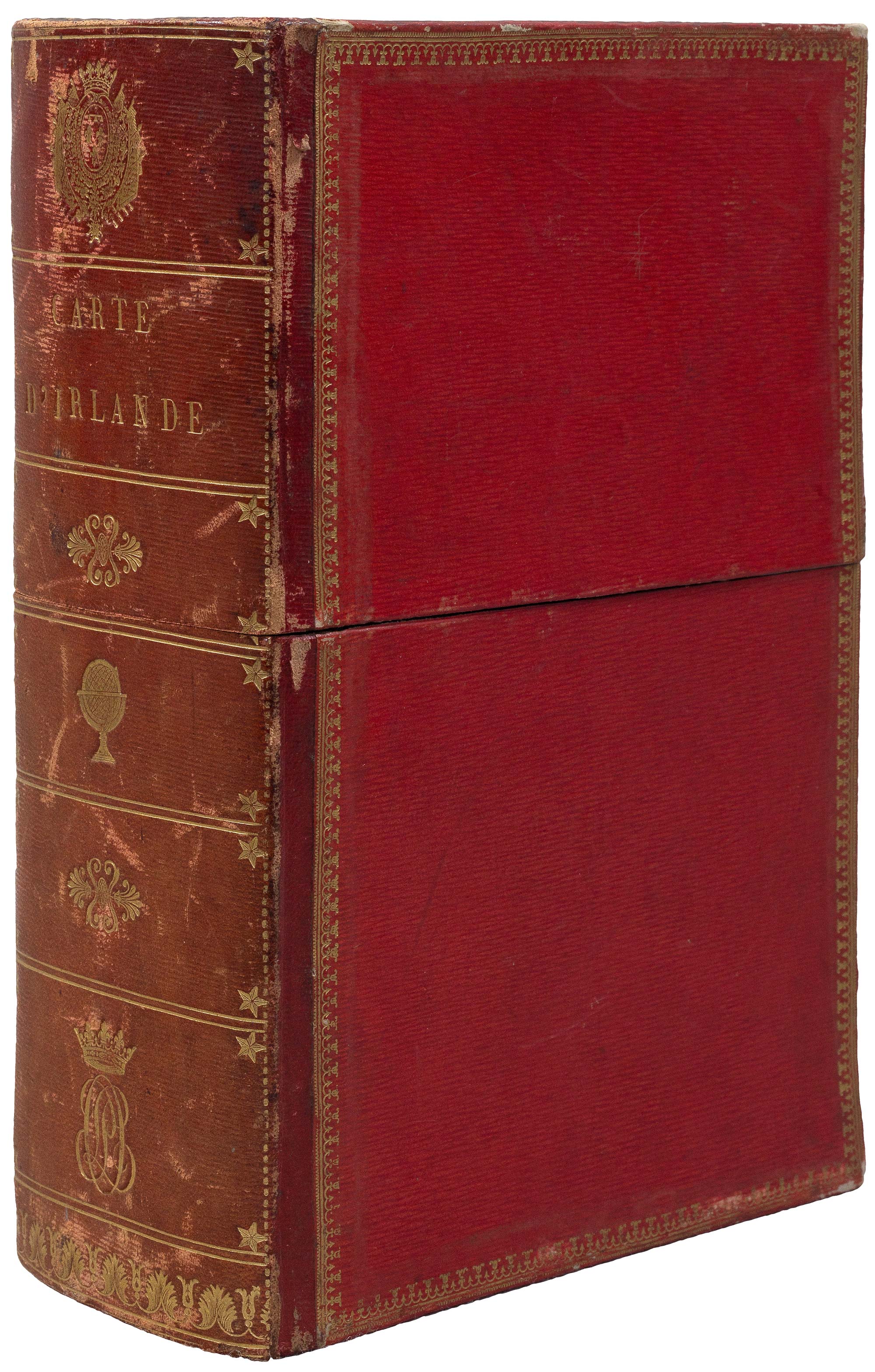
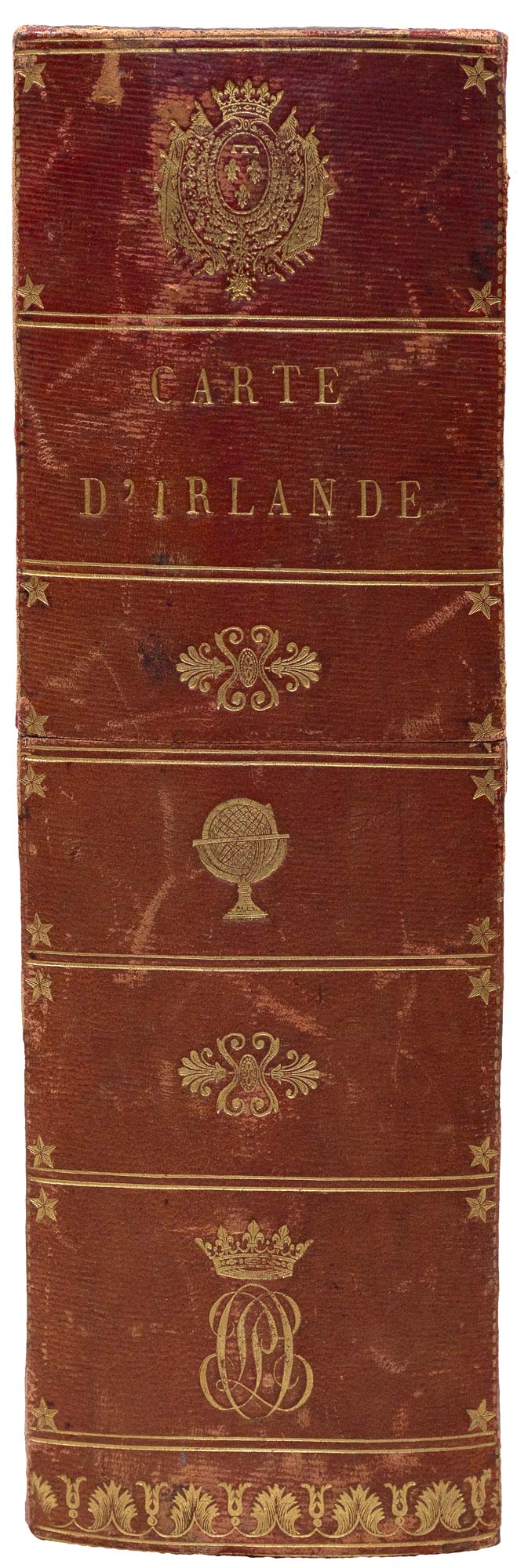
Two engraved maps. London: William Faden, & Dublin: William Allen, 1792-7. Original colour. Dissected and laid on linen, as issued, 1130 x 885mm. [&] Paris: Dépôt Géneral de la Guerre en Ventose An XII (1804). 740 x 610mm. Both maps with with the Orleans family bookplate on linen, folded into a red morocco slipcase with 'Carte d'Irelande' and Louis Philippe's monogram of crown and initials in gilt.
Beaufort map with some staining.
Two folding maps of Ireland that once belonged to Louis Phillipe I (1773-1850), penultimate King of the French. The bookplates date from after he became Duke of Orleans in 1793, when his father was guillotined during 'The Terror'; the box has his regal monogram (crown & 'LP'), after he became king in 1830.
The largest map is that of Reverend Beaufort (1739-1821), who was prominent in the foundation of both Sunday Schools and and the Royal Irish Academy. Supported by the Lord-Lieutenant of Ireland, the Marquis of Buckingham, he created this map attempting to remedy defects in existing maps, compiling a systematic index. The map was first published in 1792 and has a dedication to George III. The large title cartouche, featuring cherubs with trade good and a medallion portrait of the king, is signed 'Fra. Beaufort'; whether this is Daniel's daughter, Frances, or his son, Sir Francis Beaufort, naval hydrographer and creator of the Beaufort scale, is unclear.
The French map, dated February 1804 in the calendar of the French Revolution, is a military map published as Napoleon Bonaparte was gathering an army of 200,000 to cross the English Channel. The plan was abandoned after Nelson's decisive victory at Trafalgar in 1805.
BONAR LAW: 145, state iii of x (Beaufort); & 198 (Depot de la Guerre).
Stock ID : 23403
SOLD
To see similar items click here

Two maps of Ireland from the collection of Louis Philippe I, king of the French
BEAUFORT, Daniel Augustus.
A New Map of Ireland Civil and Ecclesiastical. Second Edition 1797. [With] Carte de l'Irlande divisée en Provences et Comtés... d'Aprés celle d'Alexandre Taylor Publiée à Londres en 1793.
Two engraved maps. London: William Faden, & Dublin: William Allen, 1792-7. Original colour. Dissected and laid on linen, as issued, 1130 x 885mm. [&] Paris: Dépôt Géneral de la Guerre en Ventose An XII (1804). 740 x 610mm. Both maps with with the Orleans family bookplate on linen, folded into a red morocco slipcase with 'Carte d'Irelande' and Louis Philippe's monogram of crown and initials in gilt.
Beaufort map with some staining.
Two folding maps of Ireland that once belonged to Louis Phillipe I (1773-1850), penultimate King of the French. The bookplates date from after he became Duke of Orleans in 1793, when his father was guillotined during 'The Terror'; the box has his regal monogram (crown & 'LP'), after he became king in 1830.
The largest map is that of Reverend Beaufort (1739-1821), who was prominent in the foundation of both Sunday Schools and and the Royal Irish Academy. Supported by the Lord-Lieutenant of Ireland, the Marquis of Buckingham, he created this map attempting to remedy defects in existing maps, compiling a systematic index. The map was first published in 1792 and has a dedication to George III. The large title cartouche, featuring cherubs with trade good and a medallion portrait of the king, is signed 'Fra. Beaufort'; whether this is Daniel's daughter, Frances, or his son, Sir Francis Beaufort, naval hydrographer and creator of the Beaufort scale, is unclear.
The French map, dated February 1804 in the calendar of the French Revolution, is a military map published as Napoleon Bonaparte was gathering an army of 200,000 to cross the English Channel. The plan was abandoned after Nelson's decisive victory at Trafalgar in 1805.
BONAR LAW: 145, state iii of x (Beaufort); & 198 (Depot de la Guerre).
Stock ID : 23403
SOLD
To see similar items click here


Altea Antique Maps & Charts
Altea Gallery Ltd, 35 St George Street
London
W1S 2FN
United Kingdom
Tel: +44 20 7491 0010
info@alteagallery.com
Sitemap :

