
Mid-Victorian wall map of London on a scale of 6'' to a Mile
STANFORD, Edward.
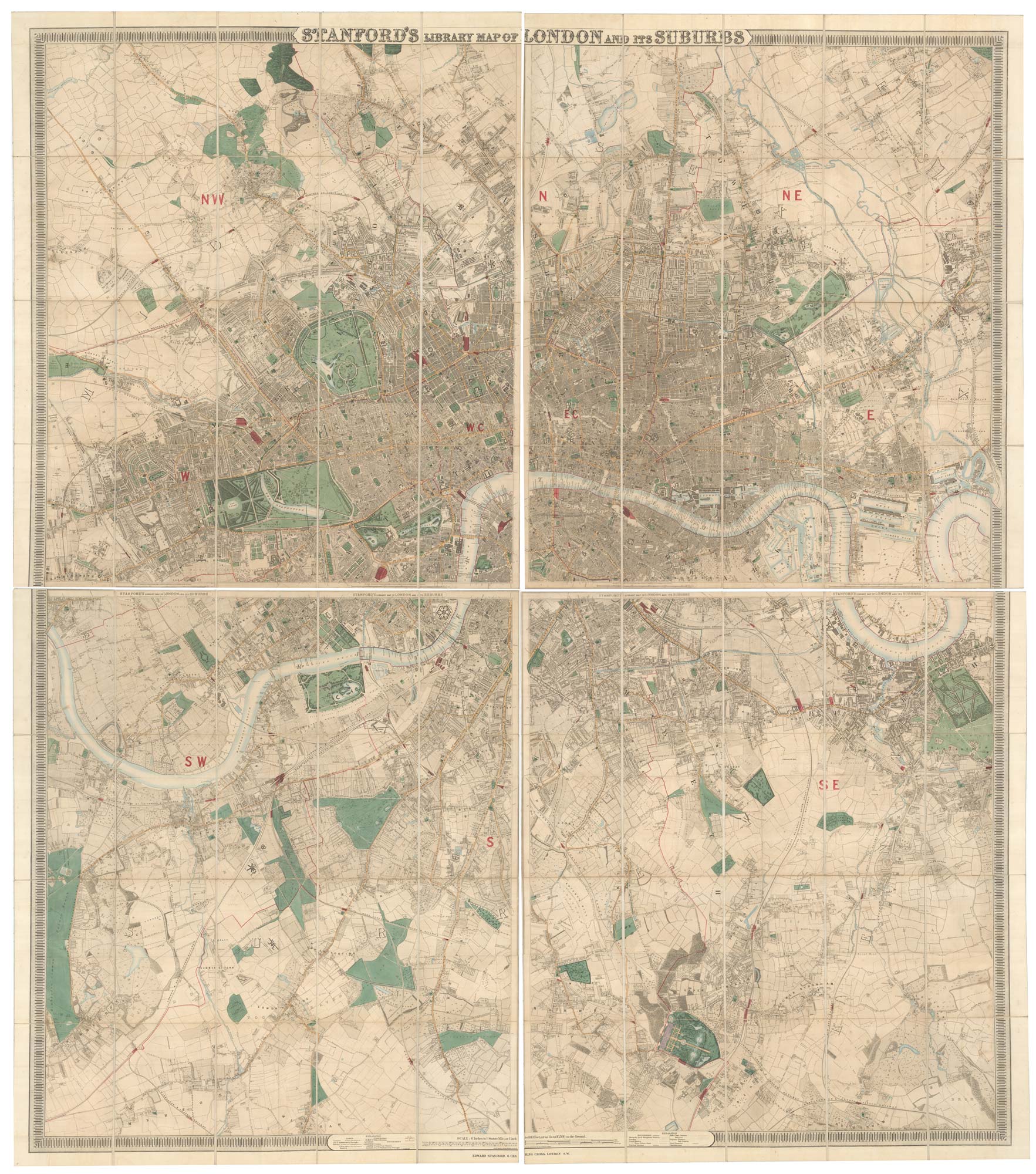
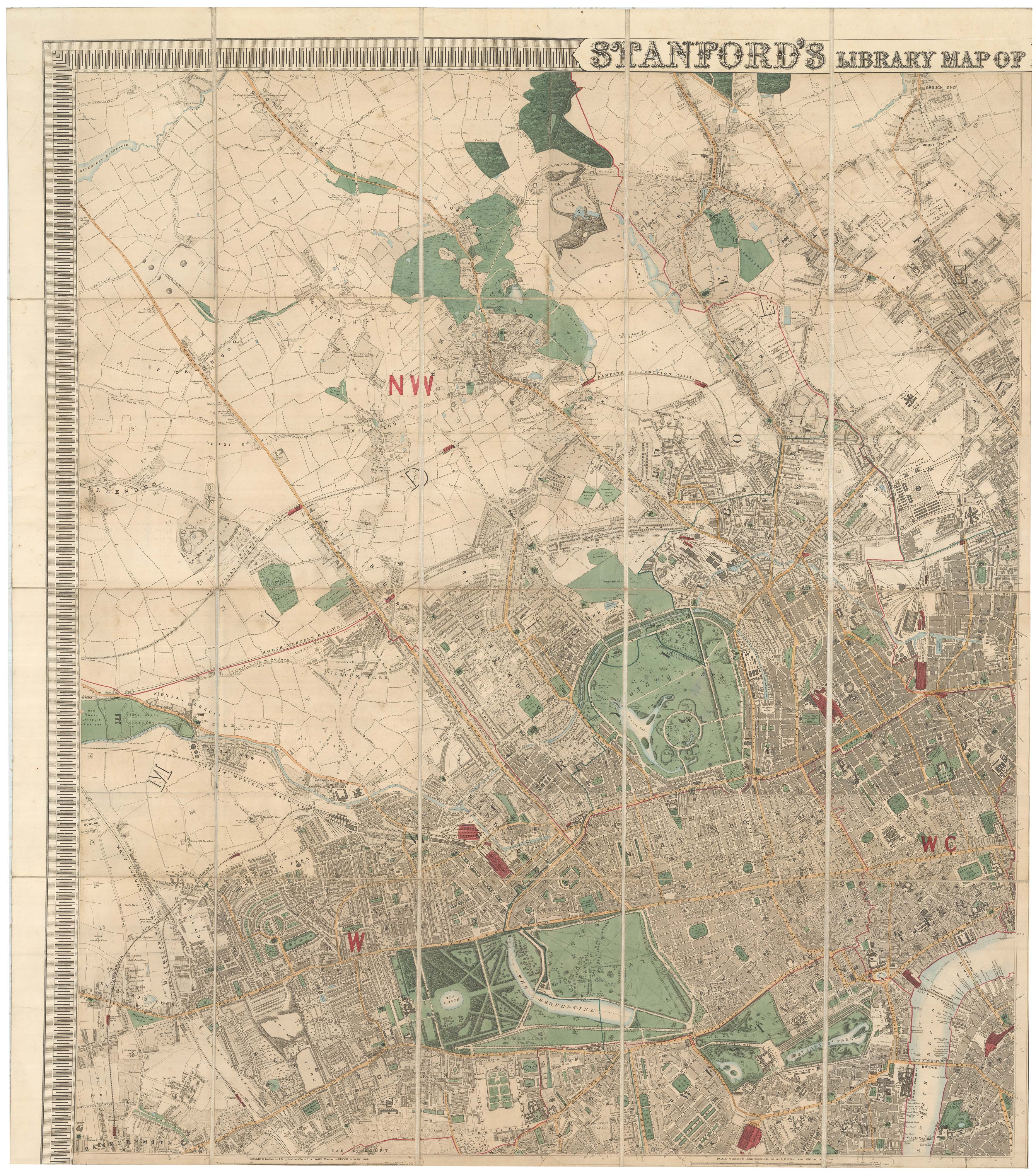
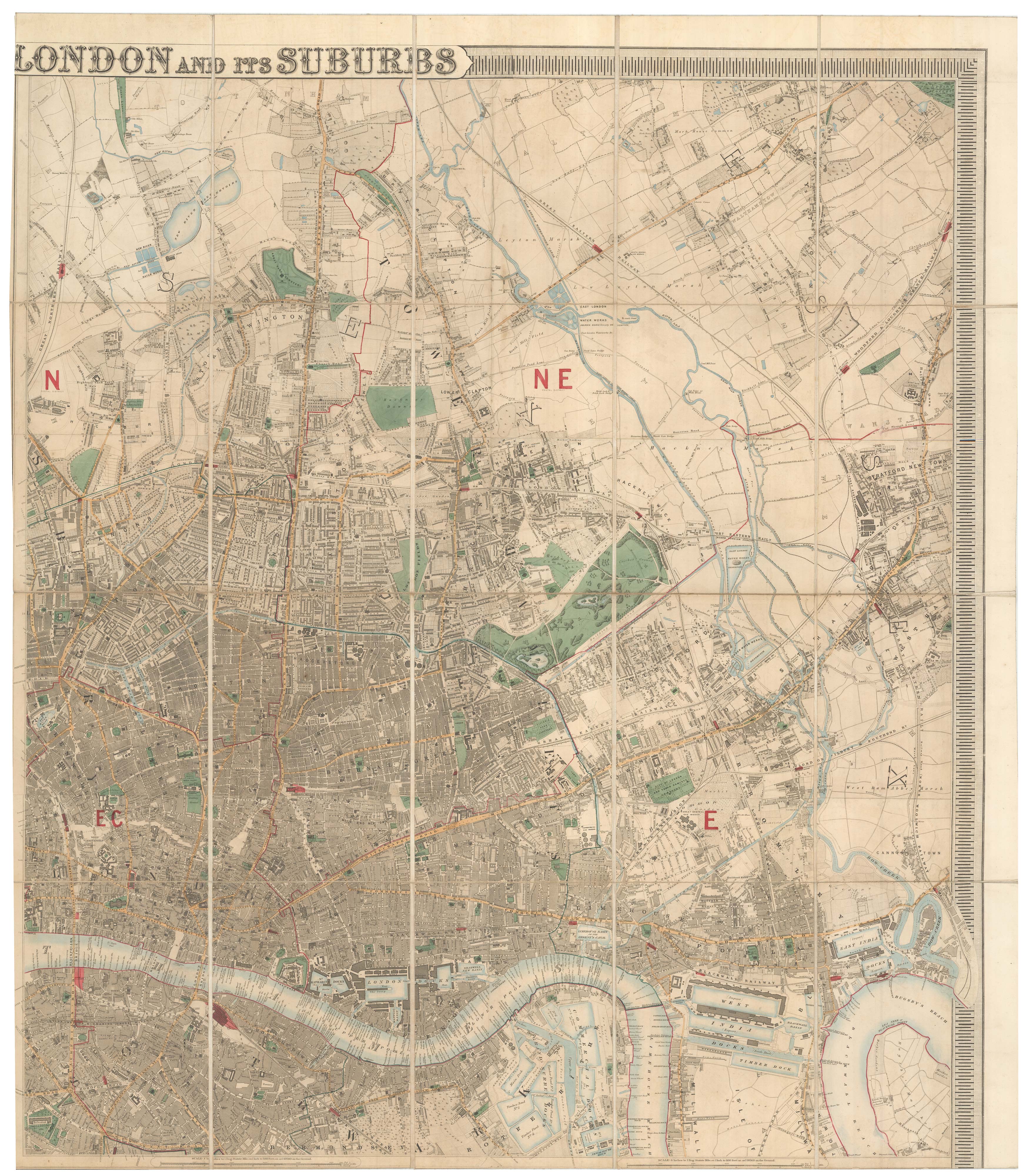
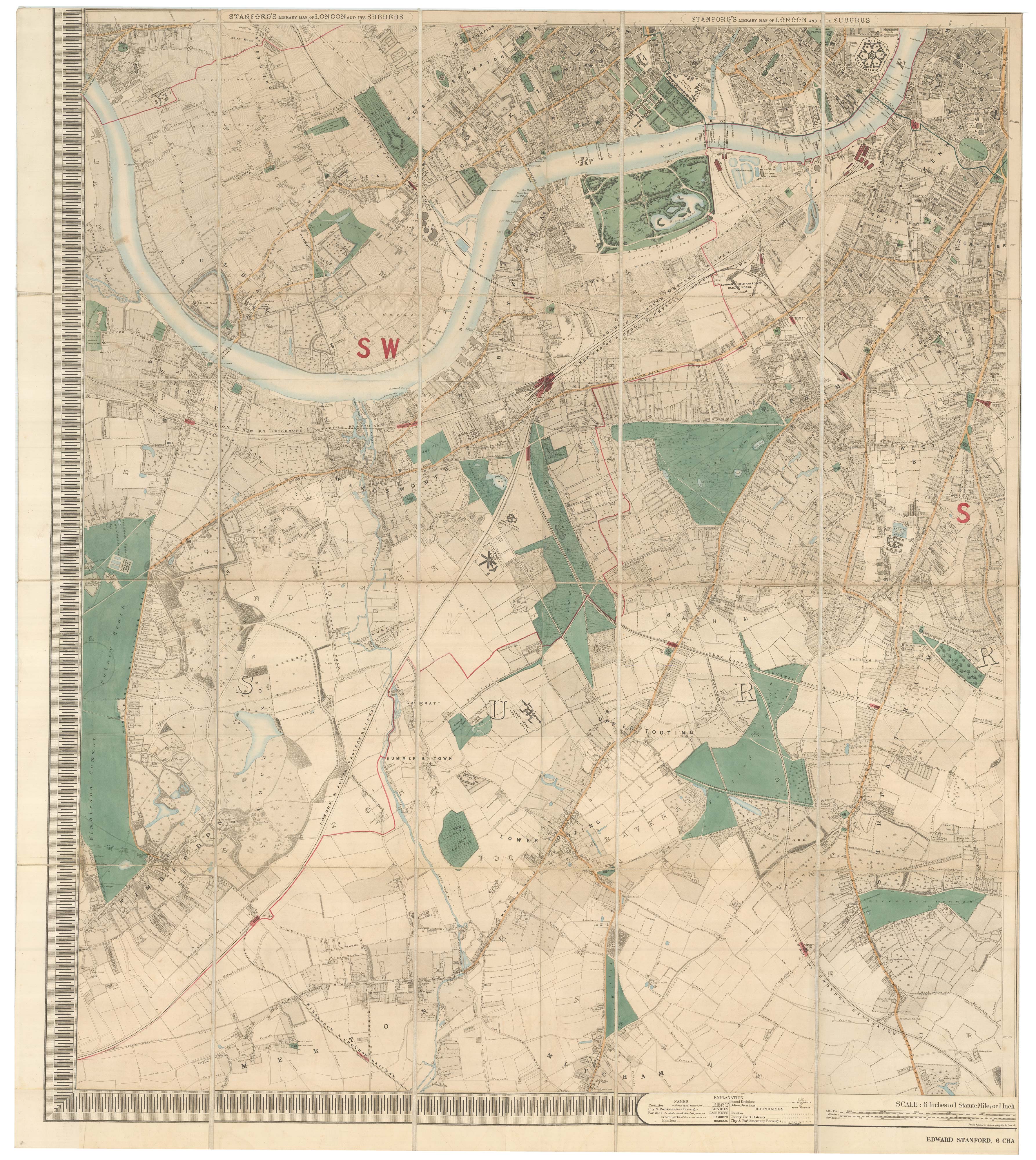
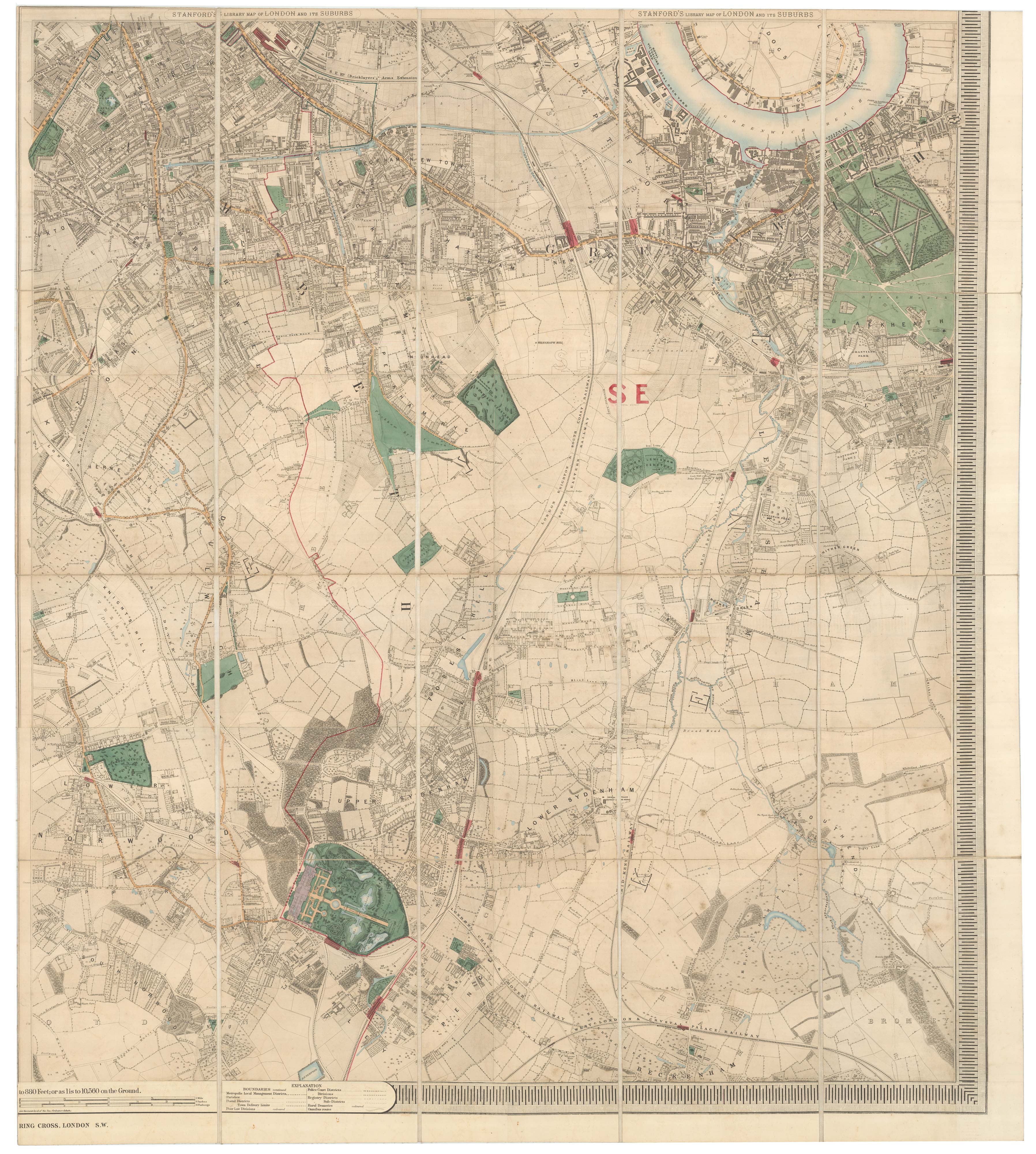
Stanford's Library Map of London and Its Suburbs.
London, Stanford, c.1861. Original colour. Four sections dissected and laid on linen with marbled paper covers with index map labels, each sheet 955 x 840mm. Total if joined c. 1990 x 1680mm.
A very fine large-scale map of London, showing (clockwise from left) Hammersmith, Crouch End, Greenwich & Mitcham.
We have estimated the date of this edition by the appearance of Lambeth Bridge under construction (opened 1862).
The printing plates for this plan were also used to print Booth's 'Descriptive Map of London Poverty', the famous landmark in social mapping, published 1889.
HYDE: 91.
Stock ID : 23419
£3,500
£3,500

Mid-Victorian wall map of London on a scale of 6'' to a Mile
STANFORD, Edward.
Stanford's Library Map of London and Its Suburbs.
London, Stanford, c.1861. Original colour. Four sections dissected and laid on linen with marbled paper covers with index map labels, each sheet 955 x 840mm. Total if joined c. 1990 x 1680mm.
A very fine large-scale map of London, showing (clockwise from left) Hammersmith, Crouch End, Greenwich & Mitcham.
We have estimated the date of this edition by the appearance of Lambeth Bridge under construction (opened 1862).
The printing plates for this plan were also used to print Booth's 'Descriptive Map of London Poverty', the famous landmark in social mapping, published 1889.
HYDE: 91.
Stock ID : 23419
£3,500
£3,500


Altea Antique Maps & Charts
Altea Gallery Ltd, 35 St George Street
London
W1S 2FN
United Kingdom
Tel: +44 20 7491 0010
info@alteagallery.com
Sitemap :

