
A rare wall map of the Netherlands
LE ROUGE, Georges-Louis.
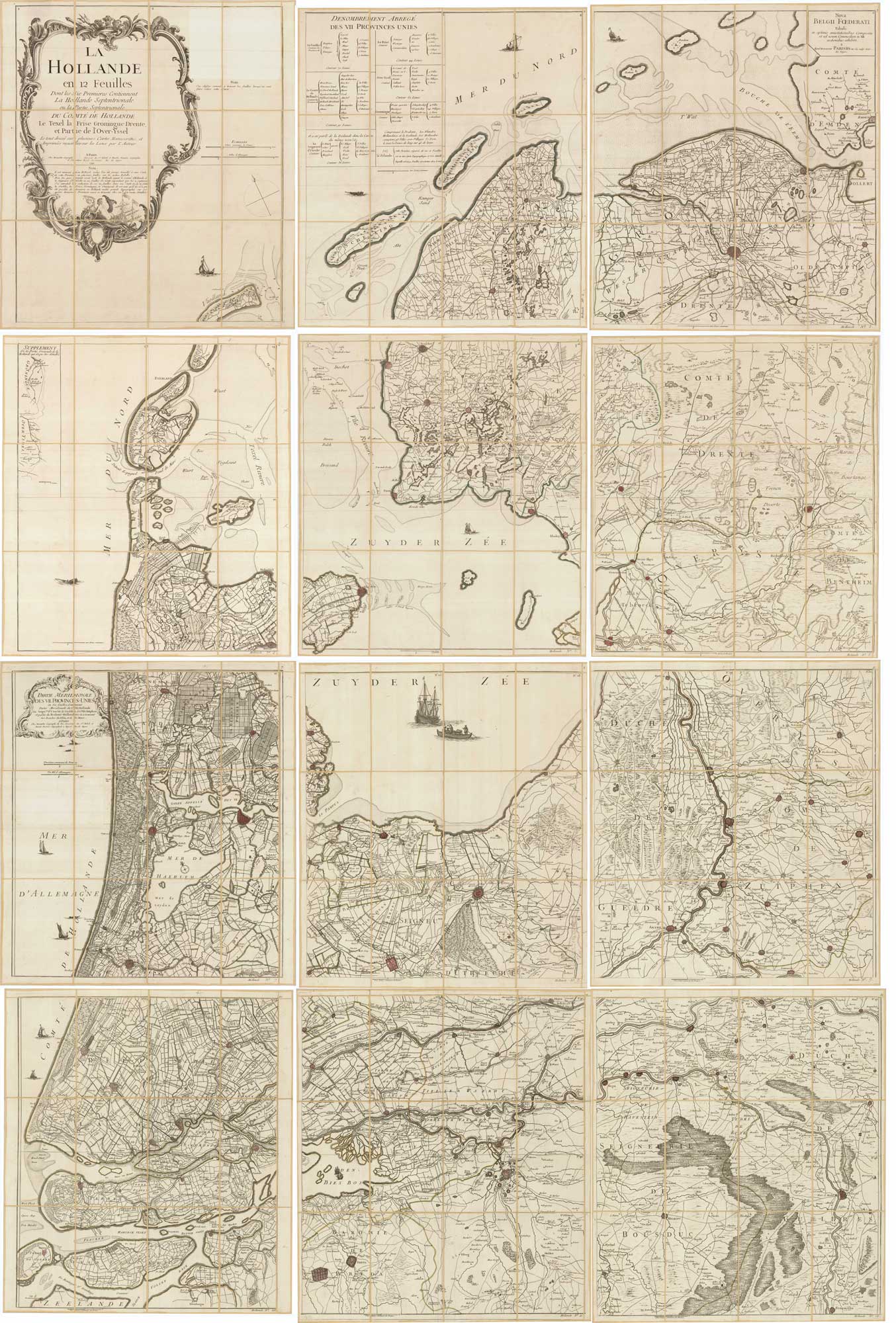
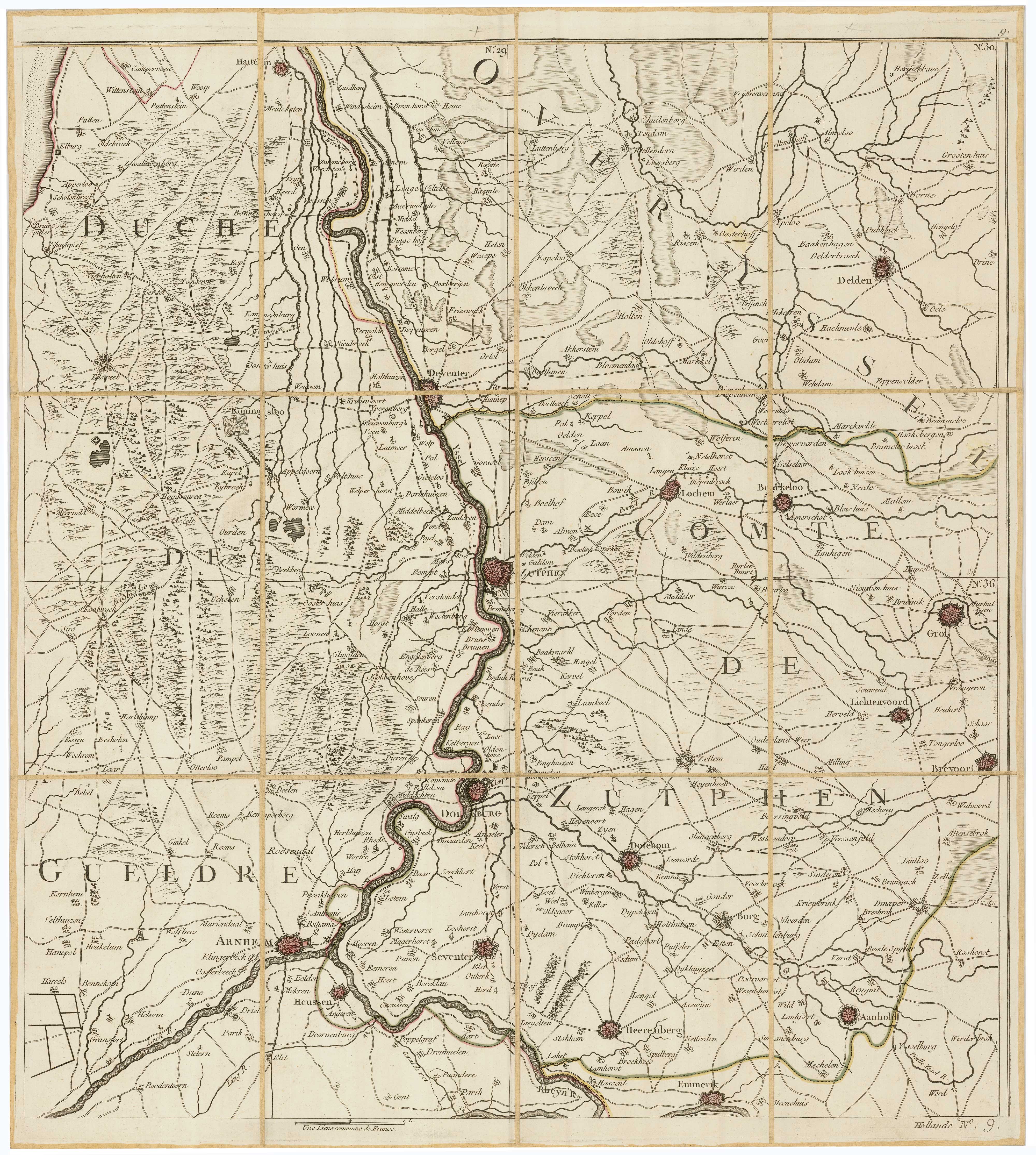
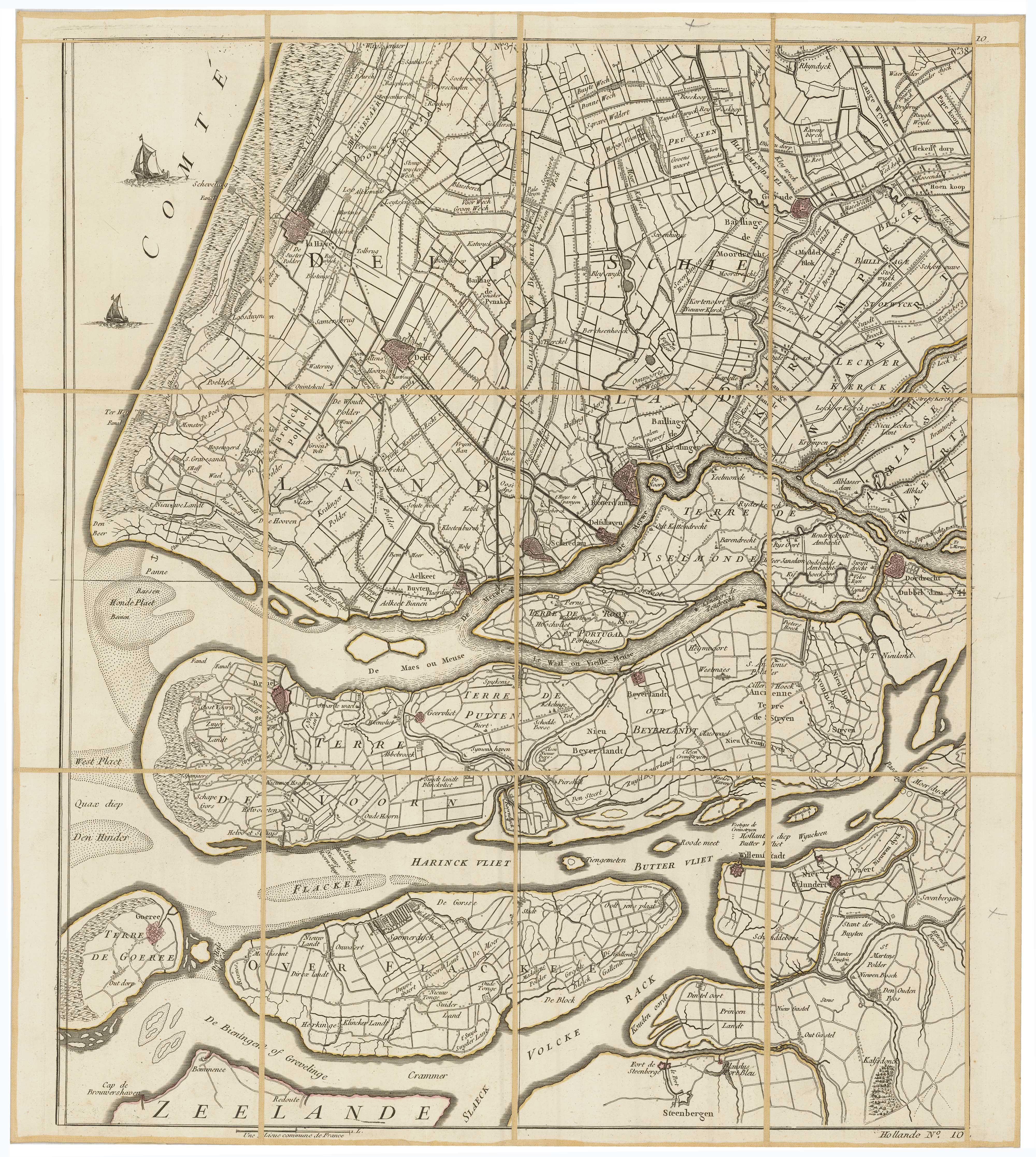
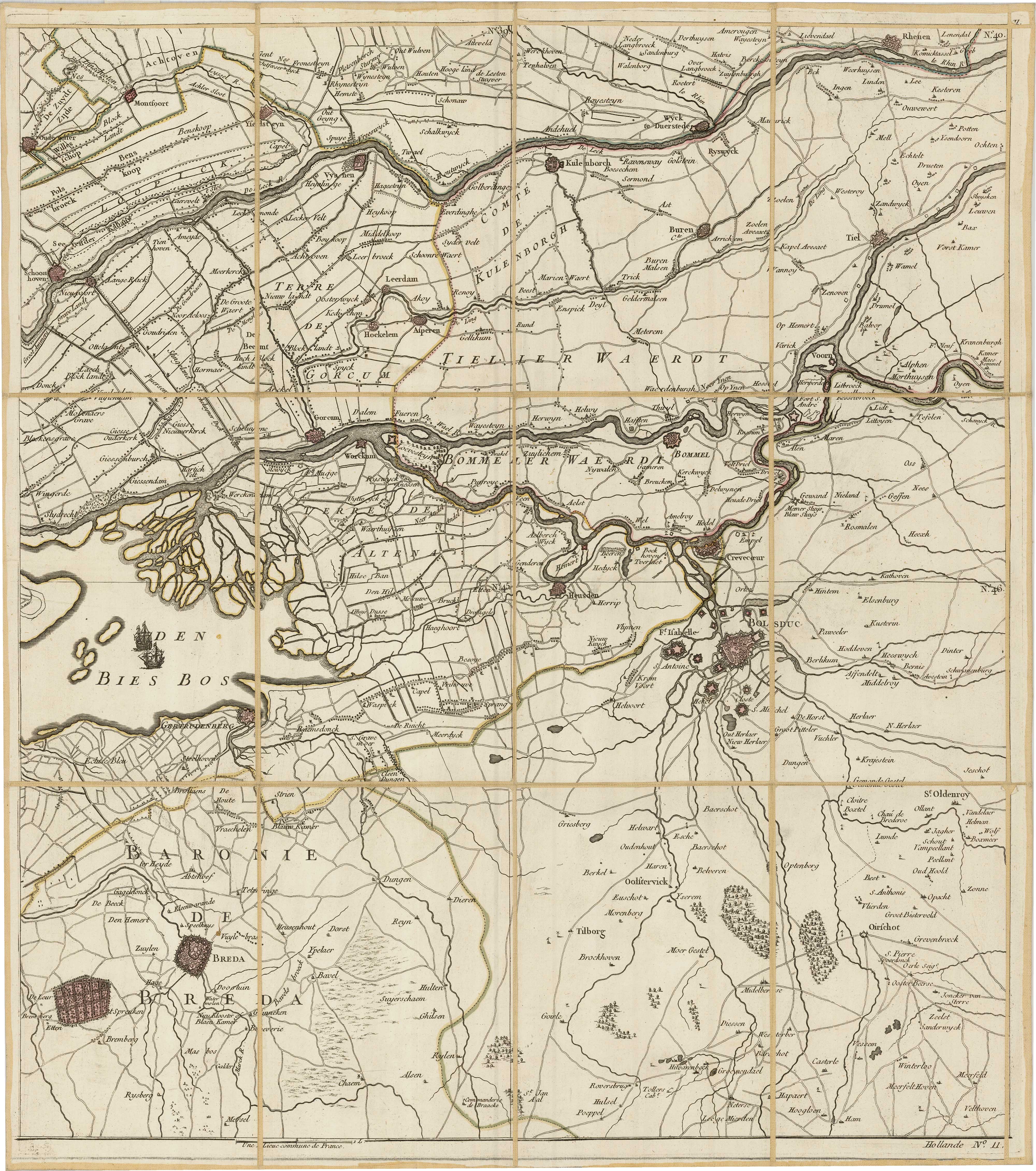
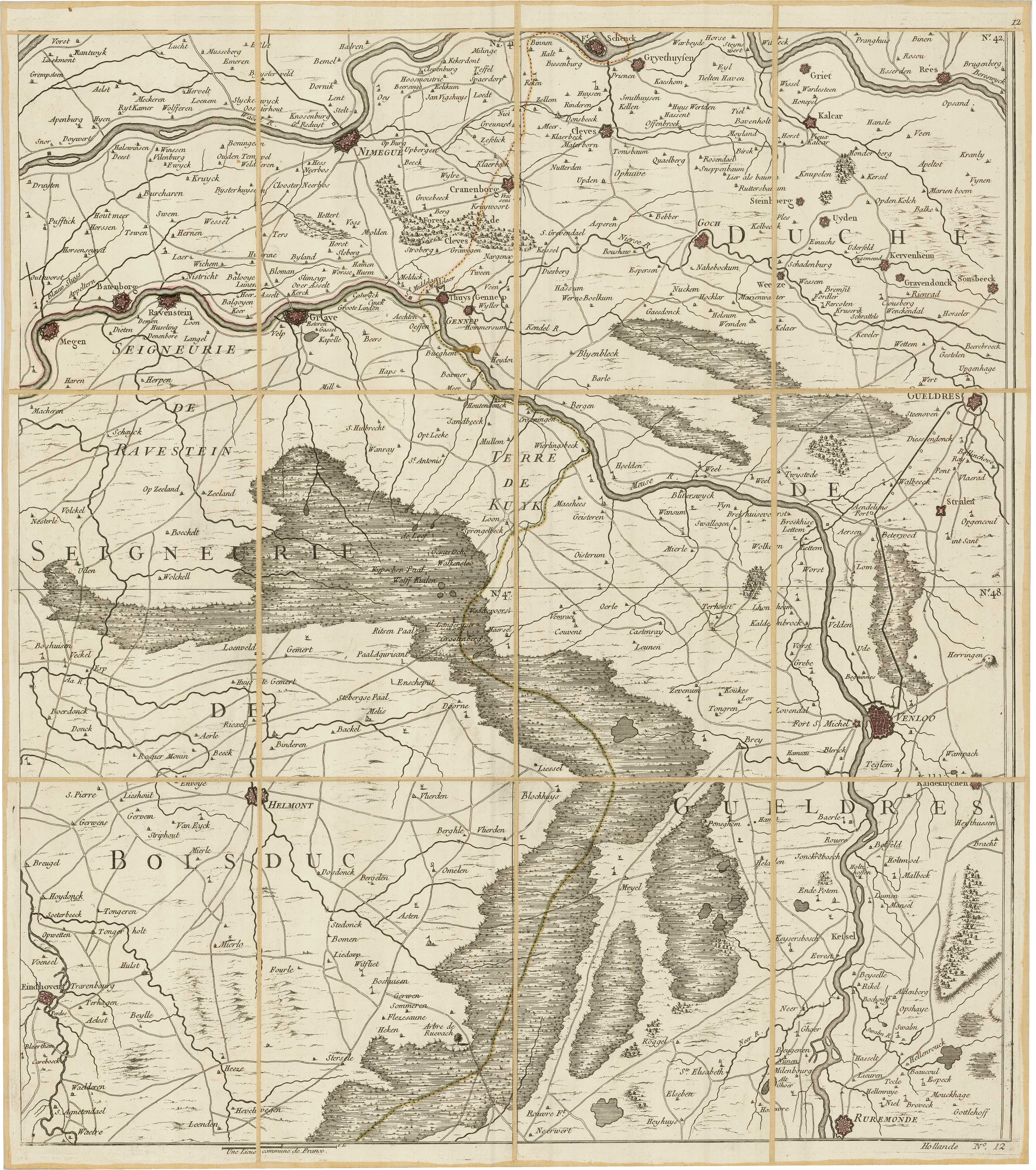
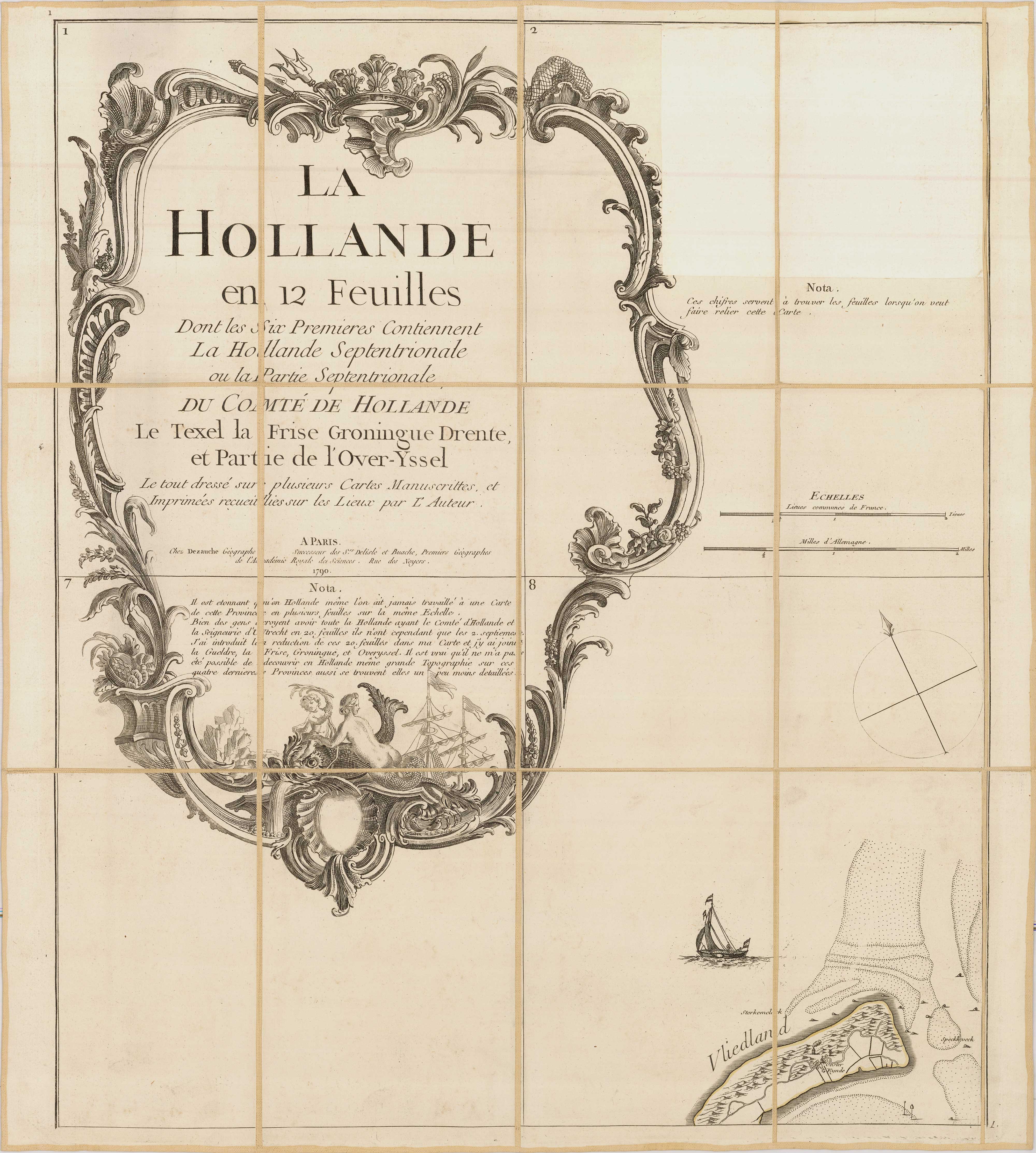
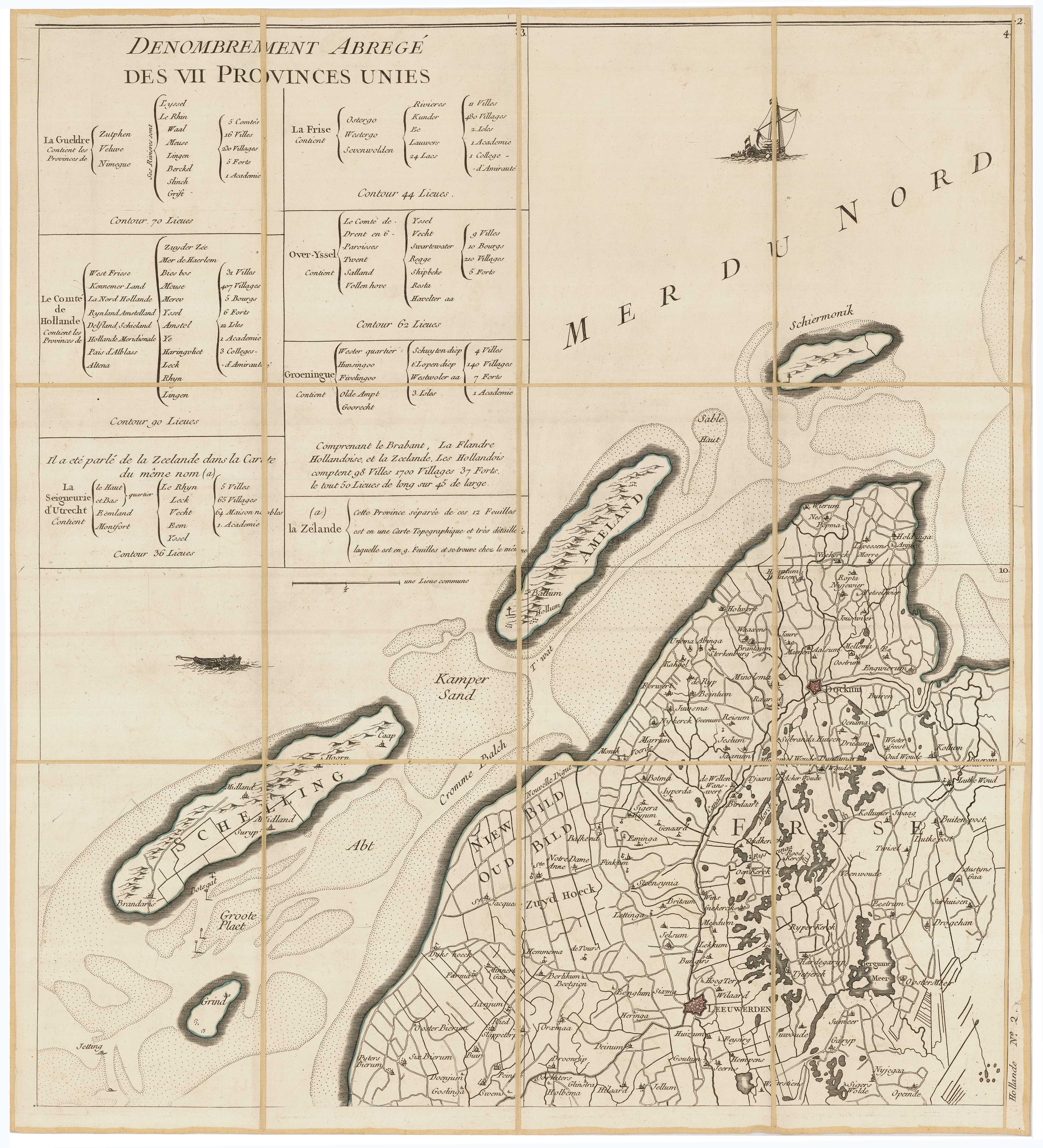
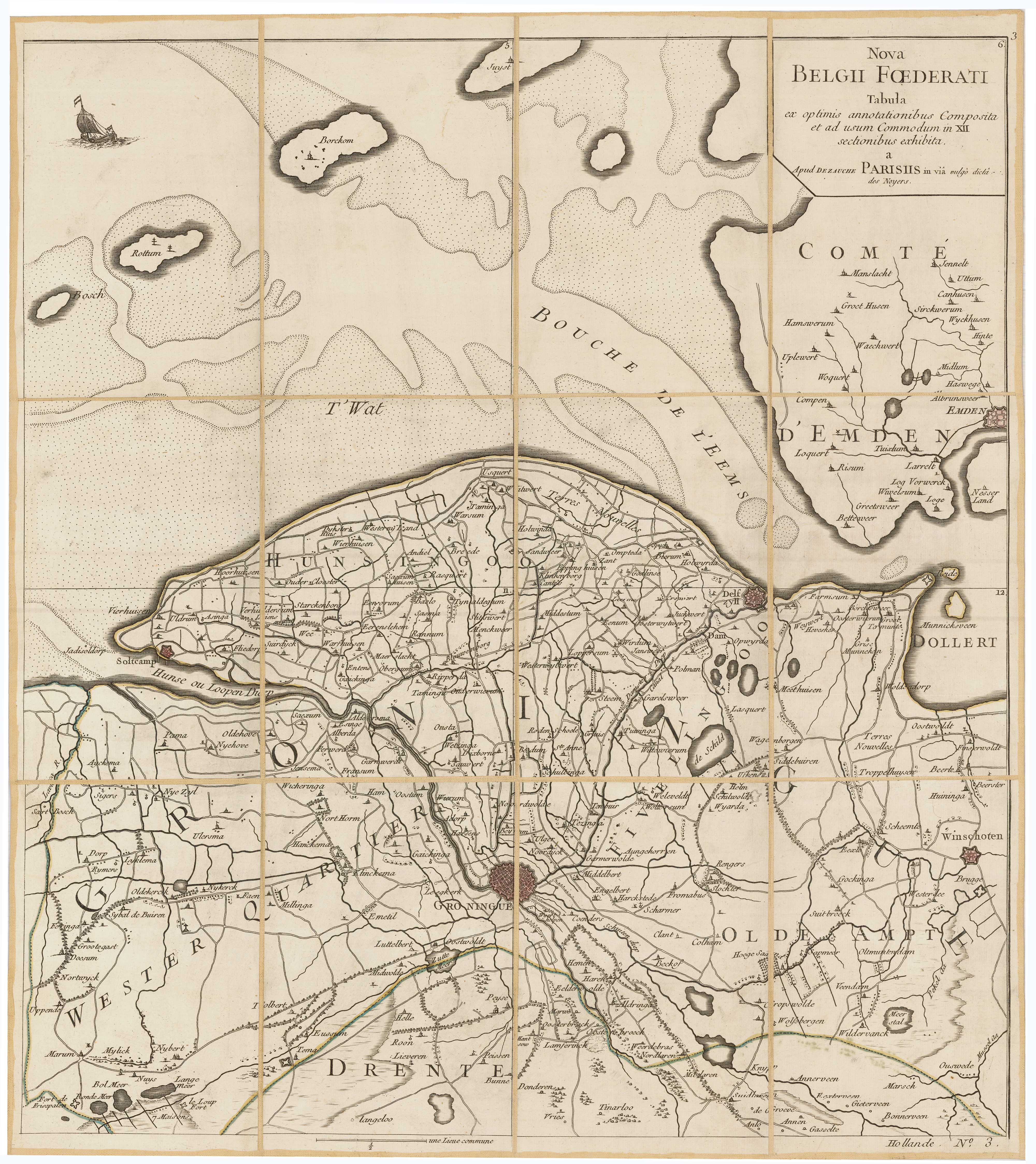
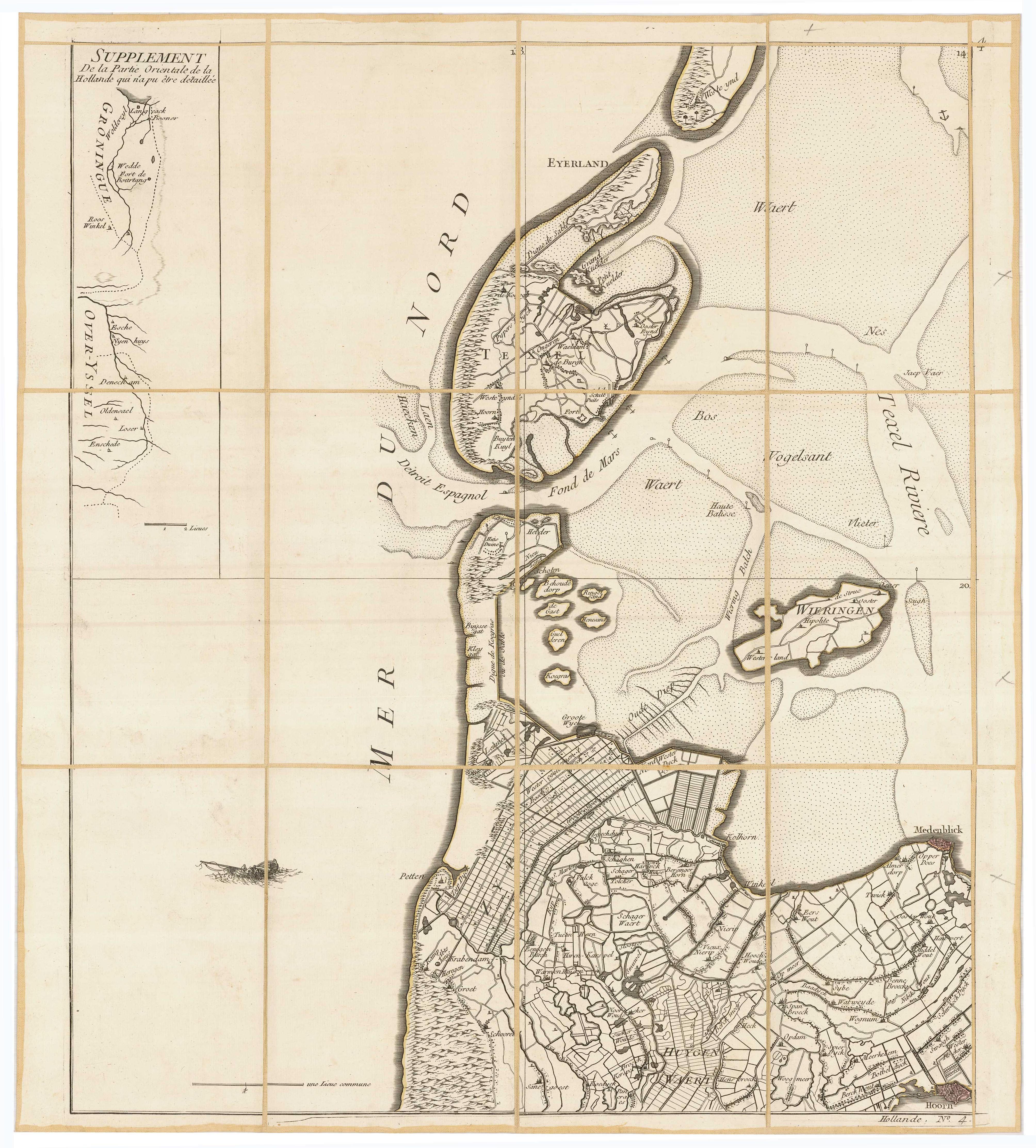
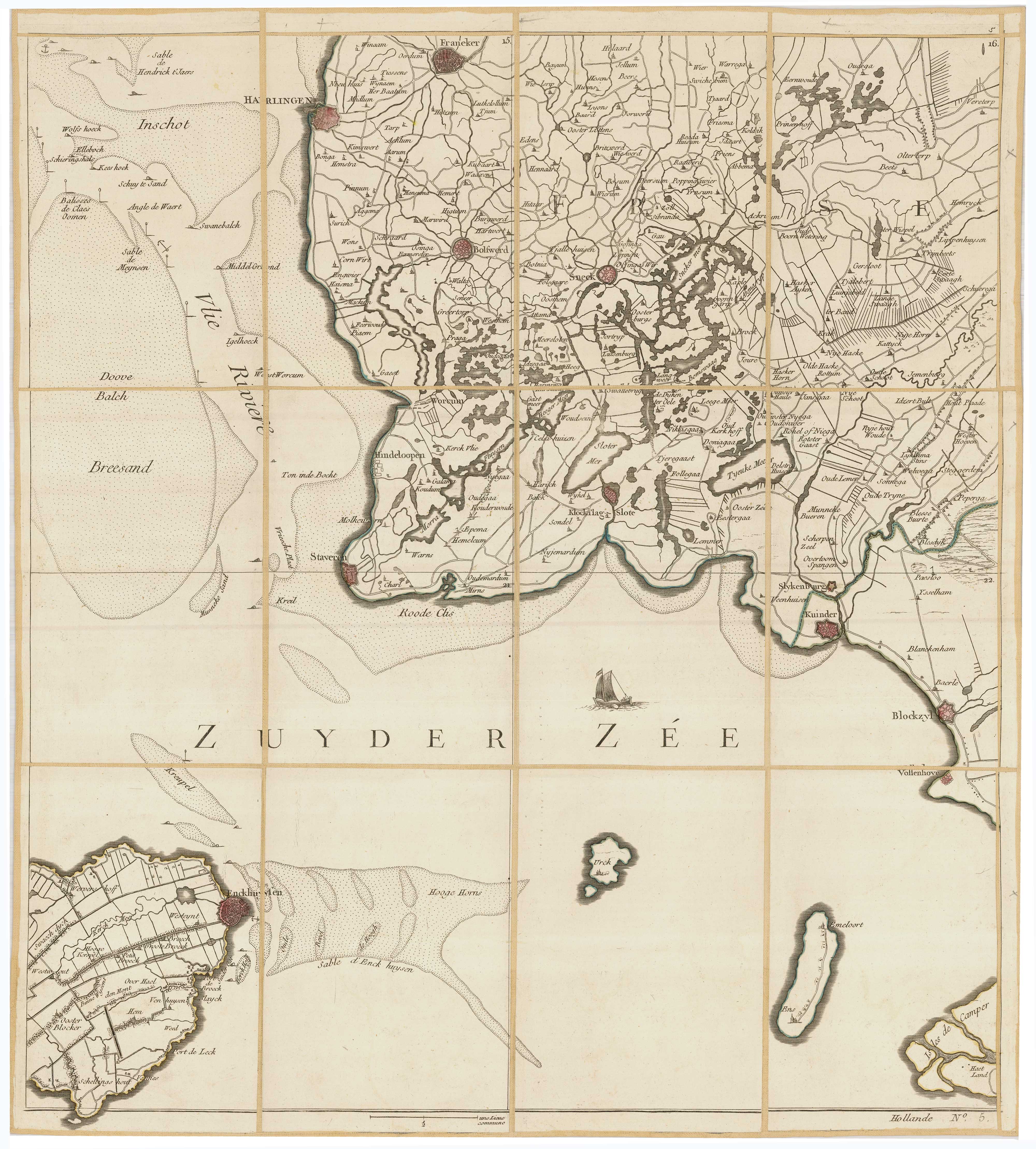
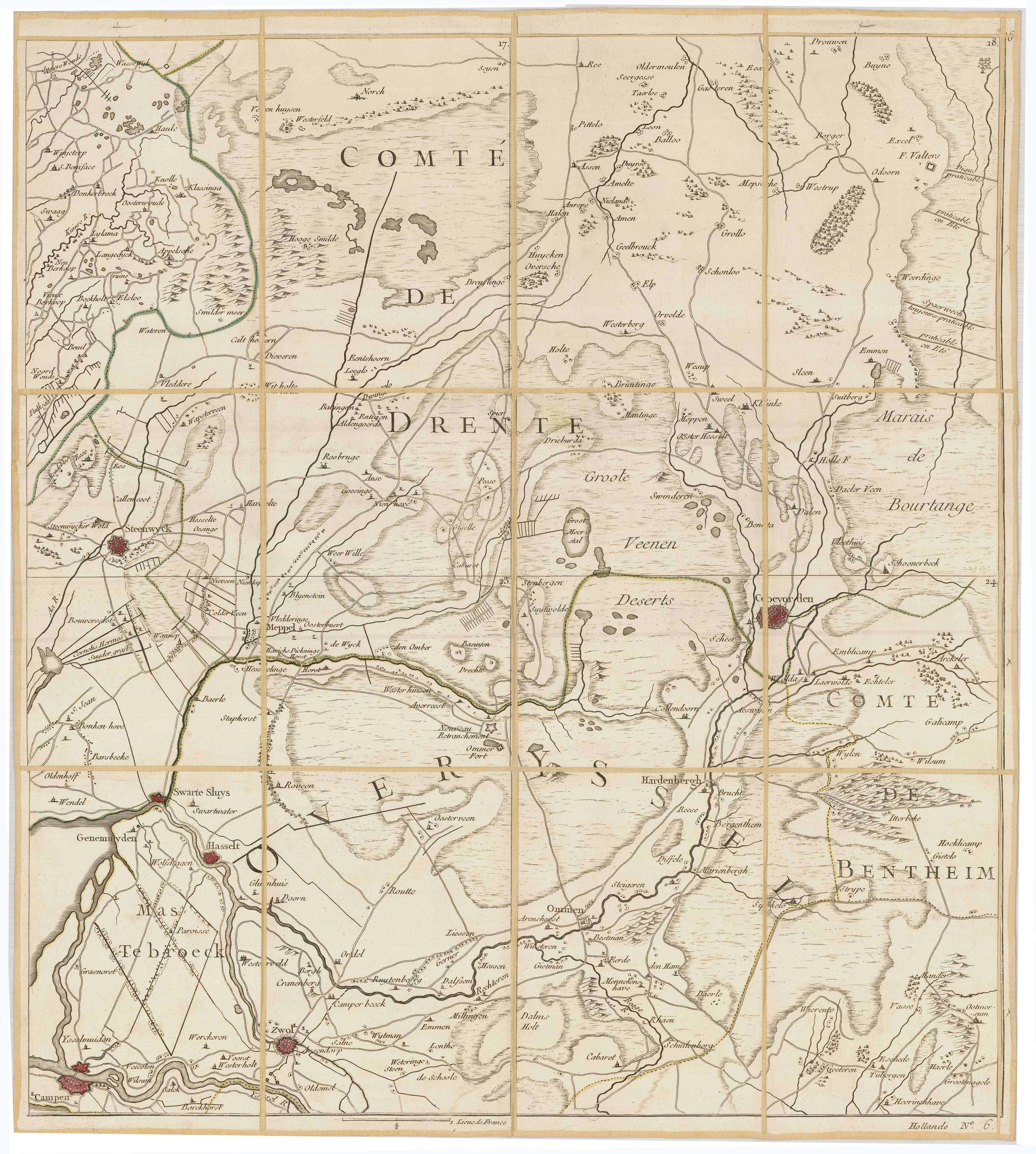
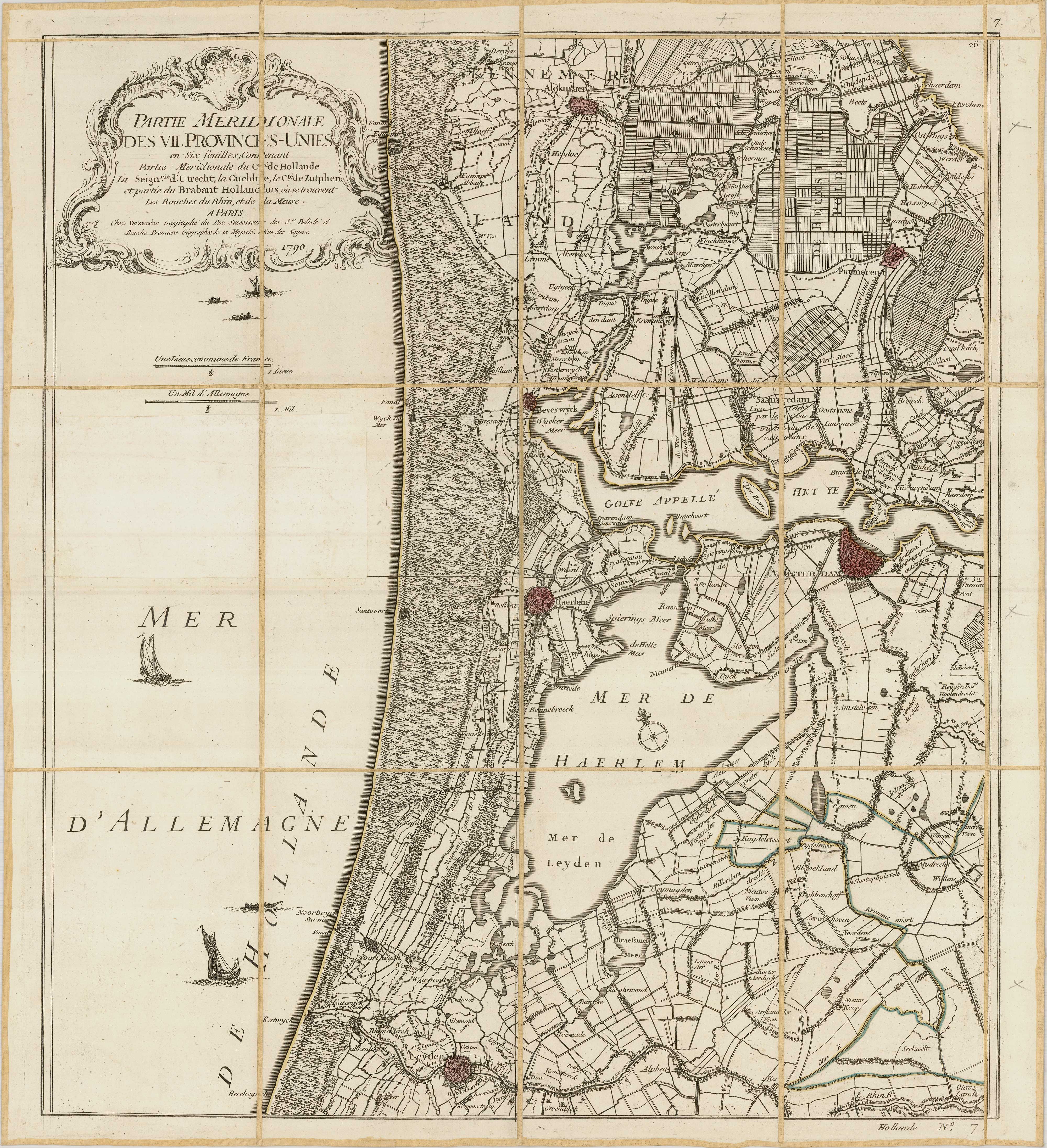
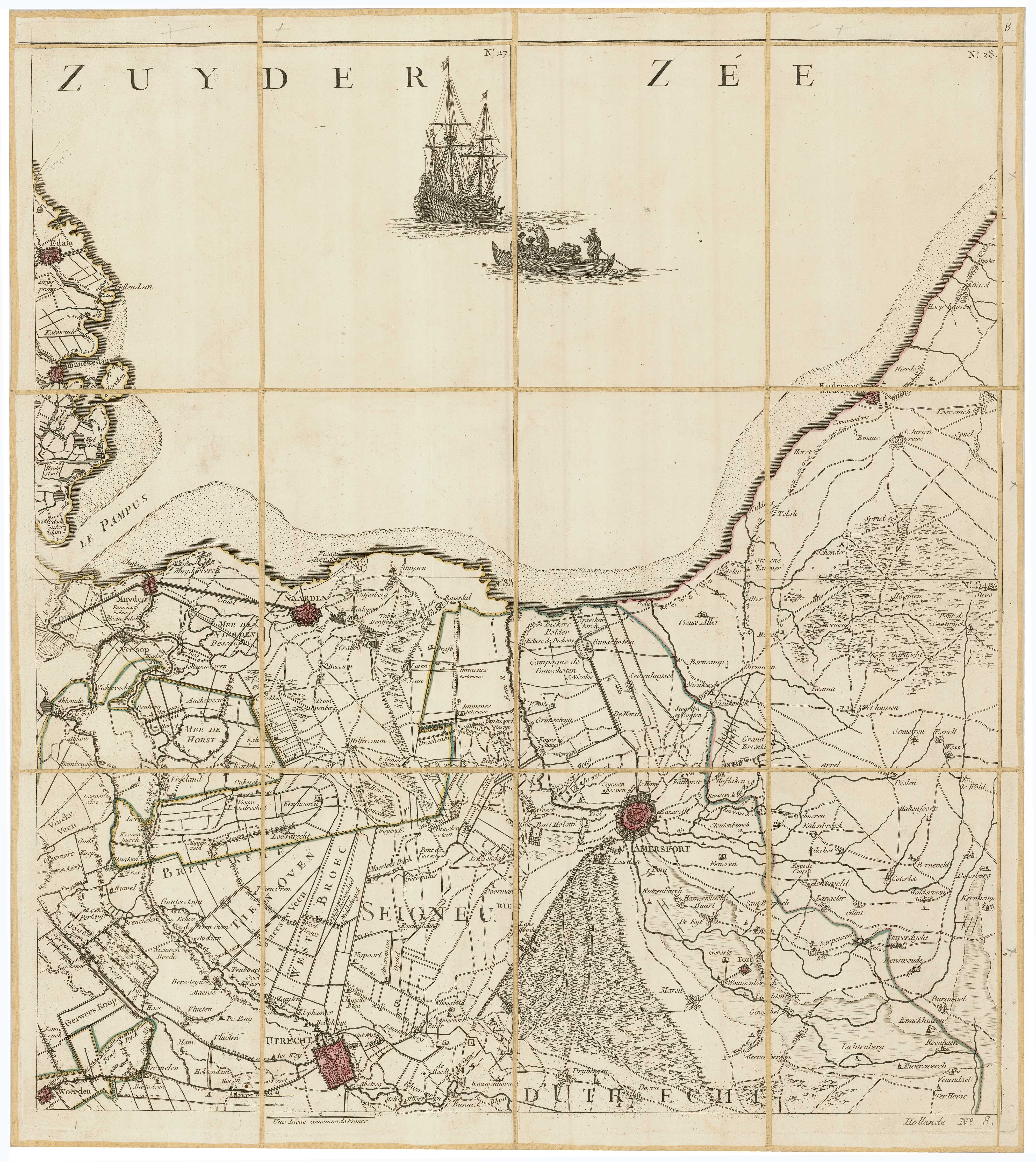
La Hollande en 12 Feuilles Dont les Six Premieres Contiennent La Hollande Septentrionale ou la Partie Septentrionale...
Paris, Jean A. Dezauche, 1790. Original colour. Dissected and laid on linen in 12 sections, as issued, total if joined 2300 x 1550mm, folded into slipcase with index sheet.
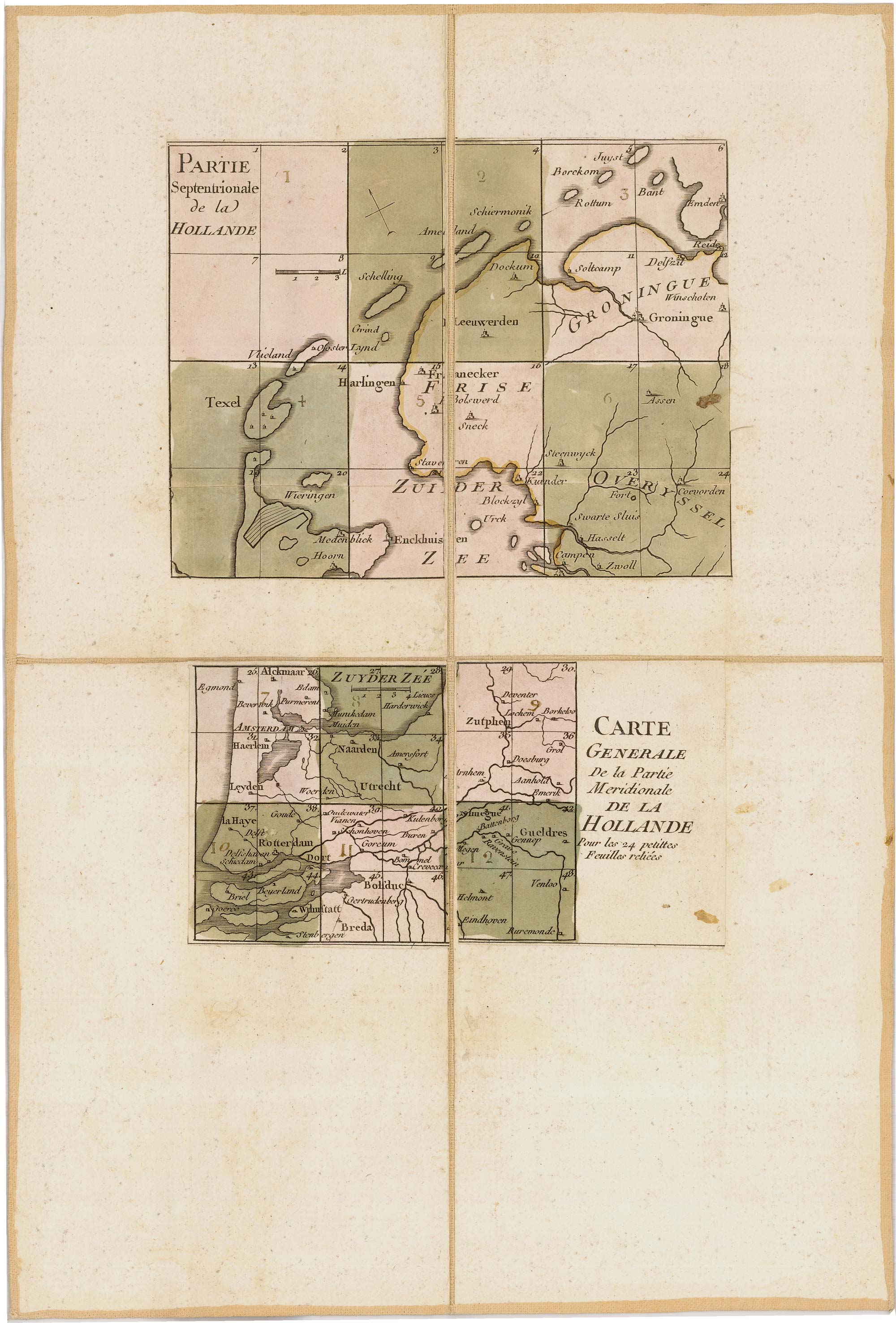
Two index maps with contemporary body colour excised from sheets and pasted on additional section.
A very fine example of a rare and large scale map of the Netherlands. Originally published in 1748, Le Rouge's plates were first revised by Jean Crepy ca. 1770, then by Dezauche in 1790. This fourth state seems only to lack Dezauches title of 'Geographer to the king' after the French revolution. On the back of each sheet is an engraved trade card of the map seller J. Goujon, 6 rue de Bac, Paris each with the sheet number and the name of the region added in manuscript.
Stock ID : 23570
£3,600
£3,600

A rare wall map of the Netherlands
LE ROUGE, Georges-Louis.
La Hollande en 12 Feuilles Dont les Six Premieres Contiennent La Hollande Septentrionale ou la Partie Septentrionale...
Paris, Jean A. Dezauche, 1790. Original colour. Dissected and laid on linen in 12 sections, as issued, total if joined 2300 x 1550mm, folded into slipcase with index sheet.
Two index maps with contemporary body colour excised from sheets and pasted on additional section.
A very fine example of a rare and large scale map of the Netherlands. Originally published in 1748, Le Rouge's plates were first revised by Jean Crepy ca. 1770, then by Dezauche in 1790. This fourth state seems only to lack Dezauches title of 'Geographer to the king' after the French revolution. On the back of each sheet is an engraved trade card of the map seller J. Goujon, 6 rue de Bac, Paris each with the sheet number and the name of the region added in manuscript.
Stock ID : 23570
£3,600
£3,600


Altea Antique Maps & Charts
Altea Gallery Ltd, 35 St George Street
London
W1S 2FN
United Kingdom
Tel: +44 20 7491 0010
info@alteagallery.com
Sitemap :

