
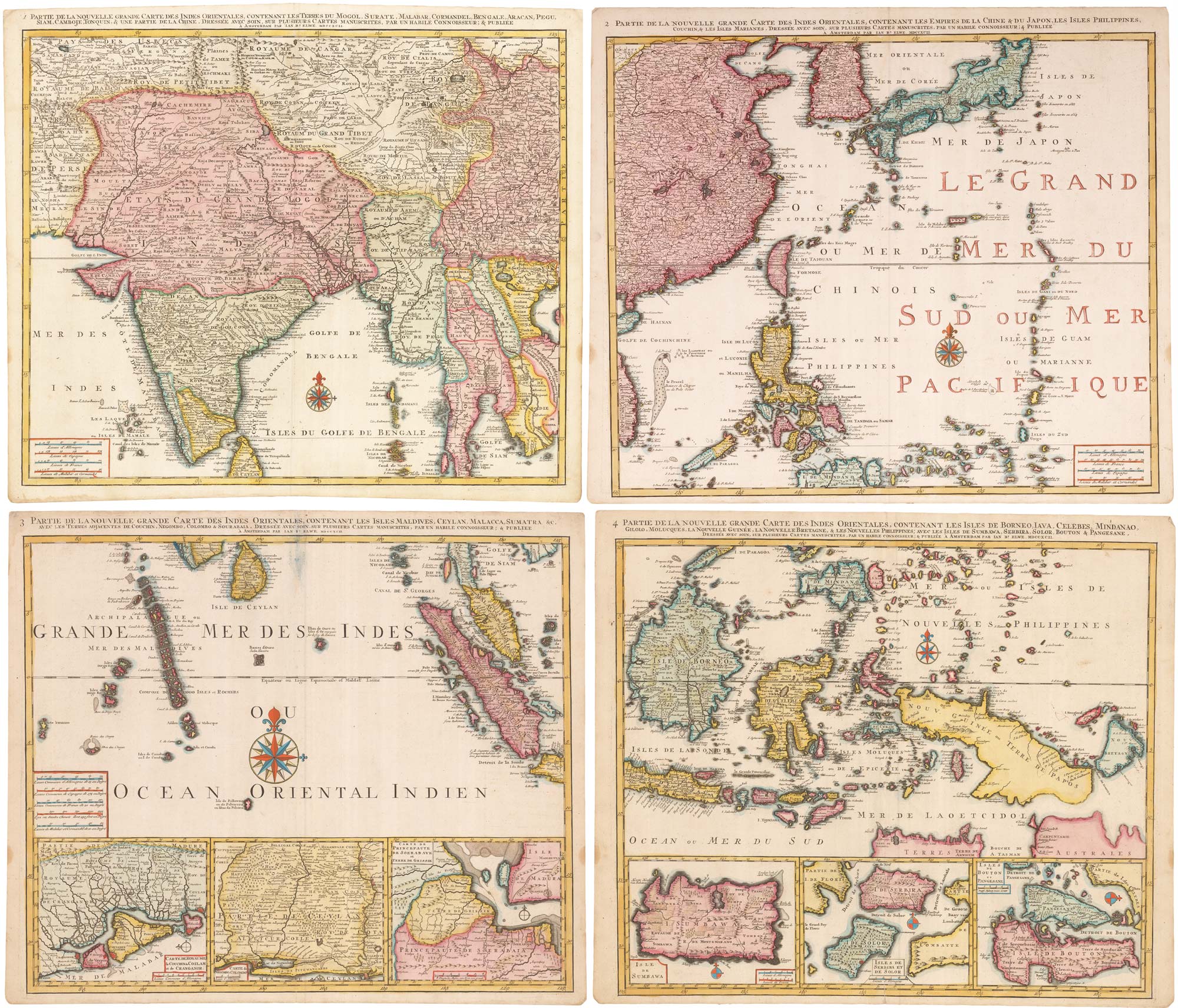
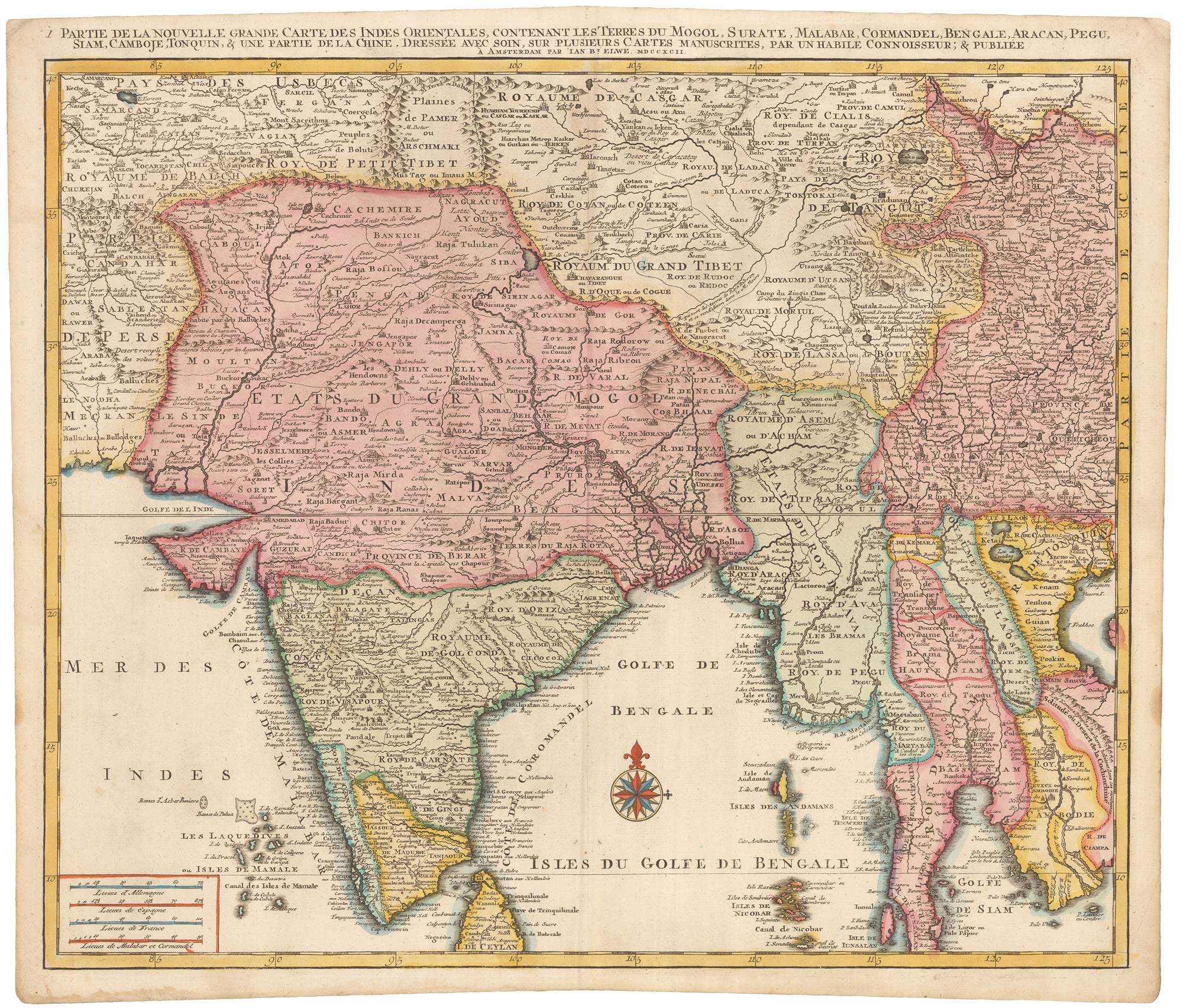
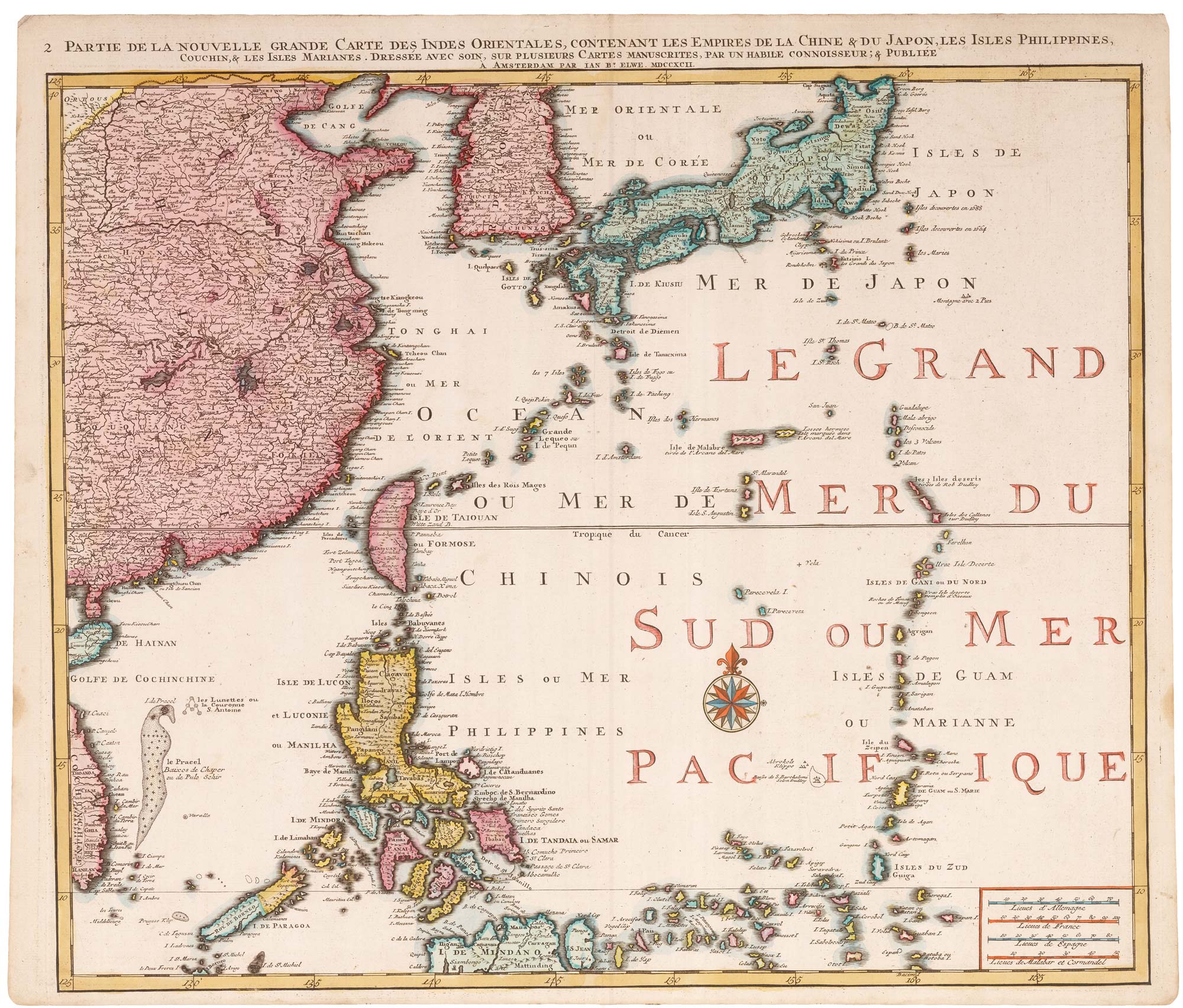
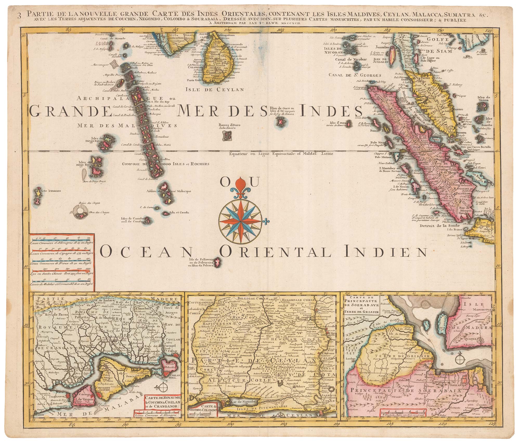

A striking four-sheet wall map of the Far East
OTTENS, Joachim.
1 Partie de la nouvelle grande carte des Indes Orientales... [& 2-4 Partie]
Amsterdam: J.B. Elwe, 1792. Fine original colour. Four sheets, each plate 525 x 610mm.
A large and detailed four-sheet map the Far East, with India and Sri Lanka, Indochina, Indonesia, the Philippines, China, Korea, Singapore and Japan. Along the bottom of the map are six inset details of the important ports used by the European traders.
The map was based on the work of Guillaume DelIsle and first published by Joachim Ottens c.1720.
Stock ID : 23571
£4,500
£4,500


Altea Antique Maps & Charts
Altea Gallery Ltd, 35 St George Street
London
W1S 2FN
United Kingdom
Tel: +44 20 7491 0010
info@alteagallery.com
Sitemap :

